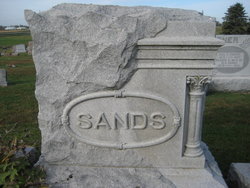
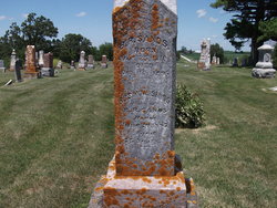
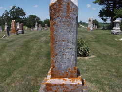
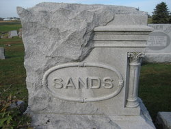
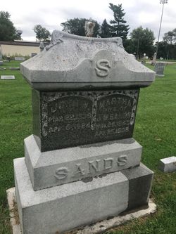
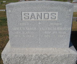
Samuel A Sands
| Birth | : | 1848 |
| Death | : | 1914 |
| Burial | : | Magnolia Cemetery, DeFuniak Springs, Walton County, USA |
| Coordinate | : | 30.7232208, -86.0984116 |
| Description | : | Here is a nice article on him found in "Portrait & Biographical Album of Washington County, Iowa" which is now in the public domain. "SAMUEL A. SANDS is a farmer and stock-raiser residing on section 4, Oregon Township, and the owner of eight acres of fine farm land. He is a native of East Tennessee, born Jan. 8, 1848, and is the son of B. R. and Rosanna (Henderson) Sands, the former a native of Tennessee and of English descent, the latter a native of North Carolina and of Scotch descent. They were among the early settlers of Washington County, emigrating... Read More |
frequently asked questions (FAQ):
-
Where is Samuel A Sands's memorial?
Samuel A Sands's memorial is located at: Magnolia Cemetery, DeFuniak Springs, Walton County, USA.
-
When did Samuel A Sands death?
Samuel A Sands death on 1914 in
-
Where are the coordinates of the Samuel A Sands's memorial?
Latitude: 30.7232208
Longitude: -86.0984116
Family Members:
Parent
Spouse
Siblings
Children
Flowers:
Nearby Cemetories:
1. Magnolia Cemetery
DeFuniak Springs, Walton County, USA
Coordinate: 30.7232208, -86.0984116
2. Saint Agathas Episcopal Church Memorial Garden
DeFuniak Springs, Walton County, USA
Coordinate: 30.7163310, -86.1161400
3. Resurrection Ground Cemetery
Argyle, Walton County, USA
Coordinate: 30.7242160, -86.0457280
4. Southwide Baptist Church Cemetery
Walton County, USA
Coordinate: 30.6874008, -86.1413574
5. Locklear Cemetery
DeFuniak Springs, Walton County, USA
Coordinate: 30.7222490, -86.1600690
6. Pleasant Ridge Cemetery
Pleasant Ridge, Walton County, USA
Coordinate: 30.6922302, -86.1744537
7. Center Ridge UMC Sandy Creek Cemetery
DeFuniak Springs, Walton County, USA
Coordinate: 30.7997500, -86.0953900
8. First Christian Church Cemetery
Walton County, USA
Coordinate: 30.7413700, -86.1866300
9. Woodlawn Baptist Church Cemetery
Steele Church, Walton County, USA
Coordinate: 30.6437206, -86.1122284
10. Friendship Cemetery #1
DeFuniak Springs, Walton County, USA
Coordinate: 30.8041430, -86.0902040
11. Friendship Baptist Church Cemetery
DeFuniak Springs, Walton County, USA
Coordinate: 30.8041890, -86.0903510
12. Piney Grove Cemetery
Piney Grove, Walton County, USA
Coordinate: 30.8040867, -86.1316833
13. Alaqua Methodist Church Cemetery
Steele Church, Walton County, USA
Coordinate: 30.6522217, -86.1552811
14. Frix Family Cemetery
DeFuniak Springs, Walton County, USA
Coordinate: 30.8100520, -86.0905480
15. Ray Cemetery
Walton County, USA
Coordinate: 30.8160992, -86.0988998
16. Parish Cemetery
Ponce de Leon, Holmes County, USA
Coordinate: 30.8100670, -86.0369000
17. Pleasant Grove Baptist Church Cemetery
Walton County, USA
Coordinate: 30.8213539, -86.0629883
18. Walker's Rest Cemetery
DeFuniak Springs, Walton County, USA
Coordinate: 30.6253847, -86.0611961
19. Oak Ridge Cemetery
Cosson Mill, Walton County, USA
Coordinate: 30.7236004, -86.2217026
20. Euchee Valley Cemetery
Eucheeanna, Walton County, USA
Coordinate: 30.6537170, -86.0032196
21. Pleasant Grove Presbyterian Church Cemetery
Walton County, USA
Coordinate: 30.6534653, -86.0016174
22. Sandy Creek Cemetery
Ponce de Leon, Holmes County, USA
Coordinate: 30.8109300, -86.0131600
23. Glendale Memorial Nature Preserve
Glendale, Walton County, USA
Coordinate: 30.8533859, -86.1150360
24. New Ponce de Leon Cemetery
Ponce de Leon, Holmes County, USA
Coordinate: 30.7325001, -85.9460983

