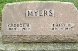
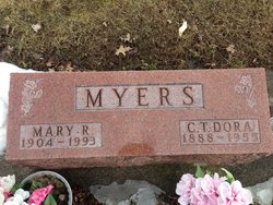
| Birth | : | 4 Jun 1882 Ohio, USA |
| Death | : | 20 Oct 1954 Phillips County, Montana, USA |
| Burial | : | Grandview Cemetery, Saco, Phillips County, USA |
| Coordinate | : | 48.4938930, -107.3460170 |
frequently asked questions (FAQ):
-
Where is Samuel Emanuel “Sam” Myers's memorial?
Samuel Emanuel “Sam” Myers's memorial is located at: Grandview Cemetery, Saco, Phillips County, USA.
-
When did Samuel Emanuel “Sam” Myers death?
Samuel Emanuel “Sam” Myers death on 20 Oct 1954 in Phillips County, Montana, USA
-
Where are the coordinates of the Samuel Emanuel “Sam” Myers's memorial?
Latitude: 48.4938930
Longitude: -107.3460170
Family Members:
Parent
Siblings
Flowers:
Nearby Cemetories:
1. Grandview Cemetery
Saco, Phillips County, USA
Coordinate: 48.4938930, -107.3460170
2. Bowdoin Cemetery
Bowdoin, Phillips County, USA
Coordinate: 48.3786000, -107.5903000
3. Hillview Cemetery
Hinsdale, Valley County, USA
Coordinate: 48.3828011, -107.0847015
4. East Malta Hutterite Colony Cemetery
East Malta Colony, Phillips County, USA
Coordinate: 48.3473997, -107.6095182
5. Forks Cemetery
Whitewater, Phillips County, USA
Coordinate: 48.7206500, -107.4905000
6. Jordan Coulee Cemetery
Valley County, USA
Coordinate: 48.7075900, -107.1230100
7. Reitan Cemetery
Saco, Phillips County, USA
Coordinate: 48.7567400, -107.3593400
8. Malta City Cemetery
Malta, Phillips County, USA
Coordinate: 48.3516150, -107.8667200
9. Scandia Lutheran Cemetery
Malta, Phillips County, USA
Coordinate: 48.1885210, -107.7866940
10. Hillcrest Cemetery
Valley County, USA
Coordinate: 48.8760986, -106.9218979
11. Loring Colony Cemetery
Loring, Phillips County, USA
Coordinate: 48.7879148, -107.9747077
12. Highland Cemetery
Glasgow, Valley County, USA
Coordinate: 48.2010994, -106.6205978
13. Hillside Cemetery
Dodson, Phillips County, USA
Coordinate: 48.4122009, -108.2352982
14. Union Baylor Cemetery
Baylor, Valley County, USA
Coordinate: 48.6645510, -106.4443020
15. Memorial Gardens
Whately, Valley County, USA
Coordinate: 48.1646100, -106.4983100
16. Zion Lutheran Cemetery
Mankota, Assiniboia Census Division, Canada
Coordinate: 49.1306360, -107.0970870
17. Saint John Lutheran Cemetery
Mankota, Assiniboia Census Division, Canada
Coordinate: 49.1157090, -106.9895840
18. Graveyard Hill Cemetery
Phillips County, USA
Coordinate: 48.3847008, -108.3638992
19. Galpin Cemetery
Valley County, USA
Coordinate: 48.0732994, -106.4692001
20. Roanwood Cemetery
Valley County, USA
Coordinate: 48.9516983, -106.4969025
21. Lawndale Cemetery
Opheim, Valley County, USA
Coordinate: 48.8521996, -106.3918991
22. Masefield Cemetery
Val Marie, Maple Creek Census Division, Canada
Coordinate: 49.1519450, -107.8100840
23. Orkney Cemetery
Orkney, Maple Creek Census Division, Canada
Coordinate: 49.1457130, -107.8533630
24. Nashua Cemetery
Nashua, Valley County, USA
Coordinate: 48.1425018, -106.3700027


