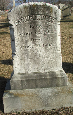
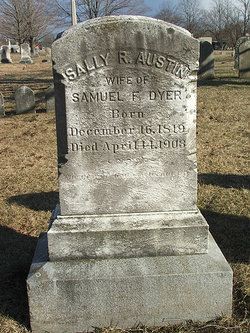
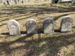
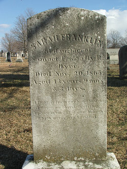
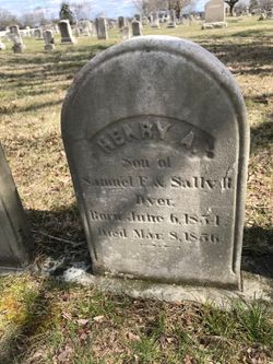
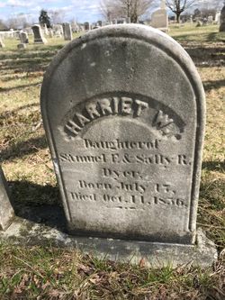
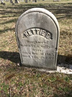
Samuel Franklin Dyer
| Birth | : | 22 Apr 1822 East Greenwich, Kent County, Rhode Island, USA |
| Death | : | 21 Apr 1895 Rhode Island, USA |
| Burial | : | Campground Cemetery, Westville, Holmes County, USA |
| Coordinate | : | 30.8215010, -85.8805560 |
frequently asked questions (FAQ):
-
Where is Samuel Franklin Dyer's memorial?
Samuel Franklin Dyer's memorial is located at: Campground Cemetery, Westville, Holmes County, USA.
-
When did Samuel Franklin Dyer death?
Samuel Franklin Dyer death on 21 Apr 1895 in Rhode Island, USA
-
Where are the coordinates of the Samuel Franklin Dyer's memorial?
Latitude: 30.8215010
Longitude: -85.8805560
Family Members:
Parent
Spouse
Siblings
Children
Flowers:
Nearby Cemetories:
1. Campground Cemetery
Westville, Holmes County, USA
Coordinate: 30.8215010, -85.8805560
2. John Braxton Cemetery
Westville, Holmes County, USA
Coordinate: 30.8177840, -85.8800537
3. Evergreen Missionary Baptist Church Cemetery
Westville, Holmes County, USA
Coordinate: 30.8243500, -85.8845100
4. Robert L Jones Cemetery
Westville, Holmes County, USA
Coordinate: 30.8405381, -85.8921500
5. Harris Chapel Cemetery
Holmes County, USA
Coordinate: 30.8572006, -85.8638992
6. Hickory Hill Baptist Church Cemetery
Westville, Holmes County, USA
Coordinate: 30.8224888, -85.9305954
7. Sellers Cemetery
Holmes County, USA
Coordinate: 30.8096470, -85.8207670
8. Westville Cemetery
Westville, Holmes County, USA
Coordinate: 30.7632999, -85.8593979
9. Hudson Hill Cemetery
Prosperity, Holmes County, USA
Coordinate: 30.8575000, -85.9386000
10. Dyson Cemetery
Holmes County, USA
Coordinate: 30.8211002, -85.8043976
11. Caryville Cemetery
Caryville, Washington County, USA
Coordinate: 30.7824993, -85.8067017
12. Otter Creek Methodist Church Cemetery
Ponce de Leon, Holmes County, USA
Coordinate: 30.7784200, -85.9539300
13. Corinth Cemetery
Prosperity, Holmes County, USA
Coordinate: 30.8188900, -85.9694300
14. Oak Grove Cemetery
Ponce de Leon, Holmes County, USA
Coordinate: 30.7464970, -85.9026520
15. Spirit Filled Church of God in Christ Cemetery
Caryville, Washington County, USA
Coordinate: 30.7738300, -85.8039750
16. Andrews Homestead Cemetery
Holmes County, USA
Coordinate: 30.8545891, -85.9680590
17. Pleasant Ridge Cemetery
Prosperity, Holmes County, USA
Coordinate: 30.8500004, -85.9779968
18. Pleasant Ridge Baptist Church Cemetery
Westville, Holmes County, USA
Coordinate: 30.8507900, -85.9779300
19. Merrill Cemetery
Westville, Holmes County, USA
Coordinate: 30.9022007, -85.9261017
20. Saint Mary A. M. E. Church Cemetery
Caryville, Washington County, USA
Coordinate: 30.7622950, -85.7983410
21. West Pittman Baptist Church Cemetery
Westville, Holmes County, USA
Coordinate: 30.9076300, -85.9212800
22. Hicks Family Cemetery
Westville, Holmes County, USA
Coordinate: 30.8807870, -85.9674910
23. Curry Cemetery
Izagora, Holmes County, USA
Coordinate: 30.9113998, -85.8383026
24. Old Mount Zion Cemetery
Westville, Holmes County, USA
Coordinate: 30.7220400, -85.8833040

