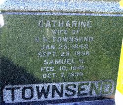
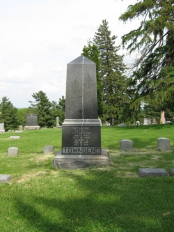
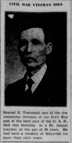
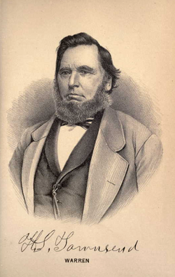
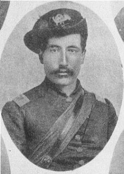
Samuel Halstead Townsend
| Birth | : | 10 Feb 1840 Stockton, Jo Daviess County, Illinois, USA |
| Death | : | 7 Oct 1930 Maryville, Nodaway County, Missouri, USA |
| Burial | : | Salem Memorial Park and Garden, Colma, San Mateo County, USA |
| Coordinate | : | 37.6774864, -122.4588470 |
| Plot | : | Sec 5, Row 9, s-n |
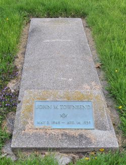
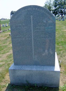
| Description | : | Cenotaph located in Elmwood Cemetery Maryville Daily Forum (Maryville, Missouri), Tuesday, October 7, 1930, [p. 1], 2Brief Illness Takes Life of Sam Townsend Pioneer Resident of County Moved Here More Than Sixty Years Ago. A Civil War Veteran Prominent Citizen Served In Union Army During War of Rebellion—Funeral Will Be Thursday. Samuel H. Townsend, Civil War veteran and a resident of Nodaway County since the late sixties, died about 10 o’clock this morning at the Missouri Methodist hospital in St. Joseph where he was taken for treatment August 28. Previous to that he was confined in the... Read More |
frequently asked questions (FAQ):
-
Where is Samuel Halstead Townsend's memorial?
Samuel Halstead Townsend's memorial is located at: Salem Memorial Park and Garden, Colma, San Mateo County, USA.
-
When did Samuel Halstead Townsend death?
Samuel Halstead Townsend death on 7 Oct 1930 in Maryville, Nodaway County, Missouri, USA
-
Where are the coordinates of the Samuel Halstead Townsend's memorial?
Latitude: 37.6774864
Longitude: -122.4588470
Family Members:
Parent
Spouse
Siblings
Flowers:
FOR THE BROTHER OF CPT. EDWARD E. TOWNSEND
Left by Anonymous on 24 May 2009

Left by Anonymous on 19 Jul 2015
Thank you for your service in the Civil War.
Left by Anonymous on 05 Dec 2020

Left by Anonymous on 08 Apr 2021
FOR THE BROTHER OF CPT. EDWARD E. TOWNSEND
Left by Anonymous on 24 May 2009

Left by Anonymous on 19 Jul 2015
Thank you for your service in the Civil War.
Left by Anonymous on 05 Dec 2020

Left by Anonymous on 08 Apr 2021
Nearby Cemetories:
1. Salem Memorial Park and Garden
Colma, San Mateo County, USA
Coordinate: 37.6774864, -122.4588470
2. Greek Orthodox Memorial Park
Colma, San Mateo County, USA
Coordinate: 37.6776314, -122.4611053
3. Eternal Home Cemetery
Colma, San Mateo County, USA
Coordinate: 37.6791060, -122.4601660
4. Home of Peace Cemetery and Emanu-El Mausoleum
Colma, San Mateo County, USA
Coordinate: 37.6755829, -122.4552231
5. Greenlawn Memorial Park
Colma, San Mateo County, USA
Coordinate: 37.6773338, -122.4632797
6. Hills of Eternity Memorial Park
Colma, San Mateo County, USA
Coordinate: 37.6763992, -122.4540024
7. The Italian Cemetery
Colma, San Mateo County, USA
Coordinate: 37.6823340, -122.4595360
8. Cypress Lawn Memorial Park
Colma, San Mateo County, USA
Coordinate: 37.6735001, -122.4551926
9. Woodlawn Memorial Park
Colma, San Mateo County, USA
Coordinate: 37.6811500, -122.4640470
10. Olivet Memorial Park
Colma, San Mateo County, USA
Coordinate: 37.6818040, -122.4544450
11. Sunset View Cemetery
Colma, San Mateo County, USA
Coordinate: 37.6809578, -122.4527359
12. Japanese Cemetery
Colma, San Mateo County, USA
Coordinate: 37.6837006, -122.4578857
13. Serbian Cemetery
Colma, San Mateo County, USA
Coordinate: 37.6793556, -122.4500198
14. Pets Rest Cemetery
Colma, San Mateo County, USA
Coordinate: 37.6789398, -122.4493027
15. Golden Hill Memorial Park
Colma, San Mateo County, USA
Coordinate: 37.6778946, -122.4471741
16. Hoy Sun Memorial Cemetery
Colma, San Mateo County, USA
Coordinate: 37.6772820, -122.4461460
17. Chinese Christian Cemetery
Daly City, San Mateo County, USA
Coordinate: 37.6675490, -122.4633350
18. Hoy Sun Ning Yung Cemetery
Daly City, San Mateo County, USA
Coordinate: 37.6670070, -122.4606940
19. Russian Sectarian Cemetery
Colma, San Mateo County, USA
Coordinate: 37.6669940, -122.4624480
20. Chong Seen Tong Cemetery
Daly City, San Mateo County, USA
Coordinate: 37.6664800, -122.4613600
21. Tung Sen Cemetery
Daly City, San Mateo County, USA
Coordinate: 37.6661660, -122.4620250
22. Holy Cross Catholic Cemetery
Colma, San Mateo County, USA
Coordinate: 37.6697006, -122.4464035
23. Chinese Cemetery
Daly City, San Mateo County, USA
Coordinate: 37.6674652, -122.4746628
24. Orange Memorial Park (Defunct)
South San Francisco, San Mateo County, USA
Coordinate: 37.6542015, -122.4257965

