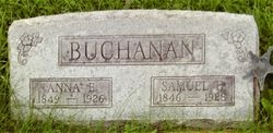
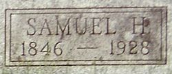
Samuel Henry Buchanan
| Birth | : | 4 Aug 1846 Westmoreland County, Pennsylvania, USA |
| Death | : | 1928 Osage County, Kansas, USA |
| Burial | : | Pinegrove Memorial Park, Minchinbury, Blacktown City, Australia |
| Coordinate | : | -33.7886400, 150.8478990 |
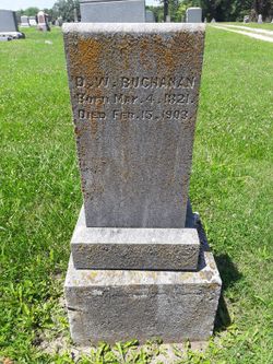
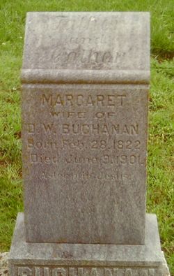
| Description | : | SAMUEL H. BUCHANAN, farmer, Section 21, P. O. Burlingame, was born in Westmoreland County, Pa., August 4, 1846; son of David W. Buchanan and Margaret Henry. His grandparents on his father's side were David Buchanan and Margaret McBride; on his mother's side Samuel Henry and Mary Ralston. He received a good common school education in his native town. He lived in Peoria county, Ill., several years and came to Kansas in 1878. He settled in Dragoon Township, where he owns a farm on Dragoon Creek with excellent improvements. He was married in Farmington, Ill., June 1, 1871, to Miss Anna... Read More |
frequently asked questions (FAQ):
-
Where is Samuel Henry Buchanan's memorial?
Samuel Henry Buchanan's memorial is located at: Pinegrove Memorial Park, Minchinbury, Blacktown City, Australia.
-
When did Samuel Henry Buchanan death?
Samuel Henry Buchanan death on 1928 in Osage County, Kansas, USA
-
Where are the coordinates of the Samuel Henry Buchanan's memorial?
Latitude: -33.7886400
Longitude: 150.8478990
Family Members:
Parent
Spouse
Siblings
Flowers:
Nearby Cemetories:
1. Pinegrove Memorial Park
Minchinbury, Blacktown City, Australia
Coordinate: -33.7886400, 150.8478990
2. Rooty Hill Presbyterian
Rooty Hill, Blacktown City, Australia
Coordinate: -33.7806700, 150.8513800
3. St Marys General Cemetery
St Marys, Penrith City, Australia
Coordinate: -33.7727050, 150.7878490
4. St. Bartholomew's Anglican Church Cemetery
Prospect, Blacktown City, Australia
Coordinate: -33.8045110, 150.9175750
5. St Mary Magdalene Anglican Churchyard
St Marys, Penrith City, Australia
Coordinate: -33.7705630, 150.7776050
6. Smithfield General Cemetery
Smithfield, Fairfield City, Australia
Coordinate: -33.8497800, 150.9252800
7. Smithfield Uniting Church Cemetery
Smithfield, Fairfield City, Australia
Coordinate: -33.8525100, 150.9373500
8. Smithfield Baptist Churchyard
Smithfield, Fairfield City, Australia
Coordinate: -33.8529380, 150.9374430
9. Smithfield Anglican
Smithfield, Fairfield City, Australia
Coordinate: -33.8536220, 150.9383850
10. Riverstone Cemetery
Riverstone, Blacktown City, Australia
Coordinate: -33.6853450, 150.8480790
11. Clydesdale Property
Marsden Park, Blacktown City, Australia
Coordinate: -33.6848034, 150.8077757
12. Castlebrook Memorial Park
Rouse Hill, Blacktown City, Australia
Coordinate: -33.6948310, 150.9219790
13. Penrith General Cemetery
Kingswood, Penrith City, Australia
Coordinate: -33.7561290, 150.7186600
14. St Phillips Church Cemetery
Marsden Park, Blacktown City, Australia
Coordinate: -33.6793810, 150.8167060
15. Animal Memorial Cemetery & Crematorium
Berkshire Park, Penrith City, Australia
Coordinate: -33.6887690, 150.7850410
16. Kemps Creek Cemetery and Crematorium
Kemps Creek, Liverpool City, Australia
Coordinate: -33.8958260, 150.7793870
17. Rouse Hill Anglican Cemetery
Rouse Hill, Blacktown City, Australia
Coordinate: -33.6810100, 150.9174190
18. St. Stephen's Penrith Anglican Church Columbarium
Penrith, Penrith City, Australia
Coordinate: -33.7552554, 150.7036009
19. St Stephens Anglican Cemetery
Penrith, Penrith City, Australia
Coordinate: -33.7558960, 150.7030470
20. Mays Hill Cemetery
Cumberland Council, Australia
Coordinate: -33.8193430, 150.9934850
21. Merrylands Anglican Church Columbarium
Merrylands, Cumberland Council, Australia
Coordinate: -33.8401100, 150.9870800
22. Lone Graves
Parramatta, City of Parramatta Council, Australia
Coordinate: -33.8186610, 150.9967800
23. St Nicholas of Myra Catholic Church, Penrith
Penrith, Penrith City, Australia
Coordinate: -33.7544695, 150.7000862
24. St. John's Cemetery
Parramatta, City of Parramatta Council, Australia
Coordinate: -33.8168010, 150.9983310

