| Birth | : | 16 Apr 1892 |
| Death | : | 19 Jan 1982 |
| Burial | : | Rose Hill Cemetery, Buffalo, Scott County, USA |
| Coordinate | : | 41.4644012, -90.7256012 |
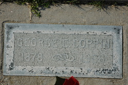
| Inscription | : | PVT U.S. ARMY WORLD WAR I |
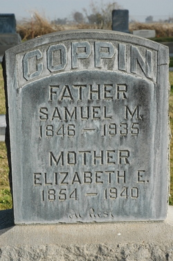
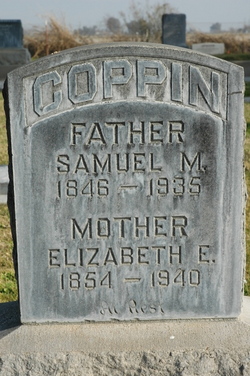
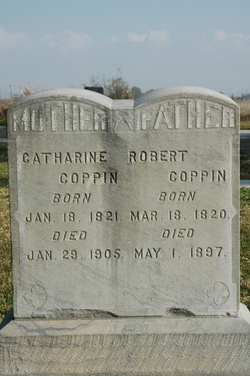
| Description | : | Samuel Mitchell Coppin was "a widely-experience and enterprising dairyman" in the city of Roseville, California, where he was the proprietor of the Roseville Dairy. Son of pioneers who crossed the plains to California in the early 1850's, he was born at Pleasant Grove, Sutter County, on April 16, 1892. After high school, he started the Coppin Brothers' Dairy, joining his three brothers, later buying them out. In 1920, he married Miss Florence Henderson of Auburn; they had one child, Maurine. (Research by Valarie Vine for bio from "History of Placer and Nevada Counties", published 1924) |
frequently asked questions (FAQ):
-
Where is Samuel Mitchell Coppin's memorial?
Samuel Mitchell Coppin's memorial is located at: Rose Hill Cemetery, Buffalo, Scott County, USA.
-
When did Samuel Mitchell Coppin death?
Samuel Mitchell Coppin death on 19 Jan 1982 in
-
Where are the coordinates of the Samuel Mitchell Coppin's memorial?
Latitude: 41.4644012
Longitude: -90.7256012
Family Members:
Parent
Siblings
Flowers:
Nearby Cemetories:
1. Rose Hill Cemetery
Buffalo, Scott County, USA
Coordinate: 41.4644012, -90.7256012
2. Saint Peters Cemetery
Buffalo, Scott County, USA
Coordinate: 41.4647522, -90.7265320
3. Andalusia Cemetery
Andalusia, Rock Island County, USA
Coordinate: 41.4361000, -90.7172012
4. Gabbert Family Cemetery
Blue Grass, Scott County, USA
Coordinate: 41.4939980, -90.7382000
5. Burnside Family Cemetery
Blue Grass, Scott County, USA
Coordinate: 41.4821500, -90.7796360
6. Chapel Hill Cemetery
Davenport, Scott County, USA
Coordinate: 41.4939194, -90.6781921
7. Blue Grass Cemetery
Blue Grass, Scott County, USA
Coordinate: 41.5083008, -90.7574997
8. Dunlap Cemetery
Edgington, Rock Island County, USA
Coordinate: 41.4085040, -90.7460400
9. Friday Family Cemetery
Davenport, Scott County, USA
Coordinate: 41.5093994, -90.6680984
10. Montpelier Cemetery
Montpelier, Muscatine County, USA
Coordinate: 41.4636002, -90.8091965
11. Kistenmacher Cemetery
Little Groves, Scott County, USA
Coordinate: 41.5381012, -90.7260971
12. Knaack Cemetery
Blue Grass, Scott County, USA
Coordinate: 41.5359535, -90.7511063
13. Fairmount Cemetery
Davenport, Scott County, USA
Coordinate: 41.5121994, -90.6371994
14. Tri-City Jewish Cemetery
Davenport, Scott County, USA
Coordinate: 41.5119362, -90.6311111
15. Edgington Cemetery
Edgington, Rock Island County, USA
Coordinate: 41.3718987, -90.7699966
16. Hazlitt Cemetery
Edgington, Rock Island County, USA
Coordinate: 41.3647740, -90.7108230
17. Holy Family Cemetery
Davenport, Scott County, USA
Coordinate: 41.5297012, -90.6211014
18. Sortore Cemetery
Edgington, Rock Island County, USA
Coordinate: 41.3628310, -90.7549670
19. Chapel Grove Cemetery
Rock Island County, USA
Coordinate: 41.3931007, -90.6241989
20. Zion Lutheran Cemetery
Taylor Ridge, Rock Island County, USA
Coordinate: 41.3874990, -90.8198550
21. Nye Cemetery
Montpelier, Muscatine County, USA
Coordinate: 41.4648552, -90.8677444
22. Davenport City Cemetery
Davenport, Scott County, USA
Coordinate: 41.5191760, -90.5997460
23. Dickson Cemetery
Rock Island, Rock Island County, USA
Coordinate: 41.4686012, -90.5783005
24. Dodge Family Cemetery
Fairport, Muscatine County, USA
Coordinate: 41.4750298, -90.8723681

