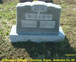
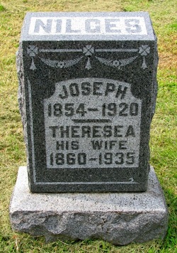
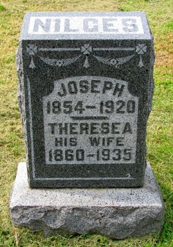
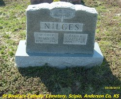
Samuel Peter Nilges
| Birth | : | 6 Jul 1889 Wardsville, Cole County, Missouri, USA |
| Death | : | 17 Jun 1965 Kincaid, Anderson County, Kansas, USA |
| Burial | : | East Rome Cemetery, Rome Township, Lenawee County, USA |
| Coordinate | : | 41.9155998, -84.1455994 |
| Description | : | Suggested edit: Based on Draft Registration 1917-1918, he was born July 6, 1888 in Castel Rock, Osage, Missouri. "United States World War I Draft Registration Cards, 1917-1918", database with images, FamilySearch (https://familysearch.org/ark:/61903/1:1:K662-RNR : 25 August 2019), Samuel Nilges, 1917-1918. Castle Rock is an extinct town in Osage County, in the U.S. state of Missouri. The townsite lies is located on the inside curve of an incised meander of the Osage River. The Castle Rock formation for which it was named lies across the river to the north in Cole County just southeast of Wardsville. The Pikes Camp Wildlife... Read More |
frequently asked questions (FAQ):
-
Where is Samuel Peter Nilges's memorial?
Samuel Peter Nilges's memorial is located at: East Rome Cemetery, Rome Township, Lenawee County, USA.
-
When did Samuel Peter Nilges death?
Samuel Peter Nilges death on 17 Jun 1965 in Kincaid, Anderson County, Kansas, USA
-
Where are the coordinates of the Samuel Peter Nilges's memorial?
Latitude: 41.9155998
Longitude: -84.1455994
Family Members:
Parent
Spouse
Siblings
Children
Flowers:
Nearby Cemetories:
1. East Rome Cemetery
Rome Township, Lenawee County, USA
Coordinate: 41.9155998, -84.1455994
2. Halstead Farm Cemetery
Rome Center, Lenawee County, USA
Coordinate: 41.9444300, -84.1533000
3. Rome Center Cemetery
Rome Township, Lenawee County, USA
Coordinate: 41.9455986, -84.1778030
4. Gage Cemetery
Dover Township, Lenawee County, USA
Coordinate: 41.8725014, -84.1260986
5. West Adrian Cemetery
Adrian, Lenawee County, USA
Coordinate: 41.9507600, -84.1055000
6. Wolf Creek Cemetery
Adrian, Lenawee County, USA
Coordinate: 41.9653015, -84.1316986
7. Lenawee Hills Memorial Park
Adrian, Lenawee County, USA
Coordinate: 41.9077988, -84.0781021
8. Adrian Center Cemetery
Adrian, Lenawee County, USA
Coordinate: 41.9277992, -84.0697021
9. Dover Center Cemetery
Dover Township, Lenawee County, USA
Coordinate: 41.8582993, -84.1699982
10. North Dover Cemetery
Clayton, Lenawee County, USA
Coordinate: 41.8878600, -84.2226000
11. County Poor House Cemetery
Madison Center, Lenawee County, USA
Coordinate: 41.8790000, -84.0746300
12. West Rome Cemetery
Rome Township, Lenawee County, USA
Coordinate: 41.9399986, -84.2257996
13. First United Methodist Church Memorial Garden
Adrian, Lenawee County, USA
Coordinate: 41.9053810, -84.0596370
14. West Madison Cemetery
Adrian, Lenawee County, USA
Coordinate: 41.8553009, -84.1066971
15. Old Adrian Burying Ground
Adrian, Lenawee County, USA
Coordinate: 41.8951360, -84.0406630
16. Woerner Cemetery
Adrian Township, Lenawee County, USA
Coordinate: 41.9763985, -84.0653000
17. Saint Marys Cemetery
Adrian, Lenawee County, USA
Coordinate: 41.8883018, -84.0344009
18. South Dover Cemetery
Clayton, Lenawee County, USA
Coordinate: 41.8431015, -84.2108002
19. Adrians Girls Training School Cemetery
Adrian, Lenawee County, USA
Coordinate: 41.9164900, -84.0274600
20. Maple Shade Cemetery
Onsted, Lenawee County, USA
Coordinate: 42.0014000, -84.1932983
21. Oakwood Cemetery
Adrian, Lenawee County, USA
Coordinate: 41.9113998, -84.0186005
22. North Rome Cemetery
Rome Center, Lenawee County, USA
Coordinate: 41.9756012, -84.2455978
23. Madison Cemetery
Adrian, Lenawee County, USA
Coordinate: 41.8600000, -84.0383330
24. Saint Josephs Catholic Cemetery
Adrian, Lenawee County, USA
Coordinate: 41.9121460, -84.0129340

