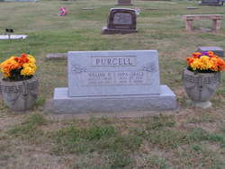
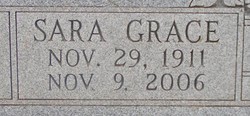
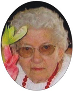
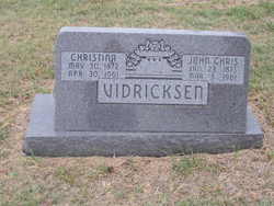
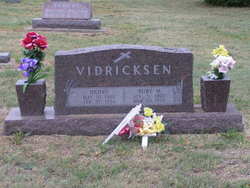
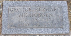
Sara Grace Vidricksen Purcell
| Birth | : | 29 Nov 1911 Kipp, Saline County, Kansas, USA |
| Death | : | 9 Nov 2006 Omaha, Douglas County, Nebraska, USA |
| Burial | : | Eagle Hill Cemetery, Westchester Station, Cumberland County, Canada |
| Coordinate | : | 45.6238800, -63.6511200 |
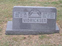
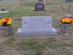
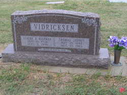
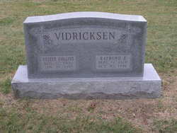
| Description | : | Obituary published in the 14 November 2006 edition of The Salina Journal. OMAHA, Neb. -- Sara G. Purcell, 94, Omaha, died Thursday, Nov. 9, 2006. Mrs. Purcell was born Sara G. Vidricksen on Nov. 29, 1911, in Kipp, the daughter of John Chris and Christine Vidricksen. She was a homemaker and an active church member all her life. She served on the New Cambria school board in the 1960s. She was preceded in death by her husband, William R. Purcell; and her siblings, Thomas Sidney (Sid), Harry, Raymond, Ann Hammond, Henry, George and John. Survivors include three daughters, Linda Reiff and husband Duaine and Dorothy... Read More |
frequently asked questions (FAQ):
-
Where is Sara Grace Vidricksen Purcell's memorial?
Sara Grace Vidricksen Purcell's memorial is located at: Eagle Hill Cemetery, Westchester Station, Cumberland County, Canada.
-
When did Sara Grace Vidricksen Purcell death?
Sara Grace Vidricksen Purcell death on 9 Nov 2006 in Omaha, Douglas County, Nebraska, USA
-
Where are the coordinates of the Sara Grace Vidricksen Purcell's memorial?
Latitude: 45.6238800
Longitude: -63.6511200
Family Members:
Parent
Spouse
Siblings
Flowers:
Nearby Cemetories:
1. Eagle Hill Cemetery
Westchester Station, Cumberland County, Canada
Coordinate: 45.6238800, -63.6511200
2. Saint Cornelius Roman Catholic Cemetery
Streets Ridge, Cumberland County, Canada
Coordinate: 45.6930960, -63.6321270
3. United Baptist
Wentworth, Cumberland County, Canada
Coordinate: 45.6471893, -63.5502902
4. Wentworth Cemetery
Wentworth Centre, Cumberland County, Canada
Coordinate: 45.6677884, -63.5530933
5. Embree Cemetery
Rose, Cumberland County, Canada
Coordinate: 45.5929900, -63.7700100
6. Rose Cemetery
Westchester Station, Cumberland County, Canada
Coordinate: 45.5935000, -63.7717600
7. Stevens Family Cemetery
Lower Wentworth, Cumberland County, Canada
Coordinate: 45.7082600, -63.5671600
8. Thomson Cemetery
Thomson Station, Cumberland County, Canada
Coordinate: 45.6914970, -63.7824860
9. Millvale Cemetery
Millvale, Cumberland County, Canada
Coordinate: 45.5993100, -63.8278400
10. Angevine Cemetery
Middleboro, Cumberland County, Canada
Coordinate: 45.7557100, -63.5642000
11. St Pauls Anglican Cemetery
Londonderry, Colchester County, Canada
Coordinate: 45.4772000, -63.6228100
12. Saint Ambrose Catholic Church Cemetery
Londonderry, Colchester County, Canada
Coordinate: 45.4739500, -63.6287400
13. Mattinson Hansford Cemetery
Oxford, Cumberland County, Canada
Coordinate: 45.7232139, -63.8172194
14. The Four Oaks Cemetery
West Tatamagouche, Colchester County, Canada
Coordinate: 45.6890300, -63.4520500
15. Hillcrest Cemetery
Londonderry, Colchester County, Canada
Coordinate: 45.4726590, -63.6112790
16. Wallace River Baptist Church
Middleboro, Cumberland County, Canada
Coordinate: 45.7724600, -63.5726000
17. Eaton Cemetery
Pugwash Junction, Cumberland County, Canada
Coordinate: 45.7867400, -63.6615600
18. Lake Road Cemetery
Lake Road, Colchester County, Canada
Coordinate: 45.6842700, -63.4263900
19. Folly Mountain Cemetery
Folly Mountain, Colchester County, Canada
Coordinate: 45.4780000, -63.5281100
20. Pugwash River Church Cemetery
Pugwash, Cumberland County, Canada
Coordinate: 45.7892430, -63.7154610
21. Williamsdale Cemetery
Williamsdale, Cumberland County, Canada
Coordinate: 45.6020609, -63.8972693
22. Oxford Junction Anglican Cemetery
Oxford Junction, Cumberland County, Canada
Coordinate: 45.6958200, -63.8846700
23. River Philip Cemetery
River Philip Centre, Cumberland County, Canada
Coordinate: 45.6855836, -63.8948214
24. River Philip United Church Cemetery
River Philip, Cumberland County, Canada
Coordinate: 45.6603500, -63.9057100

