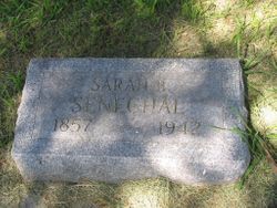
Sarah Bement Havens Senechal
| Birth | : | 1857 Wisconsin, USA |
| Death | : | 9 Oct 1942 Redfield, Spink County, South Dakota, USA |
| Burial | : | St. Stephen's United Church Cemetery, Red Bank, Northumberland County, Canada |
| Coordinate | : | 46.9387100, -65.8230800 |
| Plot | : | Division E, Block 046, Grave 002 |
| Description | : | Sarah Bement Havens was born May 1857 in Wisconsin to Sylvester D. Havens and Rachel (Phillip) Havens. She was of a pre-Revolutionary family and is named for her father's sister, Sarah Jenkins Havens Bement. Several Bement family members enlisted in the Continental Army and served in the Revolutionary War. Sarah's mother, Rachel Phillip, immigrated from Grenock, Scotland in 1849. She married Alfred F. Senechal in Milwaukee on 16 Sep 1890. Both were 33 years old at the time. They didn't have children. I can't find them in 1900, but they show up in 1910 census listings... Read More |
frequently asked questions (FAQ):
-
Where is Sarah Bement Havens Senechal's memorial?
Sarah Bement Havens Senechal's memorial is located at: St. Stephen's United Church Cemetery, Red Bank, Northumberland County, Canada.
-
When did Sarah Bement Havens Senechal death?
Sarah Bement Havens Senechal death on 9 Oct 1942 in Redfield, Spink County, South Dakota, USA
-
Where are the coordinates of the Sarah Bement Havens Senechal's memorial?
Latitude: 46.9387100
Longitude: -65.8230800
Family Members:
Flowers:
Nearby Cemetories:
1. St. Stephen's United Church Cemetery
Red Bank, Northumberland County, Canada
Coordinate: 46.9387100, -65.8230800
2. St. Stephen's Old Presbyterian Cemetery
Red Bank, Northumberland County, Canada
Coordinate: 46.9392510, -65.8217450
3. St Thomas the Apostle Roman Catholic Cemetery
Red Bank, Northumberland County, Canada
Coordinate: 46.9435920, -65.8262620
4. Boom Road Pentecostal Cemetery
Boom Road, Northumberland County, Canada
Coordinate: 46.9517840, -65.7860330
5. Boom Road Presbyterian Cemetery
Boom Road, Northumberland County, Canada
Coordinate: 46.9530417, -65.7868678
6. Little Southwest Baptist Cemetery
Sillikers, Northumberland County, Canada
Coordinate: 46.9406500, -65.8997100
7. Back Road Baptist Cemetery
Lyttleton, Northumberland County, Canada
Coordinate: 46.9463200, -65.9022100
8. Lyttleton Pentecostal Cemetery
Lyttleton, Northumberland County, Canada
Coordinate: 46.9375200, -65.9108500
9. Whitney Old Baptist Cemetery
Whitney, Northumberland County, Canada
Coordinate: 46.9662667, -65.7212500
10. Whitney New Baptist Cemetery
Whitney, Northumberland County, Canada
Coordinate: 46.9675529, -65.7158638
11. Williamstown United Cemetery
Williamstown, Northumberland County, Canada
Coordinate: 46.9262920, -65.7087740
12. Saint Philips United Cemetery
Whitney, Northumberland County, Canada
Coordinate: 46.9720600, -65.7061500
13. Cochraneville Church Cemetery
Doyles Brook, Northumberland County, Canada
Coordinate: 46.8470000, -65.7190000
14. Saint Mark's United Church Cemetery
Quarryville, Northumberland County, Canada
Coordinate: 46.8262500, -65.7761600
15. Ferguson Presbyterian Church Cemetery
Derby, Northumberland County, Canada
Coordinate: 46.8772400, -65.6715900
16. Old Saint Bridget's Roman Catholic Cemetery
Renous, Northumberland County, Canada
Coordinate: 46.8143752, -65.7963456
17. MacKinleyville-Cochranville Cemetery
McKinleyville, Northumberland County, Canada
Coordinate: 46.8650000, -65.6710000
18. MacKinley Family Cemetery
McKinleyville, Northumberland County, Canada
Coordinate: 46.8640000, -65.6710000
19. Saint Edwards Catholic Church Cemetery
Chelmsford, Northumberland County, Canada
Coordinate: 46.8670000, -65.6640000
20. Maple Glen Cemetery
Maple Glen, Northumberland County, Canada
Coordinate: 47.0355790, -65.6941930
21. St. Bridget's Catholic Church Cemetery
Renous, Northumberland County, Canada
Coordinate: 46.8089593, -65.7928838
22. St. James Roman Catholic Cemetery
Sevogle, Northumberland County, Canada
Coordinate: 47.0714300, -65.8239000
23. St. Peter's Anglican Church Cemetery
Millerton, Northumberland County, Canada
Coordinate: 46.9000200, -65.6358200
24. Eel Ground First Nation Cemetery
Eel Ground, Northumberland County, Canada
Coordinate: 46.9652600, -65.6271700


