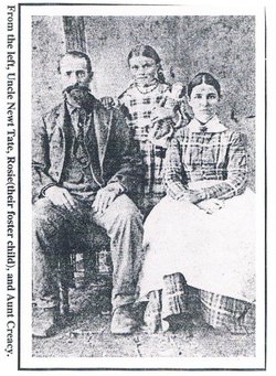
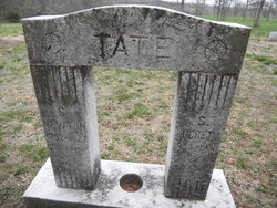
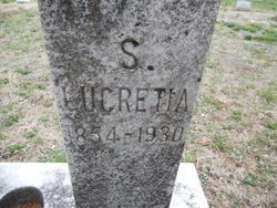
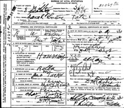
Sarah Lucretia Tucker Tate
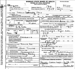
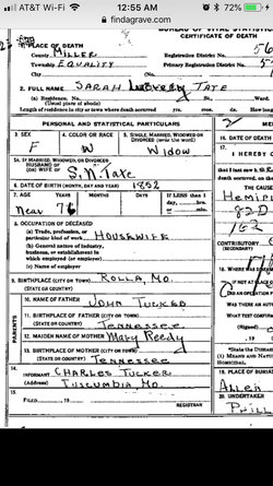
| Birth | : | 1854 Rolla, Phelps County, Missouri, USA |
| Death | : | 21 Jun 1930 Miller County, Missouri, USA |
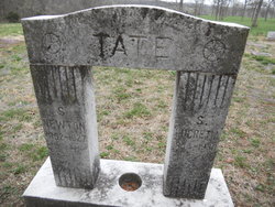
| Burial | : | Silver Terrace Cemeteries, Virginia City, Storey County, USA |
| Coordinate | : | 39.3162130, -119.6428250 |
| Description | : | d/o John Tucker & Mary Ready |
frequently asked questions (FAQ):
-
Where is Sarah Lucretia Tucker Tate's memorial?
Sarah Lucretia Tucker Tate's memorial is located at: Silver Terrace Cemeteries, Virginia City, Storey County, USA.
-
When did Sarah Lucretia Tucker Tate death?
Sarah Lucretia Tucker Tate death on 21 Jun 1930 in Miller County, Missouri, USA
-
Where are the coordinates of the Sarah Lucretia Tucker Tate's memorial?
Latitude: 39.3162130
Longitude: -119.6428250
Family Members:
Parent
Spouse
Siblings
Nearby Cemetories:
1. Silver Terrace Cemeteries
Virginia City, Storey County, USA
Coordinate: 39.3162130, -119.6428250
2. Mount Saint Mary Cemetery
Virginia City, Storey County, USA
Coordinate: 39.3139900, -119.6387900
3. Old Virginia City Jewish Cemetery
Virginia City, Storey County, USA
Coordinate: 39.3231010, -119.6414032
4. Pioneer Cemetery
Virginia City, Storey County, USA
Coordinate: 39.3035187, -119.6351646
5. Gold Hill Cemetery
Gold Hill, Storey County, USA
Coordinate: 39.2847557, -119.6602783
6. Gold Hill Catholic Cemetery
Gold Hill, Storey County, USA
Coordinate: 39.2805900, -119.6631000
7. American Flat Burial Site
Gold Hill, Storey County, USA
Coordinate: 39.2701120, -119.6647850
8. Silver City Cemetery
Silver City, Lyon County, USA
Coordinate: 39.2635994, -119.6380005
9. Dayton Cemetery
Dayton, Lyon County, USA
Coordinate: 39.2334000, -119.5970000
10. Mound House Pioneer Cemetery
Dayton, Lyon County, USA
Coordinate: 39.2155640, -119.6718910
11. Phenix Family Cemetery
Steamboat, Washoe County, USA
Coordinate: 39.3861510, -119.7469260
12. Washoe City Cemetery
Reno, Washoe County, USA
Coordinate: 39.3171997, -119.8198547
13. Empire Cemetery
Carson City, USA
Coordinate: 39.1842003, -119.7046967
14. Whispering Pines Cemetery
Reno, Washoe County, USA
Coordinate: 39.3608017, -119.8197021
15. Saint Teresa Memorial Garden
Carson City, Carson City, USA
Coordinate: 39.1871030, -119.7437150
16. Bowers Mansion Cemetery
Washoe County, USA
Coordinate: 39.2852800, -119.8422000
17. Huffaker Cemetery
Washoe County, USA
Coordinate: 39.4360771, -119.7753067
18. Franktown Creek Cemetery
Franktown, Washoe County, USA
Coordinate: 39.2752991, -119.8463974
19. Lone Mountain Cemetery
Carson City, Carson City, USA
Coordinate: 39.1768990, -119.7600021
20. Waltons Chapel of the Valley Cemetery
Carson City, Carson City, USA
Coordinate: 39.1715012, -119.7602997
21. Nevada State Prison Burial Ground
Carson City, Carson City, USA
Coordinate: 39.1581900, -119.7378200
22. Dixon Family Cemetery
Carson City, USA
Coordinate: 39.1483269, -119.7432404
23. Carson Pioneer Cemetery
Carson City, Carson City, USA
Coordinate: 39.1612396, -119.7792969
24. Old Stewart Indian Cemetery
Stewart, Carson City, USA
Coordinate: 39.1178900, -119.7546700

