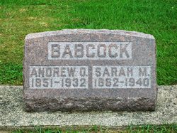
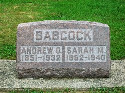
Sarah Marie Cripe Babcock
| Birth | : | 8 Apr 1862 |
| Death | : | 28 Aug 1940 |
| Burial | : | Memorial Park Cemetery, Albany, Albany City, Australia |
| Coordinate | : | -35.0172430, 117.8886040 |
| Plot | : | Section 5, Row 11 |
| Description | : | Published in The Rochester News-Sentinel Wednesday, August 28, 1940 Mrs. Sarah M. BABCOCK, aged 78, of 1309 Elm street, died at the home of her daughter, Mrs. Carmen SPENCER, in Fulton at 5:10 o'clock Wednesday morning. Death was caused by a stroke of paralysis which she suffered four months ago. Mrs. Babcock was taken to her daughter's home after she suffered the stroke. The deceased was born in Rochester township, April 8, 1862, the daughter of Hile and Hannah CRIPE. She had spent her entire life in the vicinity of Rochester. Her husband, the late Andrew O. BABCOCK, was Fulton county assessor for several... Read More |
frequently asked questions (FAQ):
-
Where is Sarah Marie Cripe Babcock's memorial?
Sarah Marie Cripe Babcock's memorial is located at: Memorial Park Cemetery, Albany, Albany City, Australia.
-
When did Sarah Marie Cripe Babcock death?
Sarah Marie Cripe Babcock death on 28 Aug 1940 in
-
Where are the coordinates of the Sarah Marie Cripe Babcock's memorial?
Latitude: -35.0172430
Longitude: 117.8886040
Family Members:
Parent
Spouse
Siblings
Children
Flowers:
Nearby Cemetories:
1. Memorial Park Cemetery
Albany, Albany City, Australia
Coordinate: -35.0172430, 117.8886040
2. Albany Burial Ground (Lot S112)
Albany City, Australia
Coordinate: -35.0237650, 117.8822610
3. Albany Burial Ground (Lot S115)
Albany City, Australia
Coordinate: -35.0247100, 117.8825210
4. Memorial Park Burial Site
Albany, Albany City, Australia
Coordinate: -35.0157600, 117.9024200
5. Allambie Park Cemetery
Albany, Albany City, Australia
Coordinate: -34.9809910, 117.9200340
6. St. Werburgh's Chapel & Cemetery
Mount Barker, Plantagenet Shire, Australia
Coordinate: -34.6853069, 117.5996387
7. Mount Barker Cemetery East
Mount Barker, Plantagenet Shire, Australia
Coordinate: -34.6437373, 117.6709039
8. Mount Barker Cemetery West
Mount Barker, Plantagenet Shire, Australia
Coordinate: -34.6437679, 117.6692459
9. Denmark Public Cemetery
Denmark, Denmark Shire, Australia
Coordinate: -34.9542900, 117.3764500
10. Tenterden General Cemetery
Tenterden, Cranbrook Shire, Australia
Coordinate: -34.3652251, 117.5709322
11. Tenterden War Memorial
Tenterden, Cranbrook Shire, Australia
Coordinate: -34.3652200, 117.5584600
12. Wansbrough Burial
Wansbrough, Broomehill-Tambellup Shire, Australia
Coordinate: -34.1425430, 117.6733960
13. Walpole Cemetery
Walpole, Manjimup Shire, Australia
Coordinate: -34.9787030, 116.7456710
14. Bonshaw Burial Ground
Cranbrook Shire, Australia
Coordinate: -34.1871390, 117.3203610
15. Borden Cemetery
Borden, Gnowangerup Shire, Australia
Coordinate: -34.0727430, 118.2646100
16. Tambellup Cemetery
Tambellup, Broomehill-Tambellup Shire, Australia
Coordinate: -34.0353790, 117.6330330
17. Gnowangerup Cemetery
Gnowangerup, Gnowangerup Shire, Australia
Coordinate: -33.9461540, 118.0135490
18. Pindellup St. Peters Church of England
Tambellup, Broomehill-Tambellup Shire, Australia
Coordinate: -33.9755683, 117.4940883
19. Broomehill Cemetery
Broomehill, Broomehill-Tambellup Shire, Australia
Coordinate: -33.8477960, 117.6227830
20. Eticup Cemetery
Broomehill, Broomehill-Tambellup Shire, Australia
Coordinate: -33.8328280, 117.5639560
21. Kojonup Cemetery
Kojonup, Kojonup Shire, Australia
Coordinate: -33.8248400, 117.1526770
22. Jerramungup Cemetery
Gnowangerup, Gnowangerup Shire, Australia
Coordinate: -33.9471830, 118.8849460
23. Chowerup Cemetery
Chowerup, Boyup Brook Shire, Australia
Coordinate: -34.0858380, 116.7028610
24. Bremer Bay Cemetery
Bremer Bay, Jerramungup Shire, Australia
Coordinate: -34.4120310, 119.3795230

