
| Birth | : | 28 Oct 1855 Iowa, USA |
| Death | : | 20 Apr 1939 Deadwood, Lawrence County, South Dakota, USA |
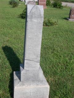
| Burial | : | Batchelder-Nye Road Cemetery, Acworth, Sullivan County, USA |
| Coordinate | : | 43.2134018, -72.2925186 |
| Description | : | Jonathan Freeman was born on 17 Mar 1851 in La Porte City, Benton Co, IA. He died on 13 Oct 1933 in Lead, Lawrence Co, SD. Listed as Johnathan in 1880 Nebraska census. Appeared in Saunders Co, NE 1880 Census-Marble Precinct (Vol 9 ED 170 Sheet 13 Line 48) Birthdate on death certificate listed as 3/27/1851 vs 3/17/1851 listed in obituary. In some family history notes written by May Asheim Comer (descended through Lucinda Freeman), she indicated that Jonathan was born in Van Buren County, IA. He was married to Sarah Melinda Caudle (daughter of Gaven Caudle and Martha Eva Duncan)... Read More |
frequently asked questions (FAQ):
-
Where is Sarah Melinda Caudle Freeman's memorial?
Sarah Melinda Caudle Freeman's memorial is located at: Batchelder-Nye Road Cemetery, Acworth, Sullivan County, USA.
-
When did Sarah Melinda Caudle Freeman death?
Sarah Melinda Caudle Freeman death on 20 Apr 1939 in Deadwood, Lawrence County, South Dakota, USA
-
Where are the coordinates of the Sarah Melinda Caudle Freeman's memorial?
Latitude: 43.2134018
Longitude: -72.2925186
Family Members:
Parent

Spouse
Siblings
Children
Flowers:


Nearby Cemetories:
1. Batchelder-Nye Road Cemetery
Acworth, Sullivan County, USA
Coordinate: 43.2134018, -72.2925186
2. Acworth Cemetery
Acworth, Sullivan County, USA
Coordinate: 43.2129211, -72.2940216
3. Mitchell Cemetery
Acworth, Sullivan County, USA
Coordinate: 43.2188100, -72.2854000
4. Marple Cemetery
Acworth, Sullivan County, USA
Coordinate: 43.1858330, -72.2502780
5. Newton Cemetery
Acworth, Sullivan County, USA
Coordinate: 43.1730560, -72.3150000
6. Walker Farm Cemetery
Acworth, Sullivan County, USA
Coordinate: 43.2627800, -72.3066700
7. Quaker City Cemetery
Quaker City, Sullivan County, USA
Coordinate: 43.2707500, -72.3315100
8. West End Cemetery
Marlow, Cheshire County, USA
Coordinate: 43.1511917, -72.2513809
9. Gee Cemetery
Lempster, Sullivan County, USA
Coordinate: 43.1883300, -72.1963900
10. Lower Cemetery
Unity, Sullivan County, USA
Coordinate: 43.2912100, -72.2835500
11. Upper Langdon Cemetery
Langdon, Sullivan County, USA
Coordinate: 43.1675500, -72.3796200
12. Unity Center Cemetery
Unity, Sullivan County, USA
Coordinate: 43.2922200, -72.2747300
13. Maple Side Cemetery
Alstead, Cheshire County, USA
Coordinate: 43.1495100, -72.3592200
14. North Cemetery
Alstead, Cheshire County, USA
Coordinate: 43.1511457, -72.3631668
15. East Alstead Cemetery
East Alstead, Cheshire County, USA
Coordinate: 43.1301900, -72.2802600
16. East Lempster Cemetery
East Lempster, Sullivan County, USA
Coordinate: 43.2253700, -72.1769500
17. Pine Grove Cemetery
Alstead, Cheshire County, USA
Coordinate: 43.1493400, -72.3693200
18. Lower Langdon Cemetery
Langdon, Sullivan County, USA
Coordinate: 43.1585999, -72.3938980
19. Forest Hill Cemetery
Charlestown, Sullivan County, USA
Coordinate: 43.2374300, -72.4208000
20. Pine Crest Cemetery
Charlestown, Sullivan County, USA
Coordinate: 43.2539700, -72.4134600
21. Sullivan County Farm Cemetery
Unity, Sullivan County, USA
Coordinate: 43.3102800, -72.3111200
22. Alstead Center Cemetery
Alstead Center, Cheshire County, USA
Coordinate: 43.1177000, -72.3264000
23. Saint Catherines Cemetery
Charlestown, Sullivan County, USA
Coordinate: 43.2314800, -72.4263300
24. Marlow Early Settlers Cemetery
Marlow, Cheshire County, USA
Coordinate: 43.1285040, -72.2204730