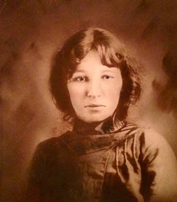
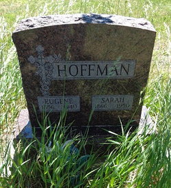
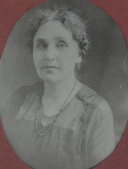
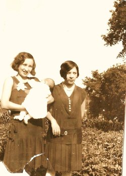
Sarah Myrick Hoffman
| Birth | : | Jan 1866 Minnesota, USA |
| Death | : | 1950 |
| Burial | : | Joliet Cemetery, Joliet, Carbon County, USA |
| Coordinate | : | 45.4799995, -108.9985962 |
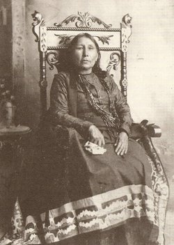
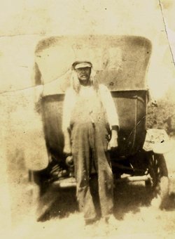
| Description | : | Sarah was born at the Crow Creek Sioux Agency in the Dakota Territory, but there is no way to notate that here. Legal Marriage Register of the Santee Tribe 1863-1906 at Santee, NE: Eugene Hoffman and Sarah Myrick 10 August 1879 The Indian name is the best I can decipher from Indian records on film # 1,015,911 at the Mesa library. Nancy Wapaha is listed as her mother, with no father shown. In other records she is listed as Sarah Merrick or Myrick. The film gives the parents' English and Indian names, and the children's ages, though the dates cover 3... Read More |
frequently asked questions (FAQ):
-
Where is Sarah Myrick Hoffman's memorial?
Sarah Myrick Hoffman's memorial is located at: Joliet Cemetery, Joliet, Carbon County, USA.
-
When did Sarah Myrick Hoffman death?
Sarah Myrick Hoffman death on 1950 in
-
Where are the coordinates of the Sarah Myrick Hoffman's memorial?
Latitude: 45.4799995
Longitude: -108.9985962
Family Members:
Parent
Spouse
Siblings
Children
Flowers:
Nearby Cemetories:
1. Joliet Cemetery
Joliet, Carbon County, USA
Coordinate: 45.4799995, -108.9985962
2. Carbonado Cemetery
Joliet, Carbon County, USA
Coordinate: 45.4585991, -109.0139008
3. Beltz Cemetery
Carbon County, USA
Coordinate: 45.4049988, -109.0706024
4. Gebo Cemetery
Fromberg, Carbon County, USA
Coordinate: 45.4030000, -108.9242000
5. Rockvale Cemetery
Rockvale, Carbon County, USA
Coordinate: 45.4888770, -108.8626350
6. Park City Cemetery
Park City, Stillwater County, USA
Coordinate: 45.6247120, -108.9165690
7. Roberts Cemetery
Roberts, Carbon County, USA
Coordinate: 45.3605995, -109.1536026
8. Pioneer Cemetery
Stillwater County, USA
Coordinate: 45.6575012, -108.8944016
9. Bridger Cemetery
Bridger, Carbon County, USA
Coordinate: 45.2825012, -108.9244003
10. Teeples Cemetery
Bridger, Carbon County, USA
Coordinate: 45.3248600, -108.7785880
11. Mountain View Cemetery
Bridger, Carbon County, USA
Coordinate: 45.2588997, -108.8910980
12. Saint Olaf Cemetery
Luther, Carbon County, USA
Coordinate: 45.4064636, -109.3343735
13. Mountain View Cemetery
Columbus, Stillwater County, USA
Coordinate: 45.6417007, -109.2727966
14. Deuel Castange Cemetery
Red Lodge, Carbon County, USA
Coordinate: 45.3380000, -109.3104370
15. Sunrise Cemetery
Carbon County, USA
Coordinate: 45.3105450, -109.2888330
16. Saint Anthony Catholic Cemetery
Laurel, Yellowstone County, USA
Coordinate: 45.6939650, -108.7685320
17. Laurel Cemetery
Laurel, Yellowstone County, USA
Coordinate: 45.6944008, -108.7692032
18. Yellowstone National Cemetery
Laurel, Yellowstone County, USA
Coordinate: 45.6962050, -108.7726520
19. Clear Creek Cemetery
Roberts, Carbon County, USA
Coordinate: 45.2416992, -109.1931000
20. Silver Tip Ranch Cemetery
Bridger, Carbon County, USA
Coordinate: 45.1889340, -108.9850340
21. John Henry Cemetery
Carbon County, USA
Coordinate: 45.2580986, -109.3031006
22. Big Day Cemetery
Pryor, Big Horn County, USA
Coordinate: 45.4169006, -108.5653000
23. Rosebud Cemetery
Stillwater County, USA
Coordinate: 45.4807014, -109.4459000
24. Plenty Coups State Park Cemetery
Pryor, Big Horn County, USA
Coordinate: 45.4287870, -108.5491920

