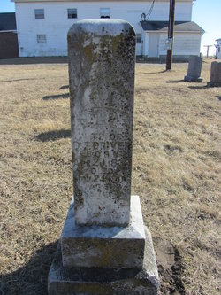
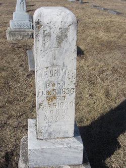
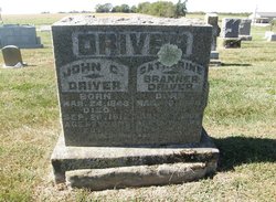
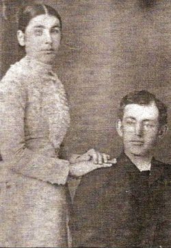
Sarah “Sallie” Branner Driver
| Birth | : | 20 Apr 1839 Rockingham County, Virginia, USA |
| Death | : | 24 Nov 1906 Versailles, Morgan County, Missouri, USA |
| Burial | : | Greenwood Cemetery, Hunters, Stevens County, USA |
| Coordinate | : | 48.1263885, -118.1127777 |
| Description | : | From the Gospel Witness, Dec. 5, 1906: DRIVER. - In the solemn hour of death, we look to the Giver of all good for comforting and sustaining grace. For the first time in the history of the family, death has entered the home of our ministering brother D. F. Driver, and taken away the devoted wife and mother. Not only the family, but also church and community, feel and mourn the loss of one whose hands were ever ready to minister to the wants of the needy, and whose life was a living testimony of the reality of the Christian... Read More |
frequently asked questions (FAQ):
-
Where is Sarah “Sallie” Branner Driver's memorial?
Sarah “Sallie” Branner Driver's memorial is located at: Greenwood Cemetery, Hunters, Stevens County, USA.
-
When did Sarah “Sallie” Branner Driver death?
Sarah “Sallie” Branner Driver death on 24 Nov 1906 in Versailles, Morgan County, Missouri, USA
-
Where are the coordinates of the Sarah “Sallie” Branner Driver's memorial?
Latitude: 48.1263885
Longitude: -118.1127777
Family Members:
Parent
Spouse
Siblings
Children
Flowers:
Nearby Cemetories:
1. Greenwood Cemetery
Hunters, Stevens County, USA
Coordinate: 48.1263885, -118.1127777
2. Cedonia Community Cemetery
Cedonia, Stevens County, USA
Coordinate: 48.1544456, -118.1677780
3. Fruitland Seventh Day Adventist Cemetery
Stevens County, USA
Coordinate: 48.0721600, -118.1604200
4. Etue Cemetery
Fruitland, Stevens County, USA
Coordinate: 48.0721500, -118.1606700
5. Matilda and Alex Quill Cemetery (Defunct)
Inchelium, Ferry County, USA
Coordinate: 48.1446400, -118.2044200
6. Charles Seltice Cemetery
Ferry County, USA
Coordinate: 48.1011600, -118.2499600
7. Kewa Cemetery
Ferry County, USA
Coordinate: 48.1803017, -118.2553024
8. Rogers Bar Cemetery
Inchelium, Ferry County, USA
Coordinate: 48.0773500, -118.2748100
9. Enterprise Cemetery
Fruitland, Stevens County, USA
Coordinate: 48.0204300, -118.2370100
10. Our Lady of Lourdes Cemetery
Fruitland, Stevens County, USA
Coordinate: 47.9727200, -118.2101800
11. LaFleur Cemetery
Fruitland, Stevens County, USA
Coordinate: 47.9935100, -118.2759300
12. Julia Brown Cemetery
Enterprise, Stevens County, USA
Coordinate: 47.9948040, -118.2839580
13. Meteor Cemetery
Meteor, Ferry County, USA
Coordinate: 48.2727780, -118.2786110
14. West End Assembly of God Cemetery
Fruitland, Stevens County, USA
Coordinate: 47.9581700, -118.2265100
15. Spokane River Presbyterian Cemetery
Fruitland, Stevens County, USA
Coordinate: 47.9377900, -118.1904000
16. Hall Creek Cemetery
Inchelium, Ferry County, USA
Coordinate: 48.3200000, -118.1925000
17. Stranger Creek Cemetery
Daisy, Stevens County, USA
Coordinate: 48.3297005, -118.0832977
18. Summit Valley Cemetery
Addy, Stevens County, USA
Coordinate: 48.3086014, -117.9424973
19. Nine Mile Cemetery
Ferry County, USA
Coordinate: 48.0294600, -118.4105500
20. Pascal Cemetery
Stevens County, USA
Coordinate: 47.9425659, -118.3146896
21. Forest Center Cemetery
Springdale, Stevens County, USA
Coordinate: 48.0937614, -117.7685471
22. Fairview Cemetery
Daisy, Stevens County, USA
Coordinate: 48.3627510, -118.1387650
23. Soccumtitckun-Lynn Cemetery
Stevens County, USA
Coordinate: 47.9206300, -118.3292300
24. Sacred Heart Catholic Cemetery
Wellpinit, Stevens County, USA
Coordinate: 47.8889809, -117.9821701

