
| Birth | : | 22 Jan 1738 Wethersfield, Hartford County, Connecticut, USA |
| Death | : | 8 Dec 1808 |
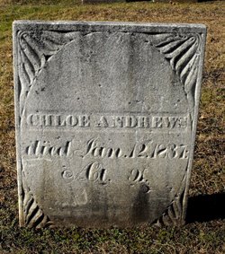
| Burial | : | Town Hill Cemetery, New Hartford, Litchfield County, USA |
| Coordinate | : | 41.8521805, -72.9964066 |
| Description | : | age 70 wife of Nehemiah |
frequently asked questions (FAQ):
-
Where is Sarah Welles Merrell's memorial?
Sarah Welles Merrell's memorial is located at: Town Hill Cemetery, New Hartford, Litchfield County, USA.
-
When did Sarah Welles Merrell death?
Sarah Welles Merrell death on 8 Dec 1808 in
-
Where are the coordinates of the Sarah Welles Merrell's memorial?
Latitude: 41.8521805
Longitude: -72.9964066
Family Members:
Parent

Spouse
Siblings
Flowers:


Nearby Cemetories:
1. Town Hill Cemetery
New Hartford, Litchfield County, USA
Coordinate: 41.8521805, -72.9964066
2. Old Nepaug Cemetery
Nepaug, Litchfield County, USA
Coordinate: 41.8300600, -72.9960200
3. New Nepaug Cemetery
New Hartford, Litchfield County, USA
Coordinate: 41.8290800, -72.9968300
4. Immaculate Conception Cemetery
New Hartford, Litchfield County, USA
Coordinate: 41.8781586, -72.9824982
5. North Village Cemetery
New Hartford, Litchfield County, USA
Coordinate: 41.8789406, -72.9826508
6. Saint John's Episcopal Church Memorial Garden
Pine Meadow, Litchfield County, USA
Coordinate: 41.8745850, -72.9681730
7. Bakersville Cemetery
Bakersville, Litchfield County, USA
Coordinate: 41.8324699, -73.0293732
8. Pine Meadow Cemetery
New Hartford, Litchfield County, USA
Coordinate: 41.8760490, -72.9681473
9. Pine Grove Cemetery
New Hartford, Litchfield County, USA
Coordinate: 41.8782997, -72.9621964
10. Riverside Cemetery
Barkhamsted, Litchfield County, USA
Coordinate: 41.9096985, -72.9880981
11. Dyer Cemetery
Canton, Hartford County, USA
Coordinate: 41.8338699, -72.9222260
12. Canton Center Cemetery
Canton, Hartford County, USA
Coordinate: 41.8550960, -72.9159270
13. Saint Peter Cemetery
Torrington, Litchfield County, USA
Coordinate: 41.8302383, -73.0727310
14. Southwest Cemetery
Collinsville, Hartford County, USA
Coordinate: 41.8227997, -72.9227982
15. Torringford Cemetery
Torrington, Litchfield County, USA
Coordinate: 41.8333270, -73.0760070
16. Trinity Episcopal Church Memorial Cemetery
Canton, Hartford County, USA
Coordinate: 41.8216060, -72.9234460
17. Calvary Cemetery
Canton, Hartford County, USA
Coordinate: 41.8153000, -72.9242020
18. Burrville Cemetery
Torrington, Litchfield County, USA
Coordinate: 41.8650360, -73.0848236
19. Canton Veterans Memorial
Collinsville, Hartford County, USA
Coordinate: 41.8122750, -72.9217530
20. Seventh Day Baptist Cemetery
Burlington, Hartford County, USA
Coordinate: 41.7835290, -72.9739330
21. Canton Memorial Monument
Collinsville, Hartford County, USA
Coordinate: 41.8096100, -72.9194000
22. Saint Patricks Cemetery
Canton, Hartford County, USA
Coordinate: 41.8092003, -72.9175034
23. Burr Pond State Park
Torrington, Litchfield County, USA
Coordinate: 41.8725204, -73.0907516
24. Collinsville Cemetery
Collinsville, Hartford County, USA
Coordinate: 41.8089409, -72.9170609