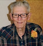
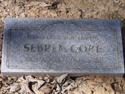
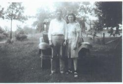
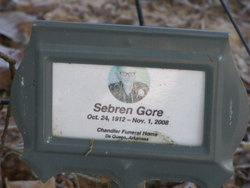
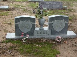
Sebren Gore
| Birth | : | 24 Oct 1912 Lockesburg, Sevier County, Arkansas, USA |
| Death | : | 1 Nov 2008 Lockesburg, Sevier County, Arkansas, USA |
| Burial | : | Blankenship Cemetery, Bedford County, USA |
| Coordinate | : | 35.6417007, -86.4644012 |
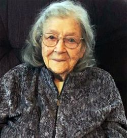
| Description | : | SEBREN GORE, AGE 96, A RESIDENT OF FALLS CHAPEL COMMUNITY OF SEVIER COUNTY, ARKANSAS, DIED SATURDAY, NOVEMBER 1, 2008 IN A TEXARKANA TEXAS HOSPITAL. HE WAS BORN TO CHARLIE AND LENA BROWN GORE AT LOCKESBURG, ARKANSAS, ON OCTOBER 24, 1912, AND WAS A RANCHER AND FARMER. HE WAS A MEMBER OF THE FALLS CHAPEL CUMBERLAND PRESBYTERIAN CHURCH AND ENJOYED MOWING THE LAWN, RIDING 4-WHEELERS, AND WORKING CATTLE. HE IS SURVIVED BY HIS WIFE OF OVER 74 YEARS, LOIS MCKELLER GORE OF FALLS CHAPEL, A DAUGHTER, LENA DELOIS LEE OF ARLINGTON, TENN., TWO GRANDCHILDREN, RANDALL GEORGE, AND HIS... Read More |
frequently asked questions (FAQ):
-
Where is Sebren Gore's memorial?
Sebren Gore's memorial is located at: Blankenship Cemetery, Bedford County, USA.
-
When did Sebren Gore death?
Sebren Gore death on 1 Nov 2008 in Lockesburg, Sevier County, Arkansas, USA
-
Where are the coordinates of the Sebren Gore's memorial?
Latitude: 35.6417007
Longitude: -86.4644012
Family Members:
Parent
Spouse
Siblings
Nearby Cemetories:
1. Blankenship Cemetery
Bedford County, USA
Coordinate: 35.6417007, -86.4644012
2. Barnes Cemetery
Bedford County, USA
Coordinate: 35.6469002, -86.4880981
3. Dozier Cemetery
Bedford County, USA
Coordinate: 35.6286011, -86.4428024
4. Morgan Cemetery
Big Springs, Rutherford County, USA
Coordinate: 35.6618996, -86.4503021
5. Guy Cemetery
Bedford County, USA
Coordinate: 35.6342010, -86.4278030
6. Harris Cemetery
Rutherford County, USA
Coordinate: 35.6711006, -86.4807968
7. Clark Cemetery
Bedford County, USA
Coordinate: 35.6282997, -86.5081024
8. Burton Cemetery
Bedford County, USA
Coordinate: 35.6189003, -86.5100021
9. Bell Cemetery
Deason, Bedford County, USA
Coordinate: 35.5999985, -86.4250031
10. Gilmore Cemetery
Fosterville, Rutherford County, USA
Coordinate: 35.6446991, -86.3993988
11. Bingham Cemetery
Fosterville, Rutherford County, USA
Coordinate: 35.6288986, -86.3996964
12. Holden Cemetery
Christiana, Rutherford County, USA
Coordinate: 35.6917000, -86.4360962
13. Fosterville Cemetery
Fosterville, Rutherford County, USA
Coordinate: 35.6571999, -86.3989029
14. Adcock Cemetery
Bedford County, USA
Coordinate: 35.5980988, -86.5068970
15. Webb Cemetery
Fosterville, Rutherford County, USA
Coordinate: 35.6716995, -86.4064026
16. Harris Cemetery
Rutherford County, USA
Coordinate: 35.6988983, -86.4578018
17. Batt Cemetery
Bedford County, USA
Coordinate: 35.6455994, -86.5366974
18. Houston-Whitworth Cemetery
Deason, Bedford County, USA
Coordinate: 35.5844002, -86.4443970
19. Haynes Cemetery
Rutherford County, USA
Coordinate: 35.6963997, -86.5038986
20. Allen Cemetery
Bedford County, USA
Coordinate: 35.6796989, -86.5271988
21. Brothers Cemetery
Fosterville, Rutherford County, USA
Coordinate: 35.6608009, -86.3858032
22. Cross Roads Church of Christ Cemetery
Bell Buckle, Bedford County, USA
Coordinate: 35.5985985, -86.3938980
23. Erwin Slave Cemetery
Bedford County, USA
Coordinate: 35.5746994, -86.4328003
24. Dial Cemetery
Bell Buckle, Bedford County, USA
Coordinate: 35.5964012, -86.3933029

