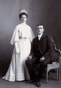
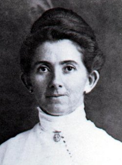
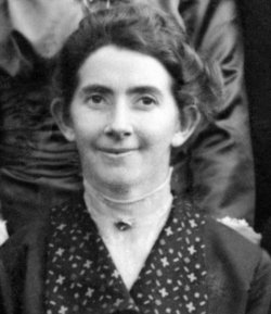
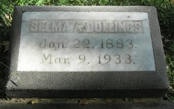
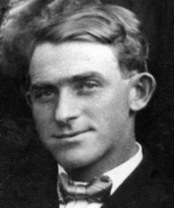
Selma Alma Osborn Dollings
| Birth | : | 22 Jan 1883 Colusa County, California, USA |
| Death | : | 9 Mar 1933 Red Bluff, Tehama County, California, USA |
| Burial | : | Buckingham Cemetery, Glastonbury, Hartford County, USA |
| Coordinate | : | 41.7120094, -72.5229721 |
| Plot | : | 9S, Row 1, Grave 33 |
| Description | : | "Daily News" (Red Bluff, California), Thursday, 9 March 1933, Page 1, Column 6 SELMA DOLLINGS IS SUMMONED BY DEATH HERE THIS MORNING Due to an illness from which she had been a sufferer for many months, Mrs. Selma Alma Dollings, 50, wife of Frank Dollings and mother of James Otto Dollings and Frank Herman Dollings of this city, passed away early this morning at the family home. Her death was not unexpected as she had been in a critical condition for several days. Only her strong will... Read More |
frequently asked questions (FAQ):
-
Where is Selma Alma Osborn Dollings's memorial?
Selma Alma Osborn Dollings's memorial is located at: Buckingham Cemetery, Glastonbury, Hartford County, USA.
-
When did Selma Alma Osborn Dollings death?
Selma Alma Osborn Dollings death on 9 Mar 1933 in Red Bluff, Tehama County, California, USA
-
Where are the coordinates of the Selma Alma Osborn Dollings's memorial?
Latitude: 41.7120094
Longitude: -72.5229721
Family Members:
Parent
Spouse
Siblings
Children
Flowers:
Nearby Cemetories:
1. Buckingham Cemetery
Glastonbury, Hartford County, USA
Coordinate: 41.7120094, -72.5229721
2. Old Eastbury Cemetery
Glastonbury, Hartford County, USA
Coordinate: 41.7043991, -72.5318985
3. Neipsic Cemetery
Glastonbury, Hartford County, USA
Coordinate: 41.6972008, -72.5374985
4. Holy Cross Cemetery
Glastonbury, Hartford County, USA
Coordinate: 41.7166710, -72.5606613
5. John Tom Hill Cemetery
Glastonbury, Hartford County, USA
Coordinate: 41.7075005, -72.4775009
6. Our Saviour Cemetery
Glastonbury, Hartford County, USA
Coordinate: 41.7033005, -72.5725021
7. Saint Michaels Ukrainian Catholic Church Cemetery
Glastonbury, Hartford County, USA
Coordinate: 41.6962013, -72.5724030
8. Wassuc Cemetery
Glastonbury, Hartford County, USA
Coordinate: 41.6730995, -72.5389023
9. Saint John the Baptist Ukranian Catholic Cemetery
Glastonbury, Hartford County, USA
Coordinate: 41.6960983, -72.5733032
10. Hillstown Road Cemetery
Manchester, Hartford County, USA
Coordinate: 41.7620277, -72.5698013
11. Green Cemetery
Glastonbury, Hartford County, USA
Coordinate: 41.7014008, -72.6053009
12. Beth Sholom Memorial Park
Manchester, Hartford County, USA
Coordinate: 41.7738991, -72.5061035
13. East Cemetery
Manchester, Hartford County, USA
Coordinate: 41.7747002, -72.5111008
14. Saint James Cemetery
Glastonbury, Hartford County, USA
Coordinate: 41.7158012, -72.6078033
15. Jones Hollow Cemetery
Marlborough, Hartford County, USA
Coordinate: 41.6693382, -72.4599533
16. Gay Cemetery
Hebron, Tolland County, USA
Coordinate: 41.7206001, -72.4383011
17. Saint James Cemetery
Manchester, Hartford County, USA
Coordinate: 41.7752991, -72.5355988
18. Saint James Episcopal Church Memorial Garden
Glastonbury, Hartford County, USA
Coordinate: 41.7146200, -72.6101870
19. Old Church Cemetery
South Glastonbury, Hartford County, USA
Coordinate: 41.6814003, -72.6007996
20. Cheney Cemetery
Manchester, Hartford County, USA
Coordinate: 41.7773438, -72.5118713
21. West Cemetery
Manchester, Hartford County, USA
Coordinate: 41.7680397, -72.5733032
22. Silver Lane Cemetery
East Hartford, Hartford County, USA
Coordinate: 41.7659302, -72.5859985
23. Saint Augustine Cemetery
Glastonbury, Hartford County, USA
Coordinate: 41.6646996, -72.5952988
24. Faith Lutheran Church Memorial Garden
East Hartford, Hartford County, USA
Coordinate: 41.7667110, -72.5946570

