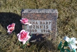
Sena June Harp Dennis
| Birth | : | 30 Sep 1880 Davis City, Decatur County, Iowa, USA |
| Death | : | 18 May 1910 Harrison County, Missouri, USA |
| Burial | : | Bountiful Memorial Park, Bountiful, Davis County, USA |
| Coordinate | : | 40.8678017, -111.8861008 |
| Plot | : | 399 |
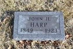
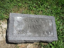
| Description | : | Daughter of John Henry Harp and Susan Catherine Lambkin. She married Alfred Austin Dennis on 1 January 1899 in Centerville, Iowa and they became the parents of five known children: Georgia, John Roy, Virgil Clair, Willard and Esther Kathryn. **headstone gives 1889 as death year, however, birth record gives 1880 which coincides with age at death. She died at Fox Creek Twp., Harrison, Missouri. Find A Grave won't take that place. |
frequently asked questions (FAQ):
-
Where is Sena June Harp Dennis's memorial?
Sena June Harp Dennis's memorial is located at: Bountiful Memorial Park, Bountiful, Davis County, USA.
-
When did Sena June Harp Dennis death?
Sena June Harp Dennis death on 18 May 1910 in Harrison County, Missouri, USA
-
Where are the coordinates of the Sena June Harp Dennis's memorial?
Latitude: 40.8678017
Longitude: -111.8861008
Family Members:
Parent
Spouse
Siblings
Children
Flowers:
Nearby Cemetories:
1. Bountiful Memorial Park
Bountiful, Davis County, USA
Coordinate: 40.8678017, -111.8861008
2. Sessions Settlement Cemetery
Woods Cross, Davis County, USA
Coordinate: 40.8746000, -111.9004000
3. Daniel Wood Cemetery
Bountiful, Davis County, USA
Coordinate: 40.8856000, -111.8925000
4. Lakeview Memorial Park
Bountiful, Davis County, USA
Coordinate: 40.8776400, -111.8454400
5. Centerville City Cemetery
Centerville, Davis County, USA
Coordinate: 40.9124985, -111.8675003
6. Shaarey Tzedek Cemetery
Salt Lake City, Salt Lake County, USA
Coordinate: 40.7812110, -111.8619330
7. City View Memoriam Mausoleum
Salt Lake City, Salt Lake County, USA
Coordinate: 40.7806000, -111.8596000
8. Memory Grove Memorial
Salt Lake City, Salt Lake County, USA
Coordinate: 40.7776300, -111.8844000
9. Salt Lake City Cemetery
Salt Lake City, Salt Lake County, USA
Coordinate: 40.7771988, -111.8580017
10. Kimball-Whitney Cemetery
Salt Lake City, Salt Lake County, USA
Coordinate: 40.7730000, -111.8897500
11. Mount Calvary Cemetery
Salt Lake City, Salt Lake County, USA
Coordinate: 40.7756004, -111.8538971
12. BNai Israel Cemetery
Salt Lake City, Salt Lake County, USA
Coordinate: 40.7747002, -111.8581009
13. Montefiore Cemetery
Salt Lake City, Salt Lake County, USA
Coordinate: 40.7740990, -111.8577880
14. Mormon Pioneer Memorial
Salt Lake City, Salt Lake County, USA
Coordinate: 40.7703133, -111.8856201
15. Cathedral of the Madeleine
Salt Lake City, Salt Lake County, USA
Coordinate: 40.7696000, -111.8817000
16. Saint Marks Cathedral Columbarium
Salt Lake City, Salt Lake County, USA
Coordinate: 40.7668460, -111.8841120
17. Farmington City Cemetery
Farmington, Davis County, USA
Coordinate: 40.9723100, -111.8832200
18. Block 49 Pioneer Cemetery
Salt Lake City, Salt Lake County, USA
Coordinate: 40.7626410, -111.8970370
19. Saint Pauls Episcopal Church Memorial Garden
Salt Lake City, Salt Lake County, USA
Coordinate: 40.7633000, -111.8645500
20. Mount Olivet Cemetery
Salt Lake City, Salt Lake County, USA
Coordinate: 40.7564250, -111.8504330
21. Fort Douglas Cemetery
Salt Lake City, Salt Lake County, USA
Coordinate: 40.7601776, -111.8248444
22. William O Smith Farm Cemetery
Farmington, Davis County, USA
Coordinate: 40.9849030, -111.8939710
23. Pioneer Cemetery
Salt Lake City, Salt Lake County, USA
Coordinate: 40.7564800, -111.8143500
24. Old Deseret Village Pioneer Cemetery
Salt Lake City, Salt Lake County, USA
Coordinate: 40.7564000, -111.8143000

