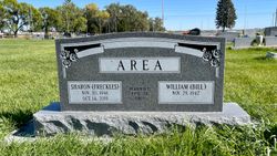
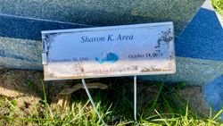
Sharon Kay Schroeder Area
| Birth | : | 30 Nov 1946 Nebraska, USA |
| Death | : | 14 Oct 2019 Overton, Dawson County, Nebraska, USA |
| Burial | : | Overton Cemetery, Overton, Dawson County, USA |
| Coordinate | : | 40.7317009, -99.5222015 |
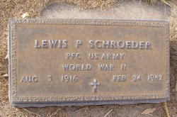
| Description | : | Sharon K. Area, 72, of Overton, Nebraska passed away after a lengthy illness on Monday, October 14, 2019 at her home with her family by her side. She was born November 30, 1946 to Lewis and Betty (Brown) Schroeder. She grew up in the rural Elm Creek/Overton area. She attended grade school at District 96 and then attended Overton High School and graduated with the class of 1965. After graduating High School, she worked at the Campbell Soup Factory in Tecumseh, Nebraska. Sharon met Bill Area in Havensville, Kansas. They were united in marriage on February 26, 1968... Read More |
frequently asked questions (FAQ):
-
Where is Sharon Kay Schroeder Area's memorial?
Sharon Kay Schroeder Area's memorial is located at: Overton Cemetery, Overton, Dawson County, USA.
-
When did Sharon Kay Schroeder Area death?
Sharon Kay Schroeder Area death on 14 Oct 2019 in Overton, Dawson County, Nebraska, USA
-
Where are the coordinates of the Sharon Kay Schroeder Area's memorial?
Latitude: 40.7317009
Longitude: -99.5222015
Family Members:
Parent
Siblings
Flowers:
Nearby Cemetories:
1. Overton Cemetery
Overton, Dawson County, USA
Coordinate: 40.7317009, -99.5222015
2. Plum Creek Massacre Cemetery
Phelps County, USA
Coordinate: 40.6726840, -99.6058220
3. Platte Valley Cemetery
Phelps County, USA
Coordinate: 40.6425018, -99.5028000
4. Williamsburg Cemetery
Phelps County, USA
Coordinate: 40.6490290, -99.4543150
5. Elm Creek Cemetery
Elm Creek, Buffalo County, USA
Coordinate: 40.7253890, -99.3851490
6. Elm Creek Catholic Cemetery
Elm Creek, Buffalo County, USA
Coordinate: 40.7250330, -99.3701420
7. Adullam Cemetery
Bertrand, Phelps County, USA
Coordinate: 40.6265000, -99.5856000
8. Fairview Cemetery
Elm Creek, Buffalo County, USA
Coordinate: 40.7993870, -99.3929670
9. Evergreen Cemetery
Lexington, Dawson County, USA
Coordinate: 40.7639008, -99.6791992
10. Sandstrom Cemetery
Phelps County, USA
Coordinate: 40.5983009, -99.5661011
11. Robb Cemetery
Smithfield, Gosper County, USA
Coordinate: 40.6710691, -99.6996001
12. Mount Hope Cemetery
Dawson County, USA
Coordinate: 40.8293991, -99.6733017
13. Saint Anns Cemetery
Lexington, Dawson County, USA
Coordinate: 40.7789001, -99.7114029
14. Greenwood Cemetery
Lexington, Dawson County, USA
Coordinate: 40.7956467, -99.7286682
15. First United Methodist Church Columbarium
Lexington, Dawson County, USA
Coordinate: 40.7810000, -99.7397000
16. Immanuel Cemetery
Bertrand, Phelps County, USA
Coordinate: 40.5682983, -99.6283035
17. Keely Cemetery
Smithfield, Gosper County, USA
Coordinate: 40.5727500, -99.6563500
18. Hope Lutheran Cemetery
Smithfield, Gosper County, USA
Coordinate: 40.5667500, -99.6800000
19. Stanley Cemetery
Amherst, Buffalo County, USA
Coordinate: 40.8157997, -99.2500000
20. Sumner Cemetery
Sumner, Dawson County, USA
Coordinate: 40.9608002, -99.5018997
21. Moses Hill Cemetery
Loomis, Phelps County, USA
Coordinate: 40.5104490, -99.4388600
22. Jewell Cemetery
Sumner, Dawson County, USA
Coordinate: 40.9599991, -99.5646973
23. Hewitt Cemetery
Lexington, Dawson County, USA
Coordinate: 40.8588982, -99.7769012
24. Highland Cemetery
Bertrand, Phelps County, USA
Coordinate: 40.5194016, -99.6430969


