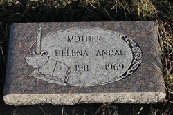
Signe Helena Osthus Andal
| Birth | : | 20 Sep 1911 |
| Death | : | 25 Oct 1969 |
| Burial | : | Holland Cemetery, Centerville, Turner County, USA |
| Coordinate | : | 43.1114006, -97.0314026 |
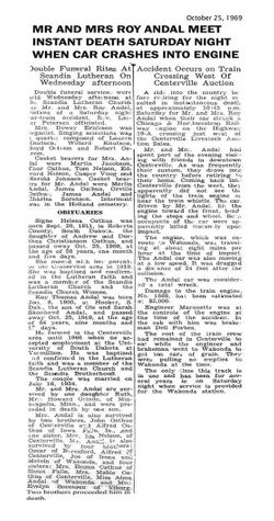
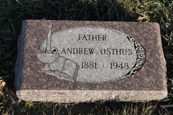
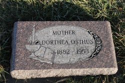
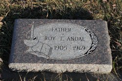
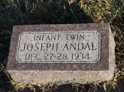
| Description | : | Signe Helena Osthus Andal was born Sept 20, 1911 to Andrew and Dorthea (Christenson) Osthus in Sisseton SD. She married Roy T Andal on July 16, 1934 at Sioux Falls SD. Helena was a member of Scandia Lutheran Church an A.L.C.W. officer. Helena and Roy died on Oct 25, 1969 in a car/train accident on the west edge of Centerville SD on Hwy 19A. She is survived by her daughter, Ruth (Howard) Grinde and two grandchildren. She is preceded in death by her husband, Roy and an infant son, Joseph in 1934. |
frequently asked questions (FAQ):
-
Where is Signe Helena Osthus Andal's memorial?
Signe Helena Osthus Andal's memorial is located at: Holland Cemetery, Centerville, Turner County, USA.
-
When did Signe Helena Osthus Andal death?
Signe Helena Osthus Andal death on 25 Oct 1969 in
-
Where are the coordinates of the Signe Helena Osthus Andal's memorial?
Latitude: 43.1114006
Longitude: -97.0314026
Family Members:
Parent
Spouse
Siblings
Children
Flowers:
Nearby Cemetories:
1. Holland Cemetery
Centerville, Turner County, USA
Coordinate: 43.1114006, -97.0314026
2. Grace Lutheran Cemetery
Turner County, USA
Coordinate: 43.1489100, -97.0034000
3. Evangelical Cemetery
Turner County, USA
Coordinate: 43.1569950, -96.9931519
4. Riverview Cemetery
Centerville, Turner County, USA
Coordinate: 43.1333008, -96.9567032
5. Saint Columbkill Cemetery
Wakonda, Clay County, USA
Coordinate: 43.0642014, -97.0828018
6. Baptist Cemetery
Viborg, Turner County, USA
Coordinate: 43.1702000, -97.0512000
7. Rose Hill Cemetery
Viborg, Turner County, USA
Coordinate: 43.1669000, -97.0813000
8. Hattervig Cemetery
Turner County, USA
Coordinate: 43.1925011, -97.0438995
9. Riverside-Barton Cemetery
Clay County, USA
Coordinate: 43.0402985, -96.9725037
10. Hansen Cemetery
Turner County, USA
Coordinate: 43.1260986, -97.1511002
11. Bethania Cemetery
Viborg, Turner County, USA
Coordinate: 43.1702995, -97.1417007
12. Saint Johns Cemetery
Clay County, USA
Coordinate: 43.0696983, -96.9056015
13. CJ Anderson Homestead
Riverside Township, Clay County, USA
Coordinate: 43.0214180, -96.9675540
14. Hillcrest Cemetery
Yankton County, USA
Coordinate: 43.0835991, -97.1680984
15. Mount Zion Cemetery
Lincoln County, USA
Coordinate: 43.1716995, -96.9105988
16. Turkey Valley Baptist Cemetery
Yankton County, USA
Coordinate: 43.1260100, -97.1800110
17. Turkey Valley Lutheran Cemetery
Yankton County, USA
Coordinate: 43.1257950, -97.1803430
18. Frieling Cemetery
Turner County, USA
Coordinate: 43.2186012, -96.9816971
19. Komstad Cemetery
Dalesburg, Clay County, USA
Coordinate: 43.0417938, -96.9058914
20. Hovde Cemetery
Clay County, USA
Coordinate: 43.0685997, -96.8835983
21. Evergreen Cemetery
Viborg, Turner County, USA
Coordinate: 43.1994019, -97.1607971
22. Salem Cemetery
Yankton County, USA
Coordinate: 43.0830180, -97.2090590
23. Pioneer Cemetery
Yankton County, USA
Coordinate: 43.0758018, -97.2118988
24. Old Lodi Cemetery
Lodi, Clay County, USA
Coordinate: 42.9757996, -96.9907990

