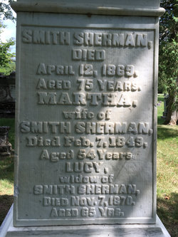
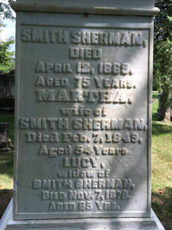
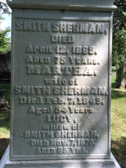
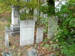
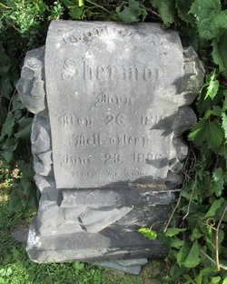
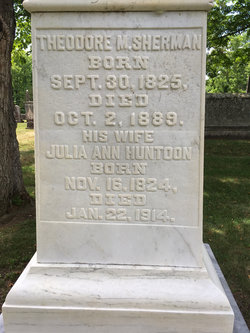
Smith Sherman
| Birth | : | 10 Apr 1794 Barre, Washington County, Vermont, USA |
| Death | : | 12 Apr 1869 Castleton, Rutland County, Vermont, USA |
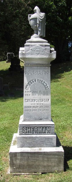
| Burial | : | Hillside Cemetery, Castleton, Rutland County, USA |
| Coordinate | : | 43.6133003, -73.1864014 |
| Plot | : | section 3 row 4 |
| Description | : | died aged 75y 2m; farmer; disease of kidneys son of Jonathan Sherman & Thankful (__) Sherman m. 1) Martha "Patty" Woodward 10 Apr 1815 at Barre, Vermont m. 2) Lucy ______ abt 1849/1850 children: Carlos S b. c.1818 d. 25 Jun 1896 Theodore M b. c.1825 d. 2 Oct 1889 |
frequently asked questions (FAQ):
-
Where is Smith Sherman's memorial?
Smith Sherman's memorial is located at: Hillside Cemetery, Castleton, Rutland County, USA.
-
When did Smith Sherman death?
Smith Sherman death on 12 Apr 1869 in Castleton, Rutland County, Vermont, USA
-
Where are the coordinates of the Smith Sherman's memorial?
Latitude: 43.6133003
Longitude: -73.1864014
Family Members:
Parent
Spouse
Siblings
Children
Flowers:
Nearby Cemetories:
1. Hillside Cemetery
Castleton, Rutland County, USA
Coordinate: 43.6133003, -73.1864014
2. Congregational Cemetery
Castleton, Rutland County, USA
Coordinate: 43.6127396, -73.1755524
3. Gates Cemetery
Castleton Corners, Rutland County, USA
Coordinate: 43.5938988, -73.2080994
4. Hydeville Cemetery
Hydeville, Rutland County, USA
Coordinate: 43.6027600, -73.2278000
5. Blissville Cemetery
Blissville, Rutland County, USA
Coordinate: 43.5923000, -73.2292000
6. Culver Cemetery
Blissville, Rutland County, USA
Coordinate: 43.5867004, -73.2268982
7. Fifield Cemetery
Poultney, Rutland County, USA
Coordinate: 43.5750008, -73.2181015
8. Crystal Beach Cemetery
Bomoseen, Rutland County, USA
Coordinate: 43.6603433, -73.1903886
9. Ames Cemetery
Poultney, Rutland County, USA
Coordinate: 43.5864830, -73.1311798
10. Ward Cemetery
Poultney, Rutland County, USA
Coordinate: 43.5581017, -73.1710968
11. Hosford Crossing Cemetery
Poultney, Rutland County, USA
Coordinate: 43.5621600, -73.2252200
12. West Street Cemetery
Fair Haven, Rutland County, USA
Coordinate: 43.5950900, -73.2708500
13. Old Burial Ground
Fair Haven, Rutland County, USA
Coordinate: 43.6011800, -73.2740400
14. Saint Marys Cemetery
Fair Haven, Rutland County, USA
Coordinate: 43.5968500, -73.2728800
15. Lincoln Cemetery
Castleton, Rutland County, USA
Coordinate: 43.6707000, -73.1392300
16. Cedar Grove Cemetery
Fair Haven, Rutland County, USA
Coordinate: 43.5824200, -73.2689000
17. Hampton Flats Cemetery
Hampton, Washington County, USA
Coordinate: 43.5550003, -73.2574997
18. Carvers Falls Cemetery
West Haven, Rutland County, USA
Coordinate: 43.6264000, -73.3007965
19. William Miller Cemetery
Low Hampton, Washington County, USA
Coordinate: 43.5950600, -73.2997200
20. East Poultney Jewish Cemetery
East Poultney, Rutland County, USA
Coordinate: 43.5275002, -73.2009964
21. East Poultney Cemetery
East Poultney, Rutland County, USA
Coordinate: 43.5270004, -73.2009964
22. Saint Johns Episcopal Church Cemetery
East Poultney, Rutland County, USA
Coordinate: 43.5261330, -73.2072670
23. East Hubbardton Cemetery
East Hubbardton, Rutland County, USA
Coordinate: 43.6986008, -73.1430969
24. Saint Stanislaus Kostka Cemetery
West Rutland, Rutland County, USA
Coordinate: 43.5963402, -73.0555115

