SSGT John D. “Jack” Furman
| Birth | : | 21 Sep 1918 |
| Death | : | 28 Jan 2014 |
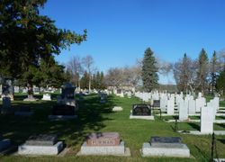
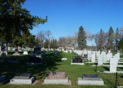
| Burial | : | Mountain View Cemetery, Lethbridge, Lethbridge Census Division, Canada |
| Coordinate | : | 49.6800385, -112.8297729 |
| Plot | : | Section B |
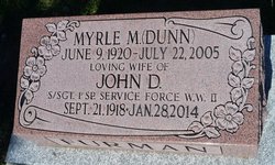
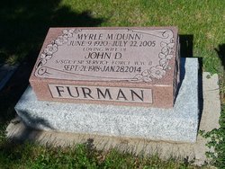
| Inscription | : | MYRLE M. (DUNN) June 9, 1920-July 22, 2005 LOVING WIFE OF JOHN D. S/SGT. 1st SP. SERVICE FORCE W.W.II Sept. 21, 1918 - Jan. 28, 2014 FURMAN |
| Description | : | LETHBRIDGE HERALD OBITUARY April 26 2014 JOHN DAYMOTH FURMAN Jack Furman passed away peacefully January 28, 2014 at the Kamloops hospital. John [Jack] Furman was born in Fort Macleod, Alberta, on September 21, 1918. Jack operated the Speedway Service Station in Fort Macleod when duty called. Jack received his training in the Canadian Army Trade School (CATS) in Hamilton Ontario. Jack heard that there was a call to join a special top secret outfit. He volunteered and was accepted into the First Canadian Special Service Battalion, the Canadian component of the Canadian / American, First Special Service Force. Jack was one of the... Read More |
frequently asked questions (FAQ):
-
Where is SSGT John D. “Jack” Furman's memorial?
SSGT John D. “Jack” Furman's memorial is located at: Mountain View Cemetery, Lethbridge, Lethbridge Census Division, Canada.
-
When did SSGT John D. “Jack” Furman death?
SSGT John D. “Jack” Furman death on 28 Jan 2014 in
-
Where are the coordinates of the SSGT John D. “Jack” Furman's memorial?
Latitude: 49.6800385
Longitude: -112.8297729
Family Members:
Spouse
Nearby Cemetories:
1. Mountain View Cemetery
Lethbridge, Lethbridge Census Division, Canada
Coordinate: 49.6800385, -112.8297729
2. Indian Battle Park
Lethbridge, Lethbridge Census Division, Canada
Coordinate: 49.6928200, -112.8582900
3. Saint Patrick's Cemetery
Lethbridge, Lethbridge Census Division, Canada
Coordinate: 49.7084618, -112.8428726
4. Archmount Cemetery
Lethbridge, Lethbridge Census Division, Canada
Coordinate: 49.7057900, -112.9017500
5. Royal View Memorial Cemetery
Lethbridge, Lethbridge Census Division, Canada
Coordinate: 49.7518540, -112.8242250
6. Diamond City Cemetery
Diamond City, Lethbridge Census Division, Canada
Coordinate: 49.7979150, -112.8326800
7. Coaldale Community Cemetery
Coaldale, Lethbridge Census Division, Canada
Coordinate: 49.7355600, -112.6242300
8. Coaldale Mennonite Cemetery
Coaldale, Lethbridge Census Division, Canada
Coordinate: 49.7355600, -112.6242300
9. Wilson Siding Hutterite Cemetery
Wilson, Lethbridge Census Division, Canada
Coordinate: 49.6203914, -112.5781130
10. Picture Butte Memorial Cemetery
Picture Butte, Lethbridge Census Division, Canada
Coordinate: 49.8671600, -112.7760500
11. Monarch Cemetery
Monarch, Lethbridge Census Division, Canada
Coordinate: 49.8020980, -113.0953220
12. Temple Hill Cemetery
Raymond, Lethbridge Census Division, Canada
Coordinate: 49.4916300, -112.6605200
13. Nobleford Monarch Cemetery
Nobleford, Lethbridge Census Division, Canada
Coordinate: 49.8456500, -113.0942100
14. Huntsville Cemetery
Iron Springs, Lethbridge Census Division, Canada
Coordinate: 49.9028100, -112.6886100
15. Stirling Cemetery
Stirling, Lethbridge Census Division, Canada
Coordinate: 49.5093400, -112.5380000
16. Magrath Cemetery
Magrath, Claresholm Census Division, Canada
Coordinate: 49.3985700, -112.8648700
17. Orton Cemetery
Orton, Claresholm Census Division, Canada
Coordinate: 49.7484600, -113.2540900
18. Albion Ridge Cemetery
Barons, Lethbridge Census Division, Canada
Coordinate: 49.9598350, -112.9169650
19. Stirling Mennonite Church Cemetery
Stirling, Lethbridge Census Division, Canada
Coordinate: 49.4607570, -112.5387970
20. New York Hutterite Cemetery
Judson, Lethbridge Census Division, Canada
Coordinate: 49.5931870, -112.3956383
21. Lakeside Hutterite Colony Cemetery
Cranford, Lethbridge Census Division, Canada
Coordinate: 49.6685448, -112.3586315
22. East Raymond Hutterite Colony Cemetery
Raymond, Lethbridge Census Division, Canada
Coordinate: 49.4185305, -112.5791329
23. Hillridge Hutterite Colony Cemetery
Cranford, Lethbridge Census Division, Canada
Coordinate: 49.7196094, -112.3393464
24. White Lake Cemetery
Nobleford, Lethbridge Census Division, Canada
Coordinate: 49.9018700, -113.2107750


