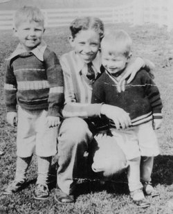
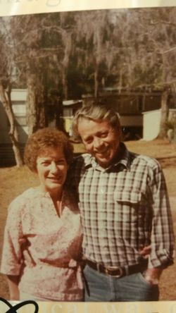
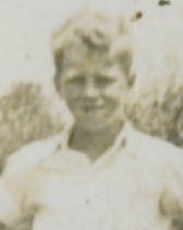
Stanley Enoch Hash
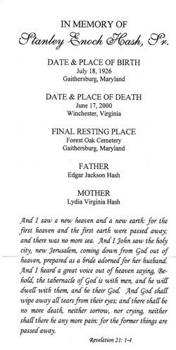
| Birth | : | 18 Jul 1926 Quince Orchard, Montgomery County, Maryland, USA |
| Death | : | 17 Jun 2000 Winchester, Winchester City, Virginia, USA |
| Burial | : | Crownpoint Cemetery, Crownpoint, McKinley County, USA |
| Coordinate | : | 35.6757630, -108.1533320 |
| Description | : | Married Margaret Schaffer November 5, 1946 Married Fannie Rebecca Hash on June 8, 2000, in Charles Town Occupation: Assistant manager of A&P grocery store Alexandria VA 30 years Served in the Army during World War II 6 children, 13 grandchildren and 6 great-grandchildren --------------------------------------------------------------------------------------- |
frequently asked questions (FAQ):
-
Where is Stanley Enoch Hash's memorial?
Stanley Enoch Hash's memorial is located at: Crownpoint Cemetery, Crownpoint, McKinley County, USA.
-
When did Stanley Enoch Hash death?
Stanley Enoch Hash death on 17 Jun 2000 in Winchester, Winchester City, Virginia, USA
-
Where are the coordinates of the Stanley Enoch Hash's memorial?
Latitude: 35.6757630
Longitude: -108.1533320
Family Members:
Parent
Spouse
Siblings
Flowers:
Nearby Cemetories:
1. Crownpoint Cemetery
Crownpoint, McKinley County, USA
Coordinate: 35.6757630, -108.1533320
2. Borrego Pass Cemetery
McKinley County, USA
Coordinate: 35.5711550, -108.0172970
3. Standing Rock Cemetery
Standing Rock, McKinley County, USA
Coordinate: 35.8014560, -108.3614590
4. Pinedale Cemetery
Pinedale, McKinley County, USA
Coordinate: 35.6113860, -108.4498390
5. Thoreau Cemetery
Thoreau, McKinley County, USA
Coordinate: 35.4082450, -108.2066630
6. Whitehorse Lake Cemetery
Whitehorse, McKinley County, USA
Coordinate: 35.8117800, -107.7478300
7. Wetherill Cemetery
Nageezi, San Juan County, USA
Coordinate: 36.0633850, -107.9649170
8. White Rock Cemetery
White Rock, San Juan County, USA
Coordinate: 36.0873960, -108.2764430
9. McGaffey Cemetery
McGaffey, McKinley County, USA
Coordinate: 35.3703003, -108.5224991
10. Torreon Cemetery
McKinley County, USA
Coordinate: 35.3722000, -108.5250015
11. Rehoboth Mission Cemetery
Rehoboth, McKinley County, USA
Coordinate: 35.5286640, -108.6540990
12. Pioneer Memorial Park
Bluewater, Cibola County, USA
Coordinate: 35.2430992, -107.9685974
13. Gallup State Veterans Cemetery
Gallup, McKinley County, USA
Coordinate: 35.5358950, -108.7086870
14. Cathedral of the Sacred Heart Crypt
Gallup, McKinley County, USA
Coordinate: 35.5258450, -108.7357330
15. Hillcrest Cemetery
Gallup, McKinley County, USA
Coordinate: 35.5214005, -108.7525024
16. Tohatchi Cemetery
Tohatchi, McKinley County, USA
Coordinate: 35.8626080, -108.7582670
17. San Mateo Cemetery
San Mateo, Cibola County, USA
Coordinate: 35.3310570, -107.6425840
18. Mormon Colony Cemetery
Cibola County, USA
Coordinate: 35.1730995, -108.4661026
19. Pinehaven Cemetery
Pinehaven, McKinley County, USA
Coordinate: 35.3518982, -108.7268982
20. Star Lake Mission Cemetery
McKinley County, USA
Coordinate: 35.8688200, -107.4907900
21. Grants Memorial Park
Grants, Cibola County, USA
Coordinate: 35.1605500, -107.8365000
22. Naschitti Cemetery
Naschitti, San Juan County, USA
Coordinate: 36.0662500, -108.6823800
23. Gallup City Cemetery
Gallup, McKinley County, USA
Coordinate: 35.5016320, -108.8400220
24. Sunset Memorial Park
Gallup, McKinley County, USA
Coordinate: 35.5028770, -108.8443640

