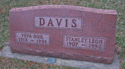
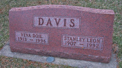
Stanley Leon Davis
| Birth | : | 10 Apr 1907 Cedar Rapids, Linn County, Iowa, USA |
| Death | : | 1 May 1992 Cedar Rapids, Linn County, Iowa, USA |
| Burial | : | Quirindi General Cemetery, Quirindi, Liverpool Plains Shire, Australia |
| Coordinate | : | -31.5182600, 150.6869300 |
| Description | : | Son of George W. Davis and Daisy Parmelia Van Kirk Spouse of Veva Doil Sawyer Date: May 13, 1992 Publication: The Gazette (Cedar Rapids-Iowa City) Page: 2 Stanley L. Davis, 85, of 2602 Johnson Avenue N.W., died Monday evening, May 11, 1992 in his home, following a brief illness. Born April 10, 1907 at Cedar Rapids to George and Daisy (Van Kirk) Davis, he married Veva Sawyer on November 14, 1931. For twenty-two years, he was a policeman for the Cedar Rapids Police Department, retiring in 1963. He was a member of Cedar Christian Church; a lifetime member of Masonic... Read More |
frequently asked questions (FAQ):
-
Where is Stanley Leon Davis's memorial?
Stanley Leon Davis's memorial is located at: Quirindi General Cemetery, Quirindi, Liverpool Plains Shire, Australia.
-
When did Stanley Leon Davis death?
Stanley Leon Davis death on 1 May 1992 in Cedar Rapids, Linn County, Iowa, USA
-
Where are the coordinates of the Stanley Leon Davis's memorial?
Latitude: -31.5182600
Longitude: 150.6869300
Family Members:
Parent
Spouse
Siblings
Flowers:
Nearby Cemetories:
1. Old Quirindi Burial Ground (Defunct)
Quirindi, Liverpool Plains Shire, Australia
Coordinate: -31.5177689, 150.6779610
2. Quipolly General Cemetery
Quipolly, Liverpool Plains Shire, Australia
Coordinate: -31.4480100, 150.6145450
3. Wallabadah General Cemetery
Wallabadah, Liverpool Plains Shire, Australia
Coordinate: -31.5463600, 150.8253800
4. Willow Tree Cemetery
Willow Tree, Liverpool Plains Shire, Australia
Coordinate: -31.6533740, 150.7283810
5. Willow Tree Catholic Cemetery
Willow Tree, Liverpool Plains Shire, Australia
Coordinate: -31.6646200, 150.7267100
6. Werris Creek General Cemetery
Werris Creek, Liverpool Plains Shire, Australia
Coordinate: -31.3342800, 150.6535400
7. Walhallow Cemetery
Caroona, Liverpool Plains Shire, Australia
Coordinate: -31.4029460, 150.4242460
8. Currabubula Cemetery
Currabubula, Liverpool Plains Shire, Australia
Coordinate: -31.2639201, 150.7484767
9. Breeza General Cemetery
Breeza, Gunnedah Shire, Australia
Coordinate: -31.2498300, 150.4610290
10. Spring Ridge Cemetery
Spring Ridge, Liverpool Plains Shire, Australia
Coordinate: -31.3874828, 150.2835445
11. Blackville Catholic Cemetery
Blackville, Liverpool Plains Shire, Australia
Coordinate: -31.6440290, 150.2371790
12. Colly Blue Cemetery
Colly Blue, Liverpool Plains Shire, Australia
Coordinate: -31.4579540, 150.1393320
13. Curlewis Cemetery
Curlewis, Gunnedah Shire, Australia
Coordinate: -31.1268010, 150.2691040
14. Carroll General Cemetery
Carroll, Gunnedah Shire, Australia
Coordinate: -30.9947500, 150.4495200
15. Sisters of Mercy Cemetery
Gunnedah, Gunnedah Shire, Australia
Coordinate: -30.9805057, 150.2607847
16. Gunnedah Memorial Park
Gunnedah, Gunnedah Shire, Australia
Coordinate: -30.9929200, 150.2320660
17. Gunnedah General Cemetery
Gunnedah, Gunnedah Shire, Australia
Coordinate: -30.9840660, 150.2425840
18. Tambar Springs General Cemetery
Tambar Springs, Gunnedah Shire, Australia
Coordinate: -31.3436510, 149.8417510
19. Wybong Cemetery
Wybong, Muswellbrook Shire, Australia
Coordinate: -32.2771470, 150.6375970
20. St James Church Cemetery
Muswellbrook, Muswellbrook Shire, Australia
Coordinate: -32.2641590, 150.8900180
21. Muswellbrook Cemetery
Muswellbrook, Muswellbrook Shire, Australia
Coordinate: -32.2620530, 150.9004740
22. Muswellbrook War Cemetery
Muswellbrook, Muswellbrook Shire, Australia
Coordinate: -32.2631300, 150.9013900
23. Giants Creek Cemetery
Sandy Hollow, Muswellbrook Shire, Australia
Coordinate: -32.3249630, 150.5482480
24. Merton Cemetery
Denman, Muswellbrook Shire, Australia
Coordinate: -32.3797900, 150.7243520


