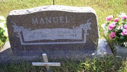
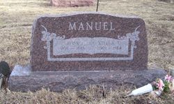
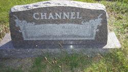
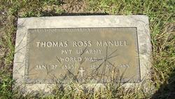
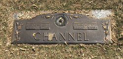
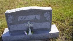
Stella Mae Channel Manuel
| Birth | : | 8 Nov 1901 Havensville, Pottawatomie County, Kansas, USA |
| Death | : | 9 Sep 1984 Havensville, Pottawatomie County, Kansas, USA |
| Burial | : | America City Cemetery, America City, Nemaha County, USA |
| Coordinate | : | 39.5727997, -96.0421982 |
| Description | : | THE TOPEKA CAPITAL-JOURNAL Sept. 11, 1984 HAVENSVILLE--Mrs. Stella Mae Manuel, 82, Havensville, died Sunday, Sept. 9, at an Onaga hospital. She was born Nov. 8, 1901, the daughter of Norman H. and Sarah Margaret Lewis Channel. Mrs. Manuel was a member of the United Methodist Church, the ladies' society at the church, a charter member of the NPJ Homemakers Demonstration Unit, and a member of America City Grange No. 1968 and the auxiliary to the Am. Legion at Havensville. She also gathered news for small newspapers in the Havensville community 25 years. She married Ross Manuel Sept. 3, 1924. ... Read More |
frequently asked questions (FAQ):
-
Where is Stella Mae Channel Manuel's memorial?
Stella Mae Channel Manuel's memorial is located at: America City Cemetery, America City, Nemaha County, USA.
-
When did Stella Mae Channel Manuel death?
Stella Mae Channel Manuel death on 9 Sep 1984 in Havensville, Pottawatomie County, Kansas, USA
-
Where are the coordinates of the Stella Mae Channel Manuel's memorial?
Latitude: 39.5727997
Longitude: -96.0421982
Family Members:
Parent
Spouse
Siblings
Children
Flowers:
Nearby Cemetories:
1. Rose Hill Cemetery
Nemaha County, USA
Coordinate: 39.5811005, -96.0130997
2. Soldier Cemetery
Soldier, Jackson County, USA
Coordinate: 39.5417900, -95.9654800
3. Havensville Cemetery
Havensville, Pottawatomie County, USA
Coordinate: 39.5119019, -96.0828018
4. Saint Patricks Cemetery
Corning, Nemaha County, USA
Coordinate: 39.6521988, -96.0250015
5. Saint Patricks Cemetery
Nemaha County, USA
Coordinate: 39.6029091, -96.1459122
6. Corning Cemetery
Corning, Nemaha County, USA
Coordinate: 39.6632996, -96.0314026
7. Regar Cemetery
Onaga, Pottawatomie County, USA
Coordinate: 39.5153008, -96.1358032
8. Suterland Cemetery
Onaga, Pottawatomie County, USA
Coordinate: 39.5156600, -96.1542000
9. Bucks Grove Church Cemetery
Soldier, Jackson County, USA
Coordinate: 39.4633293, -96.0158310
10. Ontario Cemetery
Nemaha County, USA
Coordinate: 39.5663795, -95.8885193
11. Onaga Cemetery
Onaga, Pottawatomie County, USA
Coordinate: 39.5083008, -96.1763992
12. Neuchatel Cemetery
Neuchatel, Nemaha County, USA
Coordinate: 39.5685196, -96.2015381
13. Pleasant Hill Cemetery
Corning, Nemaha County, USA
Coordinate: 39.6895800, -95.9907400
14. Masters and Warren Cemetery
Corning, Nemaha County, USA
Coordinate: 39.6970500, -96.0224800
15. Loughmiller Family Cemetery
Jackson County, USA
Coordinate: 39.4450500, -95.9988500
16. Mulberry Cemetery
Nemaha County, USA
Coordinate: 39.6314011, -96.2014008
17. Fairview Cemetery
Goff, Nemaha County, USA
Coordinate: 39.6831017, -95.9383011
18. Olive Hill Cemetery
Soldier, Jackson County, USA
Coordinate: 39.4631004, -95.9285965
19. James Cemetery
Jackson County, USA
Coordinate: 39.4535800, -95.9424500
20. Fairview Cemetery
Onaga, Pottawatomie County, USA
Coordinate: 39.4356600, -96.1101300
21. Vienna Cemetery
Pottawatomie County, USA
Coordinate: 39.4472198, -96.1466675
22. Saint Pauls Lutheran Cemetery
Duluth, Pottawatomie County, USA
Coordinate: 39.5257988, -96.2311020
23. Circleville Cemetery
Circleville, Jackson County, USA
Coordinate: 39.5014000, -95.8664017
24. Home Cemetery
Pottawatomie County, USA
Coordinate: 39.5052986, -96.2219009

