
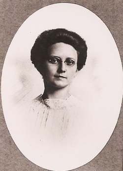
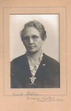
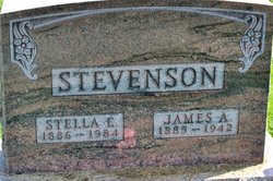

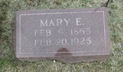
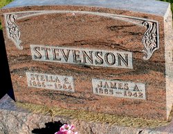
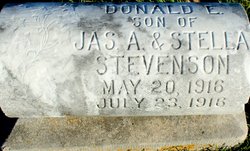
Stella Payne Stevenson Knepper
| Birth | : | 16 Oct 1886 |
| Death | : | 4 Nov 1984 |
| Burial | : | Hollywood Cemetery, Harrington, Kent County, USA |
| Coordinate | : | 38.9247017, -75.5558014 |
| Plot | : | Sec. 7, Row 17, North side. |
frequently asked questions (FAQ):
-
Where is Stella Payne Stevenson Knepper's memorial?
Stella Payne Stevenson Knepper's memorial is located at: Hollywood Cemetery, Harrington, Kent County, USA.
-
When did Stella Payne Stevenson Knepper death?
Stella Payne Stevenson Knepper death on 4 Nov 1984 in
-
Where are the coordinates of the Stella Payne Stevenson Knepper's memorial?
Latitude: 38.9247017
Longitude: -75.5558014
Family Members:
Parent
Spouse
Siblings
Children


Nearby Cemetories:
1. Hollywood Cemetery
Harrington, Kent County, USA
Coordinate: 38.9247017, -75.5558014
2. Williamsville Cemetery
Williamsville, Kent County, USA
Coordinate: 38.8946000, -75.5130000
3. Griffiths Chapel Cemetery
Williamsville, Kent County, USA
Coordinate: 38.8958015, -75.5081024
4. Townsend Family Cemetery
Church Hill Village, Kent County, USA
Coordinate: 38.9312600, -75.4896400
5. Abbott Family Burying Ground
Felton, Kent County, USA
Coordinate: 38.9731704, -75.5796893
6. Tharp Family Cemetery
Farmington, Kent County, USA
Coordinate: 38.8736000, -75.5707000
7. Thistlewood Cemetery
Kent County, USA
Coordinate: 38.9651400, -75.5060900
8. Cordray Family Cemetery
Farmington, Kent County, USA
Coordinate: 38.8694500, -75.5688900
9. Fleming Family Cemetery
Kent County, USA
Coordinate: 38.8680100, -75.5720300
10. Benston Family Plot
Harrington, Kent County, USA
Coordinate: 38.9284470, -75.6303590
11. Anderson Family Plot
Harrington, Kent County, USA
Coordinate: 38.9017180, -75.6282340
12. Simpson Family Cemetery
Milford, Sussex County, USA
Coordinate: 38.8735200, -75.5010300
13. Whites Methodist Church Cemetery
Harrington, Kent County, USA
Coordinate: 38.9320000, -75.6549000
14. Staytonville Methodist Episcopal Church Cemetery
Sussex County, USA
Coordinate: 38.8500000, -75.5182000
15. Dawson-Griffith Family Cemetery
Staytonville, Sussex County, USA
Coordinate: 38.8455800, -75.5175000
16. Bethel Methodist Church Cemetery
Andrewsville, Kent County, USA
Coordinate: 38.8617300, -75.6368100
17. Taylor Family Plot
Andrewsville, Kent County, USA
Coordinate: 38.8540300, -75.6264880
18. Hopkins Cemetery
Felton, Kent County, USA
Coordinate: 39.0005989, -75.6211014
19. Jones Family Cemetery
Farmington, Kent County, USA
Coordinate: 38.8436000, -75.6100000
20. Parson Thorne Cemetery
Milford, Kent County, USA
Coordinate: 38.9141650, -75.4356930
21. Milford Community Cemetery New
Milford, Kent County, USA
Coordinate: 38.9256148, -75.4343761
22. Christ Episcopal Church Cemetery
Milford, Kent County, USA
Coordinate: 38.9154510, -75.4320374
23. Browns Farm Burial Ground
Brownsville, Kent County, USA
Coordinate: 38.9083000, -75.6797000
24. Methodist Episcopal Cemetery
Milford, Kent County, USA
Coordinate: 38.9162000, -75.4300000