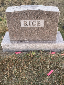
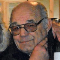
Stella Tolstad Rice
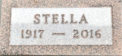
| Birth | : | 8 Feb 1917 Renville County, North Dakota, USA |
| Death | : | 14 Dec 2016 Mohall, Renville County, North Dakota, USA |
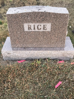
| Burial | : | Landa Cemetery, Landa, Bottineau County, USA |
| Coordinate | : | 48.9077988, -100.9067001 |
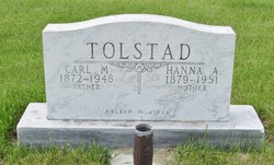
| Description | : | Stella Rice, age 99 of Westhope, died Wednesday at a Mohall nursing home. Her funeral will be held on Monday at 2:00 pm at the First Presbyterian Church in Westhope. Visitation will be held one hour prior to service time at the church. Stella was born February 8th, 1917 on the family farm in Scotia Township to Hannah Mork Tolstad & Carl M. Tolstad. She was baptized & confirmed at the Methodist church in Landa. She attended grade school, worked for several homes doing housework. Married Emmard Rice October 24, 1935. They were married by her Dad's cousin... Read More |
frequently asked questions (FAQ):
-
Where is Stella Tolstad Rice's memorial?
Stella Tolstad Rice's memorial is located at: Landa Cemetery, Landa, Bottineau County, USA.
-
When did Stella Tolstad Rice death?
Stella Tolstad Rice death on 14 Dec 2016 in Mohall, Renville County, North Dakota, USA
-
Where are the coordinates of the Stella Tolstad Rice's memorial?
Latitude: 48.9077988
Longitude: -100.9067001
Family Members:
Parent
Spouse
Siblings
Children
Flowers:
Nearby Cemetories:
1. Landa Cemetery
Landa, Bottineau County, USA
Coordinate: 48.9077988, -100.9067001
2. Zion Cemetery
Landa, Bottineau County, USA
Coordinate: 48.9375000, -100.8942032
3. Westhope Cemetery
Westhope, Bottineau County, USA
Coordinate: 48.9094009, -100.9950027
4. Roth Grave Site
Roth, Bottineau County, USA
Coordinate: 48.9008369, -100.7966385
5. Acheson Homestead Cemetery
Westhope, Bottineau County, USA
Coordinate: 48.9622620, -100.9804240
6. Lesje Cemetery
Roth, Bottineau County, USA
Coordinate: 48.9664688, -100.8221359
7. Mouse River Lutheran Cemetery
Landa, Bottineau County, USA
Coordinate: 48.8067741, -100.8635788
8. Nedaros Cemetery
Landa, Bottineau County, USA
Coordinate: 48.7916985, -100.8407974
9. Mountain View Cemetery
Souris, Bottineau County, USA
Coordinate: 48.9014015, -100.6750031
10. Weeks Cemetery
Westhope, Bottineau County, USA
Coordinate: 48.8365800, -101.1251700
11. Coultervale Cemetery
Coulter, Southwestern Census Division, Canada
Coordinate: 49.0580710, -101.0255330
12. Hamel Catholic Cemetery
Dunning, Bottineau County, USA
Coordinate: 48.7707930, -101.0599920
13. Betania Cemetery
Brander Township, Bottineau County, USA
Coordinate: 48.7480060, -101.0259820
14. Bethesda Cemetery
Souris, Bottineau County, USA
Coordinate: 48.9648933, -100.6333923
15. Dovre Lutheran Cemetery
Newburg, Bottineau County, USA
Coordinate: 48.7117690, -100.9069410
16. Lyleton Cemetery
Lyleton, Southwestern Census Division, Canada
Coordinate: 49.0300320, -101.1489680
17. Swedish Lutheran Cemetery
Souris, Bottineau County, USA
Coordinate: 48.9858055, -100.6212158
18. Waskada Cemetery
Waskada, Southwestern Census Division, Canada
Coordinate: 49.0947200, -100.7806100
19. Turtle Mountain Lutheran Cemetery
Carbury, Bottineau County, USA
Coordinate: 48.9219017, -100.5730972
20. Graceland Cemetery
Maxbass, Bottineau County, USA
Coordinate: 48.7344017, -101.1363983
21. Russell Cemetery
Russell, Bottineau County, USA
Coordinate: 48.6759990, -100.8961550
22. Holden Cemetery
Eckman, Bottineau County, USA
Coordinate: 48.6906776, -101.0336533
23. Emmanuel Lutheran Brethren Cemetery
Carbury, Bottineau County, USA
Coordinate: 48.9441872, -100.5558243
24. Saint John Lutheran Cemetery
Russell, Bottineau County, USA
Coordinate: 48.6696701, -100.8414230

