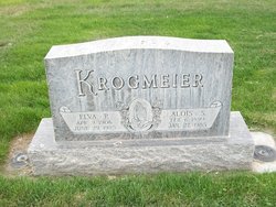
| Birth | : | 9 Oct 1877 Fort Madison, Lee County, Iowa, USA |
| Death | : | 11 Nov 1957 Fort Madison, Lee County, Iowa, USA |
| Burial | : | Elm Springs Cemetery, Elm Springs, Washington County, USA |
| Coordinate | : | 36.2060020, -94.2287270 |
| Description | : | S. Krogmeier Rites Thursday Stephen A. Krogmeier, 80, RR2, died Monday in Sacred Heart hospital after an illness of one week. Born here on Oct. 9, 1877, he spent his life farming in this vicinity. He was married to Catherine Hermes on June 26, 1906 in Sacred Heart Catholic church of which he was a member. He also belonged to the Holy Name Society. Survivors The deceased is... Read More |
frequently asked questions (FAQ):
-
Where is Stephen A Krogmeier's memorial?
Stephen A Krogmeier's memorial is located at: Elm Springs Cemetery, Elm Springs, Washington County, USA.
-
When did Stephen A Krogmeier death?
Stephen A Krogmeier death on 11 Nov 1957 in Fort Madison, Lee County, Iowa, USA
-
Where are the coordinates of the Stephen A Krogmeier's memorial?
Latitude: 36.2060020
Longitude: -94.2287270
Family Members:
Parent
Spouse
Siblings
Children
Flowers:
Nearby Cemetories:
1. Elm Springs Cemetery
Elm Springs, Washington County, USA
Coordinate: 36.2060020, -94.2287270
2. Spring Creek Cemetery
Cave Springs, Benton County, USA
Coordinate: 36.2261009, -94.1917038
3. Saint Joseph Cemetery
Tontitown, Washington County, USA
Coordinate: 36.1685982, -94.2350006
4. Sharp Cemetery
Benton County, USA
Coordinate: 36.2241880, -94.1868240
5. Derrick-Robbins Cemetery
Healing Springs, Benton County, USA
Coordinate: 36.2472100, -94.2642200
6. Murphy Cemetery
Cave Springs, Benton County, USA
Coordinate: 36.2158950, -94.2899130
7. Cave Springs Cemetery
Cave Springs, Benton County, USA
Coordinate: 36.2572490, -94.2241100
8. Old Cave Springs Cemetery
Cave Springs, Benton County, USA
Coordinate: 36.2597008, -94.2303009
9. Echo Dell Cemetery
Elm Springs, Washington County, USA
Coordinate: 36.1956750, -94.2950130
10. Burch Family Cemetery
Cave Springs, Benton County, USA
Coordinate: 36.2592239, -94.2517090
11. First Presbyterian Columbarium
Springdale, Washington County, USA
Coordinate: 36.1843530, -94.1625690
12. Silent Grove Cemetery
Benton County, USA
Coordinate: 36.2216670, -94.1598540
13. Saint Thomas Episcopal Church Columbarium
Springdale, Washington County, USA
Coordinate: 36.1604100, -94.1843600
14. Allen Cemetery
Cave Springs, Benton County, USA
Coordinate: 36.2676690, -94.2308220
15. Mount Olive Cemetery
Cave Springs, Benton County, USA
Coordinate: 36.2629050, -94.1958840
16. Stansfield Backbone Cemetery
Elm Springs, Washington County, USA
Coordinate: 36.2051400, -94.3078850
17. Salem Lutheran Church Cemetery
Springdale, Washington County, USA
Coordinate: 36.1886060, -94.1493120
18. Holcomb Cemetery
Springdale, Washington County, USA
Coordinate: 36.1828003, -94.1436005
19. Forest Park Cemetery
Springdale, Washington County, USA
Coordinate: 36.2024994, -94.1363983
20. Goad Springs Cemetery
Lowell, Benton County, USA
Coordinate: 36.2496986, -94.1530991
21. Mount Hebron Cemetery
Cave Springs, Benton County, USA
Coordinate: 36.2762450, -94.1947930
22. Thornsberry Cemetery
Tontitown, Washington County, USA
Coordinate: 36.1988100, -94.3219900
23. Stuckey Cemetery
Johnson, Washington County, USA
Coordinate: 36.1383018, -94.1866989
24. Phillips Cemetery
Cave Springs, Benton County, USA
Coordinate: 36.2813988, -94.2506027


