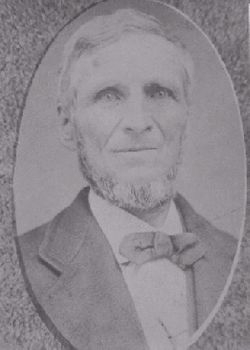
Stephen Carhart
| Birth | : | 1816 England |
| Death | : | 5 Jan 1895 Mapleton, Monona County, Iowa, USA |
| Burial | : | Saint Thomas Cemetery, St. Thomas, Elgin County, Canada |
| Coordinate | : | 42.7668500, -81.1980800 |
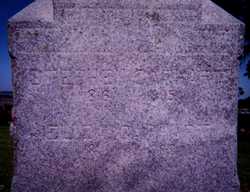
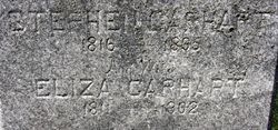
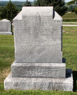
| Inscription | : | Steven and Eliza share a head stone, he is one side and her on the other. The stone says: We loved them on Earth We'll meet them in Heaven |
| Description | : | Headstone states he was born in 1816. Baptism records state he was baptized on 8 February 1817 by J. J. Hamley at St. Ervan, Cornwall, England. He is the son of John Carhart who was a Thatcher and Mary Bond Carhart. He married Eliza Ellen Rundell on 20 Nov 1841 in St. Columb, Cornwall County, England. Stephen and Eliza came to American in 1842. Stephen purchased a flour mill on the Little Platte River, northwest of the city of Platteville, at a total cost of $14,000. The mill was variously known first as the "Augustine",... Read More |
frequently asked questions (FAQ):
-
Where is Stephen Carhart's memorial?
Stephen Carhart's memorial is located at: Saint Thomas Cemetery, St. Thomas, Elgin County, Canada.
-
When did Stephen Carhart death?
Stephen Carhart death on 5 Jan 1895 in Mapleton, Monona County, Iowa, USA
-
Where are the coordinates of the Stephen Carhart's memorial?
Latitude: 42.7668500
Longitude: -81.1980800
Family Members:
Spouse
Children
Flowers:
Nearby Cemetories:
1. Holy Angels Cemetery
St. Thomas, Elgin County, Canada
Coordinate: 42.7655500, -81.1989700
2. Saint Thomas Memorial Park
Elmdale, Essex County, Canada
Coordinate: 42.7645400, -81.1949100
3. Elmdale Memorial Park Cemetery
St. Thomas, Elgin County, Canada
Coordinate: 42.7641869, -81.1953125
4. Old English Cemetery
St. Thomas, Elgin County, Canada
Coordinate: 42.7771600, -81.2064300
5. Jumbo Memorial
St. Thomas, Elgin County, Canada
Coordinate: 42.7797600, -81.2081700
6. South Park Cemetery
Lyndale, Elgin County, Canada
Coordinate: 42.7499199, -81.1919937
7. Toles Family Burial Plot
Southwold, Elgin County, Canada
Coordinate: 42.7894190, -81.2107990
8. House of Industry and Refuge Burying Ground
Middlemarch, Elgin County, Canada
Coordinate: 42.7686500, -81.2409170
9. Mellor Cemetery
Whites, Elgin County, Canada
Coordinate: 42.7197300, -81.2128800
10. Talbotville Cemetery
Talbotville Royal, Elgin County, Canada
Coordinate: 42.8009900, -81.2567100
11. Salt Creek Cemetery
St. Thomas, Elgin County, Canada
Coordinate: 42.8153200, -81.1498400
12. Plains Burial Ground
Union, Elgin County, Canada
Coordinate: 42.7039470, -81.1683230
13. Union United Church Cemetery
Union, Elgin County, Canada
Coordinate: 42.6993500, -81.1899100
14. Seminary Cemetery
Union, Elgin County, Canada
Coordinate: 42.7037888, -81.1481934
15. Wintermute Cemetery
Union, Elgin County, Canada
Coordinate: 42.6901780, -81.1900818
16. Nineteenth Mile Creek Cemetery
New Sarum, Elgin County, Canada
Coordinate: 42.7751950, -81.0914510
17. Kilmartin Cemetery
St. Thomas, Elgin County, Canada
Coordinate: 42.8232256, -81.1214937
18. Frome South Side Cemetery
Southwold, Elgin County, Canada
Coordinate: 42.7734170, -81.3120430
19. Brayne's Cemetery
Port Stanley, Elgin County, Canada
Coordinate: 42.6857441, -81.2303648
20. Frome United Church Cemetery
Frome, Elgin County, Canada
Coordinate: 42.7735405, -81.3132019
21. Fingal Cemetery
Fingal, Elgin County, Canada
Coordinate: 42.7222767, -81.3026955
22. Christ Anglican Church Cemetery
Port Stanley, Elgin County, Canada
Coordinate: 42.6708700, -81.2131500
23. Pleasant Valley Cemetery
Central Elgin, Elgin County, Canada
Coordinate: 42.7753180, -81.0643610
24. Christ Church Anglican Cemetery
Glanworth, Middlesex County, Canada
Coordinate: 42.8653600, -81.2125900

