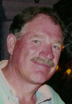
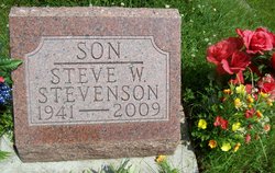
Steve W. Stevenson
| Birth | : | 16 Apr 1941 Norfolk, Madison County, Nebraska, USA |
| Death | : | 28 Jan 2009 Stanton, Stanton County, Nebraska, USA |
| Burial | : | Mayfield Cemetery, Cleveland Heights, Cuyahoga County, USA |
| Coordinate | : | 41.5133018, -81.5821991 |
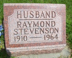
| Description | : | Steve W. Stevenson, age 67 of Stanton, died Wednesday January 28, 2009 at his home in Stanton. He was born April 16, 1941 in Norfolk, Nebraska the son of Raymond and Frances (Werner) Stevenson. He was baptized and confirmed at St. John's Lutheran Church in Stanton and attended school at Stanton County District #2, St. John's Lutheran School in Stanton, Stanton High School and Norfolk High School. Steve married Sherry Barr in 1959 and they lived in Denver, Colorado and later returned to Stanton to farm the family farmstead, where Steve fed cattle and farmed for over 40 years under... Read More |
frequently asked questions (FAQ):
-
Where is Steve W. Stevenson's memorial?
Steve W. Stevenson's memorial is located at: Mayfield Cemetery, Cleveland Heights, Cuyahoga County, USA.
-
When did Steve W. Stevenson death?
Steve W. Stevenson death on 28 Jan 2009 in Stanton, Stanton County, Nebraska, USA
-
Where are the coordinates of the Steve W. Stevenson's memorial?
Latitude: 41.5133018
Longitude: -81.5821991
Family Members:
Parent
Flowers:
Nearby Cemetories:
1. Mayfield Cemetery
Cleveland Heights, Cuyahoga County, USA
Coordinate: 41.5133018, -81.5821991
2. Lake View Cemetery
Cleveland, Cuyahoga County, USA
Coordinate: 41.5130997, -81.5982971
3. East Cleveland Township Cemetery
Cleveland, Cuyahoga County, USA
Coordinate: 41.5149994, -81.6010971
4. Saint Pauls Episcopal Church Columbarium
Cleveland Heights, Cuyahoga County, USA
Coordinate: 41.4956350, -81.5812450
5. Church of the Covenant Columbarium
Cleveland, Cuyahoga County, USA
Coordinate: 41.5079200, -81.6068400
6. Fairmount Presbyterian Church Columbarium
Cleveland Heights, Cuyahoga County, USA
Coordinate: 41.4932930, -81.5801210
7. Cleveland Museum of Natural History
Cleveland, Cuyahoga County, USA
Coordinate: 41.5115700, -81.6130905
8. Epworth Euclid United Methodist Church Columbarium
Euclid, Cuyahoga County, USA
Coordinate: 41.5058200, -81.6124990
9. Glenville Cemetery
Cleveland, Cuyahoga County, USA
Coordinate: 41.5419006, -81.5924988
10. First Presbyterian Churchyard
Cleveland, Cuyahoga County, USA
Coordinate: 41.5448230, -81.5665800
11. Shaker Burial Ground
Shaker Heights, Cuyahoga County, USA
Coordinate: 41.4827766, -81.5628128
12. Saint John Lutheran Cemetery
South Euclid, Cuyahoga County, USA
Coordinate: 41.5186005, -81.5222015
13. Saint Josephs Cemetery
Cleveland, Cuyahoga County, USA
Coordinate: 41.4869003, -81.6318970
14. Kellogg Family Cemetery
South Euclid, Cuyahoga County, USA
Coordinate: 41.5186390, -81.5200930
15. Warrensville West Cemetery
Shaker Heights, Cuyahoga County, USA
Coordinate: 41.4655991, -81.5655975
16. Woodland Cemetery
Cleveland, Cuyahoga County, USA
Coordinate: 41.4900017, -81.6425018
17. Saint John Cemetery
Cleveland, Cuyahoga County, USA
Coordinate: 41.4860992, -81.6408005
18. Church of the Good Shepherd Columbarium
Lyndhurst, Cuyahoga County, USA
Coordinate: 41.5032240, -81.5107610
19. Christ Episcopal Church Columbarium
Shaker Heights, Cuyahoga County, USA
Coordinate: 41.4658356, -81.5362854
20. Euclid Cemetery
Euclid, Cuyahoga County, USA
Coordinate: 41.5656013, -81.5381012
21. Highland Park Cemetery
Highland Hills, Cuyahoga County, USA
Coordinate: 41.4641480, -81.5287470
22. Beachwood Cemetery
Beachwood, Cuyahoga County, USA
Coordinate: 41.4674988, -81.5167007
23. Stop 8 Cemetery
Euclid, Cuyahoga County, USA
Coordinate: 41.5711240, -81.5361460
24. Silas Johnson Cemetery
South Euclid, Cuyahoga County, USA
Coordinate: 41.5199440, -81.4907100


