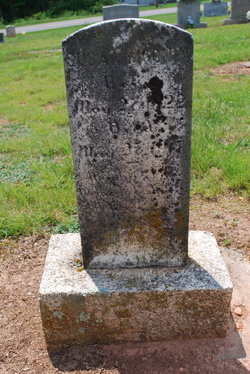
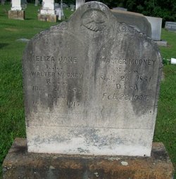
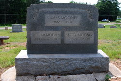
Susan A. “Susanna” Mooney Mooney
| Birth | : | 27 May 1822 Rockford, Surry County, North Carolina, USA |
| Death | : | 27 May 1917 Rockford, Surry County, North Carolina, USA |
| Burial | : | Mount Calvary Cemetery, Thomas, Tucker County, USA |
| Coordinate | : | 39.1474991, -79.4916992 |
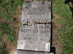
| Description | : | Presumed wife of John Ellis Mooney. (Per Robert Carter-#46599530): From some of the descendants of the MOONEY clan they tell me Susannah was not married when she had most of her children and the father of some was John Dobson. Her father was William Mooney (NC) and mother was Ann Phipps (VA). She got married bet 1870-1900 since she is shown as widowed in 1900 and living with son James in Rockford. I have her with 10 children, the first being Mary S. Leanna Mooney (married John Martin Hudson) and the last being Jesse James Mooney. |
frequently asked questions (FAQ):
-
Where is Susan A. “Susanna” Mooney Mooney's memorial?
Susan A. “Susanna” Mooney Mooney's memorial is located at: Mount Calvary Cemetery, Thomas, Tucker County, USA.
-
When did Susan A. “Susanna” Mooney Mooney death?
Susan A. “Susanna” Mooney Mooney death on 27 May 1917 in Rockford, Surry County, North Carolina, USA
-
Where are the coordinates of the Susan A. “Susanna” Mooney Mooney's memorial?
Latitude: 39.1474991
Longitude: -79.4916992
Family Members:
Children
Flowers:
Nearby Cemetories:
1. Mount Calvary Cemetery
Thomas, Tucker County, USA
Coordinate: 39.1474991, -79.4916992
2. Rose Hill Cemetery
Thomas, Tucker County, USA
Coordinate: 39.1504000, -79.5035000
3. Davis Cemetery
Davis, Tucker County, USA
Coordinate: 39.1257280, -79.4786820
4. Close Mountain Cemetery
Tucker County, USA
Coordinate: 39.1758200, -79.5716670
5. Kight Cemetery
Preston County, USA
Coordinate: 39.2218160, -79.5223730
6. Pine Grove Cemetery
Lead Mine, Tucker County, USA
Coordinate: 39.1931000, -79.5835000
7. Shaffertown Cemetery
Lead Mine, Tucker County, USA
Coordinate: 39.2175730, -79.5669040
8. Sugarlands Brethren Church Cemetery
Thomas, Tucker County, USA
Coordinate: 39.1369170, -79.6102830
9. Cortland Cemetery
Cortland, Tucker County, USA
Coordinate: 39.0581017, -79.4360962
10. Hile Cemetery
Tucker County, USA
Coordinate: 39.1946983, -79.6093979
11. Helmick
Dobbin, Grant County, USA
Coordinate: 39.2379970, -79.4156120
12. James M Wilkins Cemetery
Dobbin, Grant County, USA
Coordinate: 39.2388734, -79.4154218
13. Dobbin Cemetery
Garrett County, USA
Coordinate: 39.2421425, -79.4159961
14. Bonnifield Cemetery
Saint George, Tucker County, USA
Coordinate: 39.1617012, -79.6386032
15. Texas Cemetery
Horse Shoe Run, Preston County, USA
Coordinate: 39.2651670, -79.5270690
16. Nine Cemetery
Tucker County, USA
Coordinate: 39.0254500, -79.4642930
17. Carr-White Cemetery
Tucker County, USA
Coordinate: 39.0234100, -79.5201220
18. Fansler Cemetery
Hendricks, Tucker County, USA
Coordinate: 39.0800018, -79.6316986
19. Gnegy Church Cemetery
Redhouse, Garrett County, USA
Coordinate: 39.2769012, -79.4863968
20. Clark-Carr Cemetery
Red Creek, Tucker County, USA
Coordinate: 39.0240580, -79.5434710
21. Fairview Cemetery
Saint George, Tucker County, USA
Coordinate: 39.2140490, -79.6360880
22. Buena Chapel Cemetery
Canaan Heights, Tucker County, USA
Coordinate: 39.0223200, -79.4438200
23. Brights Chapel Cemetery
Elk, Tucker County, USA
Coordinate: 39.0201000, -79.5312400
24. Mount Olivet Cemetery
Tucker County, USA
Coordinate: 39.2047005, -79.6442032


