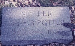
Susan Bertie Ransom Potter
| Birth | : | 22 Aug 1865 Lanark, Carroll County, Illinois, USA |
| Death | : | 19 Jul 1927 South Dakota, USA |
| Burial | : | Swinton Cemetery, Swinton, Metropolitan Borough of Salford, England |
| Coordinate | : | 53.5183372, -2.3457739 |
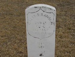
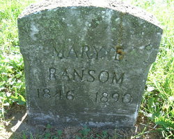
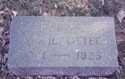
| Description | : | [Nashua Reporter, Wednesday, July 27, 1927, Nashua, Iowa] C. S. Ransom received a message Tuesday that his daughter, Mrs. Susie Ransom Potter had died at her home in Winfred, S. D., Tuesday, July 19, 1927. She was 63 years old and is survived by one daughter and five sons. Her husband, Ova Potter died about four, years ago. They went from here to Winfred some 21 years ago. The relatives who went to see her last week returned Monday and she died the next day. H. C. Ransom and family and his brother Hal and Abe from here and others from... Read More |
frequently asked questions (FAQ):
-
Where is Susan Bertie Ransom Potter's memorial?
Susan Bertie Ransom Potter's memorial is located at: Swinton Cemetery, Swinton, Metropolitan Borough of Salford, England.
-
When did Susan Bertie Ransom Potter death?
Susan Bertie Ransom Potter death on 19 Jul 1927 in South Dakota, USA
-
Where are the coordinates of the Susan Bertie Ransom Potter's memorial?
Latitude: 53.5183372
Longitude: -2.3457739
Family Members:
Parent
Spouse
Siblings
Children
Flowers:
Nearby Cemetories:
1. Swinton Cemetery
Swinton, Metropolitan Borough of Salford, England
Coordinate: 53.5183372, -2.3457739
2. St. Paul's Wesleyan Methodist Churchyard
Swinton, Metropolitan Borough of Salford, England
Coordinate: 53.5133900, -2.3397500
3. St. Peter's Churchyard
Swinton, Metropolitan Borough of Salford, England
Coordinate: 53.5119130, -2.3413860
4. St Anne Churchyard
Clifton, Metropolitan Borough of Salford, England
Coordinate: 53.5277070, -2.3391650
5. St Mary's Catholic Cemetery
Wardley, Metropolitan Borough of Salford, England
Coordinate: 53.5163700, -2.3645900
6. Saint Augustine's Churchyard
Pendlebury, Metropolitan Borough of Salford, England
Coordinate: 53.5107070, -2.3223960
7. St Stephen churchyard
Kearsley, Metropolitan Borough of Bolton, England
Coordinate: 53.5381650, -2.3717160
8. St John The Evangelist Churchyard
Pendlebury, Metropolitan Borough of Salford, England
Coordinate: 53.5036200, -2.3088500
9. St Saviour churchyard
Ringley, Metropolitan Borough of Bolton, England
Coordinate: 53.5439030, -2.3576830
10. St Mark Churchyard
Worsley, Metropolitan Borough of Salford, England
Coordinate: 53.5024361, -2.3833430
11. St Paul Churchyard
Walkden, Metropolitan Borough of Salford, England
Coordinate: 53.5231133, -2.3947620
12. Agecroft Jewish Cemetery
Pendlebury, Metropolitan Borough of Salford, England
Coordinate: 53.5110302, -2.2955830
13. Agecroft Cemetery and Crematorium
Salford, Metropolitan Borough of Salford, England
Coordinate: 53.5100250, -2.2940500
14. Rainsough Jewish Cemetery
Prestwich, Metropolitan Borough of Bury, England
Coordinate: 53.5185530, -2.2906950
15. St Mary the Virgin Churchyard
Eccles, Metropolitan Borough of Salford, England
Coordinate: 53.4843810, -2.3346810
16. New Jerusalem Church Churchyard
Kearsley, Metropolitan Borough of Bolton, England
Coordinate: 53.5435770, -2.3877380
17. Kearsley New Church Burial Ground
Farnworth, Metropolitan Borough of Bolton, England
Coordinate: 53.5435500, -2.3879200
18. St. Mary the Virgin Churchyard
Prestwich, Metropolitan Borough of Bury, England
Coordinate: 53.5294033, -2.2864891
19. Stand United Reformed Church Burial Ground
Radcliffe, Metropolitan Borough of Bury, England
Coordinate: 53.5512300, -2.3140600
20. Great Synagogue Cemetery
Prestwich, Metropolitan Borough of Bury, England
Coordinate: 53.5315510, -2.2845730
21. New Jerusalem Church Burial
Radcliffe, Metropolitan Borough of Bury, England
Coordinate: 53.5542680, -2.3174070
22. Market Street Congregational Churchyard
Farnworth, Metropolitan Borough of Bolton, England
Coordinate: 53.5475620, -2.3911703
23. Manchester Reform Jewish Old Cemetery
Whitefield, Metropolitan Borough of Bury, England
Coordinate: 53.5442728, -2.2918894
24. St. John Parish Churchyard
Radcliffe, Metropolitan Borough of Bury, England
Coordinate: 53.5571400, -2.3206700

