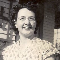
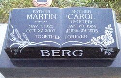
Sylvia Carol “Carol” Porter Berg
| Birth | : | 28 Jan 1924 |
| Death | : | 29 Jun 2015 |
| Burial | : | Skyline Cemetery, Provost, Wainwright Census Division, Canada |
| Coordinate | : | 52.2890200, -110.3278000 |
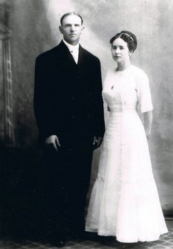
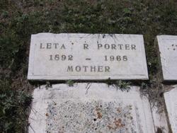
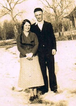
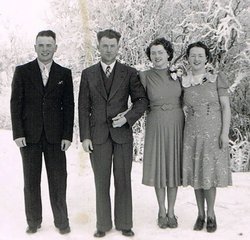
| Description | : | Sylvia "Carol" Berg was born January 28, 1924, at the farm - the Porter Ranch - in Czar, Alberta to Leta and Will Porter. Carol was the youngest of four children born to this union. She attended Birdsview School from Grades 1 - 8, then Horsehaven for 2 years and taking some correspondence prior to finishing Grade 12 in Provost in 1943. Carol worked in the M.D. office until the fall of 1951, which was only months after her July 1, 1951 marriage to Alfred "Martin" Berg. Carol and Martin were blessed with five children and... Read More |
frequently asked questions (FAQ):
-
Where is Sylvia Carol “Carol” Porter Berg's memorial?
Sylvia Carol “Carol” Porter Berg's memorial is located at: Skyline Cemetery, Provost, Wainwright Census Division, Canada.
-
When did Sylvia Carol “Carol” Porter Berg death?
Sylvia Carol “Carol” Porter Berg death on 29 Jun 2015 in
-
Where are the coordinates of the Sylvia Carol “Carol” Porter Berg's memorial?
Latitude: 52.2890200
Longitude: -110.3278000
Family Members:
Parent
Spouse
Siblings
Children
Flowers:
Nearby Cemetories:
1. Skyline Cemetery
Provost, Wainwright Census Division, Canada
Coordinate: 52.2890200, -110.3278000
2. Cadogan West Cemetery
Cadogan, Wainwright Census Division, Canada
Coordinate: 52.3000000, -110.3600000
3. Provost Mennonite Cemetery
Provost, Wainwright Census Division, Canada
Coordinate: 52.2590700, -110.2456570
4. Provost Cemetery
Provost, Wainwright Census Division, Canada
Coordinate: 52.3462500, -110.2128500
5. Cadogan Cemetery
Cadogan, Wainwright Census Division, Canada
Coordinate: 52.3170600, -110.4802500
6. Cadogan Lutheran Cemetery North
Cadogan, Wainwright Census Division, Canada
Coordinate: 52.3477150, -110.4579160
7. Rosenheim Cemetery
Rosenheim, Wainwright Census Division, Canada
Coordinate: 52.2601470, -110.1712850
8. Pleasant Ridge Lutheran
Provost, Wainwright Census Division, Canada
Coordinate: 52.1692990, -110.3810120
9. Our Saviour's
Provost, Wainwright Census Division, Canada
Coordinate: 52.2029780, -110.1200870
10. Metiskow Cemetery
Metiskow, Wainwright Census Division, Canada
Coordinate: 52.4030900, -110.6283200
11. Bodo Cemetery
Bodo, Wainwright Census Division, Canada
Coordinate: 52.1072600, -110.0943600
12. Lakeview Cemetery
Macklin, Kindersley Census Division, Canada
Coordinate: 52.3191390, -109.9369950
13. Saint Peter’s Roman Catholic Cemetery
Cosine, Kindersley Census Division, Canada
Coordinate: 52.1796160, -109.9306150
14. Sardis Lutheran Cemetery
Czar, Wainwright Census Division, Canada
Coordinate: 52.3763900, -110.7980200
15. Prairie View Cemetery
Evesham, Kindersley Census Division, Canada
Coordinate: 52.3910000, -109.8329800
16. Saint Elizabeth’s Roman Catholic Cemetery
Primate, Kindersley Census Division, Canada
Coordinate: 52.2419130, -109.8116110
17. Ribstone Hutterite Cemetery
Ribstone, Wainwright Census Division, Canada
Coordinate: 52.6092297, -110.3826397
18. Monitor Cemetery
Monitor, Hanna Census Division, Canada
Coordinate: 51.9872300, -110.5747400
19. Mount Carmel Cemetery
Altario, Hanna Census Division, Canada
Coordinate: 51.9905630, -110.0558730
20. Butte Cemetery
Sedalia, Hanna Census Division, Canada
Coordinate: 51.9936520, -110.6300270
21. Saint Anthony's Roman Catholic Cemetery
Grosswerder, Kindersley Census Division, Canada
Coordinate: 52.1729710, -109.7894450
22. Saint Donatus Roman Catholic North Cemetery
Cactus Lake, Kindersley Census Division, Canada
Coordinate: 52.0280950, -109.9317460
23. Czar Lutheran Cemetery
Czar, Wainwright Census Division, Canada
Coordinate: 52.4577900, -110.8442800
24. Long Lake Cemetery
Senlac, Kindersley Census Division, Canada
Coordinate: 52.5508100, -109.9124840

