
| Birth | : | 19 Sep 1926 Girard, Crawford County, Kansas, USA |
| Death | : | 4 Sep 2011 Bonner Springs, Wyandotte County, Kansas, USA |
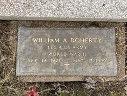
| Burial | : | Saint Aloysius Cemetery, Greenbush, Crawford County, USA |
| Coordinate | : | 37.5146600, -94.9886500 |
| Description | : | GIRARD — Theda K. Westhoff, 84, of Girard, formerly of Walnut, died at 1:20 p.m., Sunday, September 4, 2011 at her daughter's residence in Bonner Springs, Kansas surrounded by her family. She was born September 19, 1926 at Girard a daughter of Charles and Essie (Hazen) Doherty. She attended schools in the Greenbush, Walnut, and St. Paul areas. She married Leonard M. Westhoff on May 23, 1944 in St. Aloysius Catholic Church in Greenbush, Kansas. He preceded her in death on December 13, 1996. They were lifelong farmers of rural Walnut. She moved to... Read More |
frequently asked questions (FAQ):
-
Where is Theda K. Doherty Westhoff's memorial?
Theda K. Doherty Westhoff's memorial is located at: Saint Aloysius Cemetery, Greenbush, Crawford County, USA.
-
When did Theda K. Doherty Westhoff death?
Theda K. Doherty Westhoff death on 4 Sep 2011 in Bonner Springs, Wyandotte County, Kansas, USA
-
Where are the coordinates of the Theda K. Doherty Westhoff's memorial?
Latitude: 37.5146600
Longitude: -94.9886500
Family Members:
Parent

Spouse
Siblings
Children
Flowers:


Nearby Cemetories:
1. Saint Aloysius Cemetery
Greenbush, Crawford County, USA
Coordinate: 37.5146600, -94.9886500
2. Spangler Pleasant Valley Cemetery
Crawford County, USA
Coordinate: 37.5299988, -94.9606018
3. Mills Cemetery
Crawford County, USA
Coordinate: 37.5438995, -94.9955978
4. Zion Lutheran Cemetery
Brazilton, Crawford County, USA
Coordinate: 37.5583500, -94.9518600
5. Hamm Cemetery
Brazilton, Crawford County, USA
Coordinate: 37.5768400, -94.9792900
6. Olive School Cemetery
Girard, Crawford County, USA
Coordinate: 37.5438700, -95.0706900
7. Iowa Cemetery
Crawford County, USA
Coordinate: 37.5868988, -94.9417038
8. Horsley Cemetery
Walnut, Crawford County, USA
Coordinate: 37.5909800, -95.0239400
9. Hoggatt Cemetery
Girard, Crawford County, USA
Coordinate: 37.5579700, -94.9013500
10. Mount Carmel Cemetery
McCune, Crawford County, USA
Coordinate: 37.4272003, -94.9966965
11. Lutheran Cemetery
Hepler, Crawford County, USA
Coordinate: 37.6169014, -94.9700012
12. Myers Cemetery
Girard, Crawford County, USA
Coordinate: 37.4458008, -94.8889008
13. Frogge Cemetery
McCune, Crawford County, USA
Coordinate: 37.4352989, -95.0777969
14. Girard Cemetery
Girard, Crawford County, USA
Coordinate: 37.5005989, -94.8533020
15. Saint Patrick's Catholic Cemetery
Walnut, Crawford County, USA
Coordinate: 37.6094260, -95.0697860
16. Glenwood Cemetery
Walnut, Crawford County, USA
Coordinate: 37.6103600, -95.0697800
17. Fowler Cemetery
Neosho County, USA
Coordinate: 37.5722008, -95.1147003
18. Osage Brethren Cemetery
Crawford County, USA
Coordinate: 37.4039001, -94.9452972
19. Dumbauld Cemetery
Crawford County, USA
Coordinate: 37.4207993, -95.0792007
20. Valley Cemetery
Saint Paul, Neosho County, USA
Coordinate: 37.4420013, -95.1149979
21. Walnut Cemetery
Walnut, Crawford County, USA
Coordinate: 37.6296997, -95.0699997
22. Saint Francis Cemetery
Saint Paul, Neosho County, USA
Coordinate: 37.5133018, -95.1567001
23. Saint Francis Churchyard Cemetery
Saint Paul, Neosho County, USA
Coordinate: 37.5154037, -95.1621017
24. Hope Cemetery
Saint Paul, Neosho County, USA
Coordinate: 37.5283012, -95.1624985