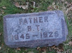
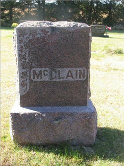
Theodore Benjamin “Beng” McClain
| Birth | : | 7 Jul 1845 Buck, Lancaster County, Pennsylvania, USA |
| Death | : | 2 Sep 1925 Willard, Fallon County, Montana, USA |
| Burial | : | Frankfort Cemetery, Frankfort, Spink County, USA |
| Coordinate | : | 44.8784800, -98.2965200 |
| Plot | : | Blk D, Lot 31, Gr 2 |
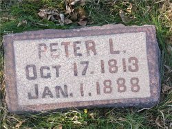
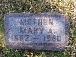
| Description | : | 1880 United States Census has B.T. listed as Theo B. McClain. Death date as listed in Montana Death Index 1868-2011. Parents: Father: Peter L. McClain Mother: Anna Willow McClain 1818-Oct 2 1912 |
frequently asked questions (FAQ):
-
Where is Theodore Benjamin “Beng” McClain's memorial?
Theodore Benjamin “Beng” McClain's memorial is located at: Frankfort Cemetery, Frankfort, Spink County, USA.
-
When did Theodore Benjamin “Beng” McClain death?
Theodore Benjamin “Beng” McClain death on 2 Sep 1925 in Willard, Fallon County, Montana, USA
-
Where are the coordinates of the Theodore Benjamin “Beng” McClain's memorial?
Latitude: 44.8784800
Longitude: -98.2965200
Family Members:
Parent
Spouse
Siblings
Children
Flowers:
Nearby Cemetories:
1. Frankfort Cemetery
Frankfort, Spink County, USA
Coordinate: 44.8784800, -98.2965200
2. Saint Ann Cemetery
Frankfort, Spink County, USA
Coordinate: 44.8821983, -98.3028030
3. Poor Farm Cemetery
Frankfort, Spink County, USA
Coordinate: 44.8836350, -98.3591071
4. Guttenberg Cemetery
Spink County, USA
Coordinate: 44.8205986, -98.2972031
5. Glendale Colony Cemetery
Spink County, USA
Coordinate: 44.7999900, -98.2856600
6. Irving Cemetery
Doland, Spink County, USA
Coordinate: 44.7751500, -98.2203600
7. Clifton Cemetery
Clifton Township, Spink County, USA
Coordinate: 45.0106010, -98.3197021
8. Spink Colony Cemetery
Spink Colony, Spink County, USA
Coordinate: 44.7440800, -98.2923800
9. Crandon Cemetery
Spink County, USA
Coordinate: 44.7825012, -98.4436035
10. Ebenezer Cemetery
Doland, Spink County, USA
Coordinate: 44.7602997, -98.1797028
11. Graceland Cemetery
Tulare, Spink County, USA
Coordinate: 44.7481003, -98.3861008
12. Rose Hill Cemetery
Doland, Spink County, USA
Coordinate: 44.7484600, -98.1993600
13. Irving Cemetery
Spink County, USA
Coordinate: 44.7486000, -98.1986008
14. Doland Cemetery
Doland, Spink County, USA
Coordinate: 44.8993988, -98.0828018
15. Saint Bernard Cemetery
Redfield, Spink County, USA
Coordinate: 44.8857994, -98.5139008
16. Greenlawn Cemetery
Redfield, Spink County, USA
Coordinate: 44.8857994, -98.5164032
17. South Dakota Developmental Center Cemetery
Spink County, USA
Coordinate: 44.8880120, -98.5234880
18. Hillestad Cemetery
Spink County, USA
Coordinate: 44.6944008, -98.2596970
19. Tulare Cemetery
Tulare, Spink County, USA
Coordinate: 44.7486000, -98.4922028
20. Ashton Cemetery
Ashton, Spink County, USA
Coordinate: 44.9914017, -98.5224991
21. Emmanuel Mennonite Cemetery
Spink County, USA
Coordinate: 44.7041300, -98.1207900
22. Hillside Colony Cemetery
Hillside Colony, Spink County, USA
Coordinate: 44.7404700, -98.0486100
23. Saint Josephs Cemetery
Turton, Spink County, USA
Coordinate: 45.0479660, -98.0899500
24. Sunnyside Cemetery
Turton, Spink County, USA
Coordinate: 45.0472600, -98.0849800

