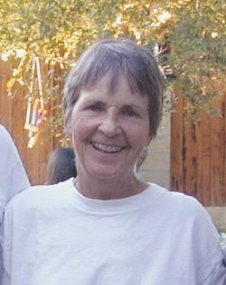
| Birth | : | 9 Sep 1909 Brumley, Miller County, Missouri, USA |
| Death | : | 3 Apr 1988 Kansas City, Jackson County, Missouri, USA |
| Burial | : | Johnson County Chapel and Memorial Gardens, Overland Park, Johnson County, USA |
| Coordinate | : | 38.9230995, -94.6686020 |
| Plot | : | Peace Garden 6 (South end of Cemetery), Lot 239, Sec. B, Spc.4 |
| Inscription | : | Together Forever Married 8-25-1926 |
| Description | : | Chester Graham and Thetis' were cousins, thrice removed. He was the grandson of John Graham, brother of Mariah Catherine Wall. Thetis had 35 grandchildren, one preceded her in death, and 39 great-grandchildren. The Eldon Advertiser, April 1988 Thetis Olga Wall Graham, died April 3, 1988 in Kansas City. She was born Sept. 9, 1909 near Brumley to Alonzo "Lonnie" and Luna Lucille Jones Wall Thomas. She was married Aug 25, 1926 to Chester E. Graham, who survives. Also surviving are ten children and a number of relatives in Miller County. Funeral services were held at... Read More |
frequently asked questions (FAQ):
-
Where is Thetis Olga Wall Graham's memorial?
Thetis Olga Wall Graham's memorial is located at: Johnson County Chapel and Memorial Gardens, Overland Park, Johnson County, USA.
-
When did Thetis Olga Wall Graham death?
Thetis Olga Wall Graham death on 3 Apr 1988 in Kansas City, Jackson County, Missouri, USA
-
Where are the coordinates of the Thetis Olga Wall Graham's memorial?
Latitude: 38.9230995
Longitude: -94.6686020
Family Members:
Parent
Spouse
Siblings
Children
Flowers:
Nearby Cemetories:
1. Johnson County Chapel and Memorial Gardens
Overland Park, Johnson County, USA
Coordinate: 38.9230995, -94.6686020
2. Overland Park 9/11 Memorila
Overland Park, Johnson County, USA
Coordinate: 38.9027040, -94.6830840
3. Tomahawk Cemetery
Overland Park, Johnson County, USA
Coordinate: 38.8869019, -94.6675034
4. Valley View Columbarium and Memorial Garden
Overland Park, Johnson County, USA
Coordinate: 38.9579200, -94.6838010
5. Christ Church Anglican Disciples' Garden
Overland Park, Johnson County, USA
Coordinate: 38.9649200, -94.6502000
6. Linwood Pioneer Cemetery
Leawood, Johnson County, USA
Coordinate: 38.9571000, -94.6271300
7. Church of the Resurrection Memorial Garden
Leawood, Johnson County, USA
Coordinate: 38.8798100, -94.6413300
8. New Santa Fe Cemetery
New Santa Fe, Jackson County, USA
Coordinate: 38.9071007, -94.6054993
9. Saint Peter's Episcopal Church Columbarium
Kansas City, Jackson County, USA
Coordinate: 38.9266130, -94.5905100
10. Pleasant Ridge Cemetery
Overland Park, Johnson County, USA
Coordinate: 38.8838900, -94.7330100
11. Mount Pleasant Cemetery
Martin City, Jackson County, USA
Coordinate: 38.9014015, -94.5911026
12. Corinth Cemetery
Prairie Village, Johnson County, USA
Coordinate: 38.9783000, -94.6266700
13. Woolford Farm Grounds
Prairie Village, Johnson County, USA
Coordinate: 38.9822388, -94.6332169
14. Mount Moriah Cemetery
Kansas City, Jackson County, USA
Coordinate: 38.9375810, -94.5814490
15. Resurrection Catholic Cemetery
Lenexa, Johnson County, USA
Coordinate: 38.9763985, -94.7277985
16. Saint Johns Catholic Cemetery
Lenexa, Johnson County, USA
Coordinate: 38.9666748, -94.7418594
17. Antioch Pioneer Cemetery
Merriam, Johnson County, USA
Coordinate: 38.9934807, -94.6868896
18. Asbury Memorial Garden
Prairie Village, Johnson County, USA
Coordinate: 38.9932800, -94.6470000
19. Lenexa Cemetery
Lenexa, Johnson County, USA
Coordinate: 38.9681015, -94.7416992
20. Davis Burying Ground
Martin City, Jackson County, USA
Coordinate: 38.8756256, -94.5937119
21. Williams Family Cemetery
Olathe, Johnson County, USA
Coordinate: 38.8603000, -94.7230100
22. Klapmeyer Cemetery
Kansas City, Jackson County, USA
Coordinate: 38.8777200, -94.5891200
23. Douglas Cemetery
Kansas City, Jackson County, USA
Coordinate: 38.9608345, -94.5779724
24. Colonial Church Garden of Life
Prairie Village, Johnson County, USA
Coordinate: 39.0009900, -94.6300200


