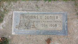
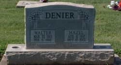
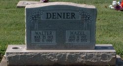
Thomas Eugene Denier
| Birth | : | 13 Feb 1934 Galt, Sacramento County, California, USA |
| Death | : | 14 Nov 1968 California, USA |
| Burial | : | Masonic Cemetery, Pocahontas, Randolph County, USA |
| Coordinate | : | 36.2668190, -90.9831467 |
| Plot | : | Section F, Row 15, Plot 8 |
frequently asked questions (FAQ):
-
Where is Thomas Eugene Denier's memorial?
Thomas Eugene Denier's memorial is located at: Masonic Cemetery, Pocahontas, Randolph County, USA.
-
When did Thomas Eugene Denier death?
Thomas Eugene Denier death on 14 Nov 1968 in California, USA
-
Where are the coordinates of the Thomas Eugene Denier's memorial?
Latitude: 36.2668190
Longitude: -90.9831467
Family Members:
Parent
Flowers:
Nearby Cemetories:
1. Masonic Cemetery
Pocahontas, Randolph County, USA
Coordinate: 36.2668190, -90.9831467
2. Saint Paul Cemetery
Pocahontas, Randolph County, USA
Coordinate: 36.2644005, -90.9788971
3. Marvin Cemetery
Randolph County, USA
Coordinate: 36.2619980, -90.9756820
4. Old Martin Cemetery
Randolph County, USA
Coordinate: 36.2869740, -90.9700520
5. Martin Cemetery
Pocahontas, Randolph County, USA
Coordinate: 36.2872009, -90.9700012
6. Friendship Cemetery
Pocahontas, Randolph County, USA
Coordinate: 36.2817001, -90.9606018
7. Troy Cemetery
Randolph County, USA
Coordinate: 36.2458000, -90.9633026
8. Pettit Cemetery
Pocahontas, Randolph County, USA
Coordinate: 36.2935982, -90.9514008
9. Randolph Memorial Gardens
Pocahontas, Randolph County, USA
Coordinate: 36.2366982, -90.9561005
10. Homeplace Cemetery
Pocahontas, Randolph County, USA
Coordinate: 36.2780830, -91.0386840
11. Shiloh Cemetery
Randolph County, USA
Coordinate: 36.2991982, -91.0314026
12. Sutton Cemetery
Pocahontas, Randolph County, USA
Coordinate: 36.2550170, -91.0470520
13. Harmony Cemetery
Pocahontas, Randolph County, USA
Coordinate: 36.2216988, -91.0250015
14. Chesser Cemetery
Noland, Randolph County, USA
Coordinate: 36.2271996, -91.0357971
15. Wilson Cemetery
Randolph County, USA
Coordinate: 36.3208008, -91.0143967
16. Clearview Cemetery
Pocahontas, Randolph County, USA
Coordinate: 36.3302994, -91.0214005
17. Brockett Cemetery
Pocahontas, Randolph County, USA
Coordinate: 36.3347015, -90.9458008
18. Thompson Cemetery
Randolph County, USA
Coordinate: 36.3119340, -91.0685500
19. Oak Grove Cemetery
Randolph County, USA
Coordinate: 36.3521996, -90.9950027
20. Jones Cemetery
Randolph County, USA
Coordinate: 36.2085991, -90.9039001
21. Lemmons Cemetery
Birdell, Randolph County, USA
Coordinate: 36.2150002, -91.0761032
22. Dunn Cemetery #1
Randolph County, USA
Coordinate: 36.2364006, -91.0922012
23. Saint John Cemetery
Engelberg, Randolph County, USA
Coordinate: 36.3396988, -90.9092026
24. Noland Cemetery
Randolph County, USA
Coordinate: 36.1899986, -91.0507965


