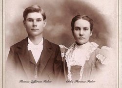
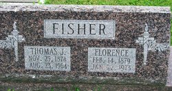
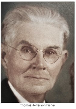
Thomas Jefferson Fisher
| Birth | : | 25 Nov 1874 Borden, Clark County, Indiana, USA |
| Death | : | 23 Aug 1964 Salem, Washington County, Indiana, USA |
| Burial | : | Hillcrest Cemetery, Thedford, Thomas County, USA |
| Coordinate | : | 41.9673000, -100.5756000 |
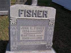
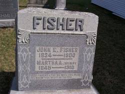
| Description | : | married Adelia Florence Johnson, son of John and Martha (Fordyce) Fisher |
frequently asked questions (FAQ):
-
Where is Thomas Jefferson Fisher's memorial?
Thomas Jefferson Fisher's memorial is located at: Hillcrest Cemetery, Thedford, Thomas County, USA.
-
When did Thomas Jefferson Fisher death?
Thomas Jefferson Fisher death on 23 Aug 1964 in Salem, Washington County, Indiana, USA
-
Where are the coordinates of the Thomas Jefferson Fisher's memorial?
Latitude: 41.9673000
Longitude: -100.5756000
Family Members:
Parent
Spouse
Siblings
Children
Flowers:
Nearby Cemetories:
1. Hillcrest Cemetery
Thedford, Thomas County, USA
Coordinate: 41.9673000, -100.5756000
2. Seneca Cemetery
Seneca, Thomas County, USA
Coordinate: 42.0364990, -100.8328018
3. Jimtown Cemetery
Brownlee, Cherry County, USA
Coordinate: 42.1174000, -100.8014500
4. Purdum Cemetery
Purdum, Blaine County, USA
Coordinate: 42.0638190, -100.2574890
5. Lone Star Cemetery
McPherson County, USA
Coordinate: 41.7106000, -100.7129000
6. Brownlee Cemetery
Brownlee, Cherry County, USA
Coordinate: 42.2889100, -100.6234710
7. Virginia Cemetery
Valentine, Cherry County, USA
Coordinate: 42.1432000, -100.9761000
8. James Cemetery
Cherry County, USA
Coordinate: 42.1436005, -100.9760971
9. Giles Cemetery
Cherry County, USA
Coordinate: 42.1603012, -100.1828003
10. Cedarview Cemetery
Mullen, Hooker County, USA
Coordinate: 42.0439491, -101.0372009
11. Long Cemetery
Cherry County, USA
Coordinate: 42.2932000, -100.8156000
12. Dunning Cemetery
Dunning, Blaine County, USA
Coordinate: 41.8213110, -100.0984530
13. Hawley Flats Cemetery
Blaine County, USA
Coordinate: 42.0003014, -100.0203018
14. Emanuel Gravesite
Brownlee, Cherry County, USA
Coordinate: 42.3514000, -100.8021500
15. Valley View Cemetery
Brown County, USA
Coordinate: 42.1217003, -100.0488968
16. Hartgrave Cemetery
Cherry County, USA
Coordinate: 42.3244500, -100.2680800
17. Miller Cemetery
Tryon, McPherson County, USA
Coordinate: 41.5892960, -100.8585770
18. DeWitty Cemetery
Brownlee, Cherry County, USA
Coordinate: 42.3714000, -100.8296000
19. Dry Valley Cemetery
Cherry County, USA
Coordinate: 42.2640300, -101.0857200
20. Hecla Graves
Hecla, Hooker County, USA
Coordinate: 42.0376840, -101.2346040
21. Shady Rest Cemetery
Valentine, Cherry County, USA
Coordinate: 42.4598160, -100.6837050
22. Loup Valley Cemetery
Logan County, USA
Coordinate: 41.4700012, -100.6841965
23. Saint Johns Cemetery
Gandy, Logan County, USA
Coordinate: 41.4655991, -100.4828033
24. Eclipse Cemetery
Mullen, Hooker County, USA
Coordinate: 41.7705500, -101.2592000

