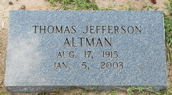
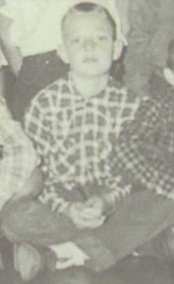
Thomas Jefferson “Tommy” Altman Sr.
| Birth | : | 17 Aug 1915 Marion County, South Carolina, USA |
| Death | : | 5 Jan 2003 Brittons Neck, Marion County, South Carolina, USA |
| Burial | : | Nebo Baptist Church Cemetery, Gresham, Marion County, USA |
| Coordinate | : | 33.9364000, -79.3442920 |
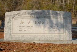
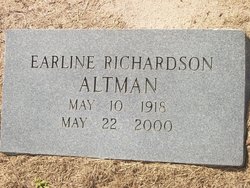
| Description | : | Son of William Samuel and Rilla Estelle Hannah Altman, husband of Earline Richardson. BRITTONS NECK - Mr. Tommy (Thomas Jefferson) Altman Sr. 87 died Sunday at his home. Mr. Altman was a member of Nebo Baptist Church where he was a deacon emeritus, was a member of Marion County Board of Education for 40 years, retired from the Fertilizer dept. of Clemson University and a retired farmer. Funeral services were held at 2 p.m. Wednesday, the 8th, at Nebo Baptist Church in Brittons Neck. He was preceded in death by his wife of 63 years, Earline Richardson Altman. He was survived by two... Read More |
frequently asked questions (FAQ):
-
Where is Thomas Jefferson “Tommy” Altman Sr.'s memorial?
Thomas Jefferson “Tommy” Altman Sr.'s memorial is located at: Nebo Baptist Church Cemetery, Gresham, Marion County, USA.
-
When did Thomas Jefferson “Tommy” Altman Sr. death?
Thomas Jefferson “Tommy” Altman Sr. death on 5 Jan 2003 in Brittons Neck, Marion County, South Carolina, USA
-
Where are the coordinates of the Thomas Jefferson “Tommy” Altman Sr.'s memorial?
Latitude: 33.9364000
Longitude: -79.3442920
Family Members:
Parent
Spouse
Siblings
Children
Flowers:
Nearby Cemetories:
1. Nebo Baptist Church Cemetery
Gresham, Marion County, USA
Coordinate: 33.9364000, -79.3442920
2. Richardson Family Cemetery
Brittons Neck, Marion County, USA
Coordinate: 33.9346310, -79.3362370
3. Antley Richardson Cemetery
Centenary, Marion County, USA
Coordinate: 33.9454500, -79.3386667
4. Antley Cemetery
Gresham, Marion County, USA
Coordinate: 33.9473751, -79.3367195
5. Watson Cemetery
Brittons Neck, Marion County, USA
Coordinate: 33.9221410, -79.3347220
6. Brittons Neck Cemetery
Brittons Neck, Marion County, USA
Coordinate: 33.9216750, -79.3348070
7. Hickory Hill Free Will Baptist Church Cemetery
Gresham, Marion County, USA
Coordinate: 33.8952050, -79.3848740
8. Beach Field Cemetery
Brittons Neck, Marion County, USA
Coordinate: 33.8822600, -79.3518200
9. Pee Dee Baptist Church Cemetery
Gresham, Marion County, USA
Coordinate: 33.9277200, -79.4123300
10. Soul Chapel A.M.E. Cemetery
Gresham, Marion County, USA
Coordinate: 33.9104300, -79.4094700
11. White Hill Missionary Baptist Church Cemetery
Gresham, Marion County, USA
Coordinate: 33.9346000, -79.4215300
12. Souls Chapel Cemetery
Gresham, Marion County, USA
Coordinate: 33.9182600, -79.4186200
13. Old Neck Cemetery
Brittons Neck, Marion County, USA
Coordinate: 33.8630700, -79.3312500
14. Alison Graveyard
Kingsburg, Florence County, USA
Coordinate: 33.8788600, -79.4018400
15. True Gospel Church Cemetery
Brittons Neck, Marion County, USA
Coordinate: 33.8625600, -79.3285000
16. Friendship AME Church Cemetery
Gresham, Marion County, USA
Coordinate: 33.9900970, -79.4180260
17. Palmer Cemetery
Marion County, USA
Coordinate: 34.0205994, -79.3458023
18. Gethsemane Freewill Baptist Church Cemetery
Galivants Ferry, Horry County, USA
Coordinate: 33.9615400, -79.2397900
19. Centerville Baptist Church Cemetery
Centenary, Marion County, USA
Coordinate: 34.0302990, -79.3608240
20. Red Hill Methodist Church Cemetery
Galivants Ferry, Horry County, USA
Coordinate: 34.0001800, -79.2578170
21. Baptist Colored Cemetery
Galivants Ferry, Horry County, USA
Coordinate: 33.9906830, -79.2469640
22. Pisgah United Methodist Church Cemetery
Galivants Ferry, Horry County, USA
Coordinate: 33.9650860, -79.2316450
23. Johnson Family Cemetery
Galivants Ferry, Horry County, USA
Coordinate: 33.9528650, -79.2279750
24. Mount Hermon Baptist Church Cemetery
Galivants Ferry, Horry County, USA
Coordinate: 33.9129660, -79.2277850

