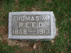
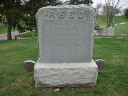
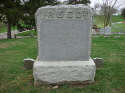
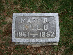
Thomas M Reed
| Birth | : | 1858 |
| Death | : | 1913 |
| Burial | : | Te Henui Cemetery, New Plymouth, New Plymouth District, New Zealand |
| Coordinate | : | -39.0558000, 174.0910000 |
| Description | : | Thomas M. Reed, one of six children given to John and Margaret Reed, was a native of Guernsey county, Ohio, where he first saw the light of day, Aug. 1, 1858, and closed the last page of his laborious, successful and devoutly Christian records among men, after a brief but painful illness on Jan. 10, 1913, aged fifty-four years, five mo. and 8 days. At the age of six years he came with his parents to Albion, Ind., where they lived for two years, after which they moved to the farm in York Twp. two miles west of this... Read More |
frequently asked questions (FAQ):
-
Where is Thomas M Reed's memorial?
Thomas M Reed's memorial is located at: Te Henui Cemetery, New Plymouth, New Plymouth District, New Zealand.
-
When did Thomas M Reed death?
Thomas M Reed death on 1913 in
-
Where are the coordinates of the Thomas M Reed's memorial?
Latitude: -39.0558000
Longitude: 174.0910000
Family Members:
Parent
Spouse
Siblings
Flowers:
Nearby Cemetories:
1. Te Henui Cemetery
New Plymouth, New Plymouth District, New Zealand
Coordinate: -39.0558000, 174.0910000
2. Henui Primitive Methodist Burial Ground
Fitzroy, New Plymouth District, New Zealand
Coordinate: -39.0502937, 174.0987132
3. Awanui Cemetery
New Plymouth, New Plymouth District, New Zealand
Coordinate: -39.0670040, 174.0972140
4. St Mary's Anglican Churchyard
New Plymouth, New Plymouth District, New Zealand
Coordinate: -39.0601390, 174.0734240
5. Marsland Hill
New Plymouth, New Plymouth District, New Zealand
Coordinate: -39.0607490, 174.0733470
6. Port Taranaki
New Plymouth, New Plymouth District, New Zealand
Coordinate: -39.0615099, 174.0420725
7. Otaka Park
New Plymouth District, New Zealand
Coordinate: -39.0614948, 174.0363927
8. Hurdon Cemetery
New Plymouth, New Plymouth District, New Zealand
Coordinate: -39.0870420, 174.0529740
9. St. Luke's Cemetery Biblical Garden and Labyrinth
Bell Block, New Plymouth District, New Zealand
Coordinate: -39.0348800, 174.1475250
10. St Luke's Methodist Church Cemetery
Bell Block, New Plymouth District, New Zealand
Coordinate: -39.0331650, 174.1537750
11. St Lukes Churchyard
New Plymouth, New Plymouth District, New Zealand
Coordinate: -39.0332876, 174.1539411
12. Taumata Historic Reserve
Bell Block, New Plymouth District, New Zealand
Coordinate: -39.0478297, 174.1720073
13. Taranaki Crematorium
New Plymouth, New Plymouth District, New Zealand
Coordinate: -39.1216900, 174.1149500
14. Waireka Cemetery
Omata, New Plymouth District, New Zealand
Coordinate: -39.0929300, 174.0087200
15. Mangapouri Cemetery
Egmont Village, New Plymouth District, New Zealand
Coordinate: -39.1347278, 174.1282396
16. Lepperton Cemetery
Lepperton, New Plymouth District, New Zealand
Coordinate: -39.0575500, 174.2086000
17. Huirangi Cemetery
Huirangi, New Plymouth District, New Zealand
Coordinate: -39.0500060, 174.2513380
18. O'Carroll Family Cemetery
New Plymouth District, New Zealand
Coordinate: -39.0465210, 174.2651080
19. Inglewood Cemetery
Inglewood, New Plymouth District, New Zealand
Coordinate: -39.1554140, 174.2145930
20. Waitara Cemetery
Waitara, New Plymouth District, New Zealand
Coordinate: -38.9953000, 174.2537000
21. Waipapa Māori Cemetery
Motunui, New Plymouth District, New Zealand
Coordinate: -38.9872800, 174.2702100
22. Tikorangi Cemetery
Tikorangi, New Plymouth District, New Zealand
Coordinate: -39.0291440, 174.2967880
23. Tataraimaka Cemetery
Oakura, New Plymouth District, New Zealand
Coordinate: -39.1503230, 173.9138870
24. Okato Cemetery
Okato, New Plymouth District, New Zealand
Coordinate: -39.1904200, 173.8821100

