
| Birth | : | 18 Dec 1864 Buchanan County, Iowa, USA |
| Death | : | 16 May 1943 Big Sandy, Chouteau County, Montana, USA |
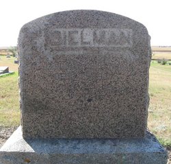
| Burial | : | Big Sandy Cemetery, Big Sandy, Chouteau County, USA |
| Coordinate | : | 48.1801170, -110.1207500 |
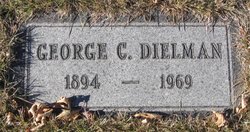
| Description | : | The following provided by Find A Grave contributor "Cara": Havre Daily News (MT), 19 May 1943 Services for Mrs. Tillie Dielman Services for Mrs. Tillie Dielman, who died in a local hospital Sunday, were attended by a large number of friends at the Methodist church in Big Sandy. Burial was at the side of Mrs. Dielman's husband at Big Sandy. Mr. Dielman passed away on July 1, 1916. Pallbearers were Frank Eves, Elmer Lund, Peter Sonksen, Elmer Holmes, Albert Archibald, and Henry C. Hurd. Floral tributes were numerous. Mrs. Dielman is survived by a son, George, with whom she had been... Read More |
frequently asked questions (FAQ):
-
Where is Tillie Vallie Dielman's memorial?
Tillie Vallie Dielman's memorial is located at: Big Sandy Cemetery, Big Sandy, Chouteau County, USA.
-
When did Tillie Vallie Dielman death?
Tillie Vallie Dielman death on 16 May 1943 in Big Sandy, Chouteau County, Montana, USA
-
Where are the coordinates of the Tillie Vallie Dielman's memorial?
Latitude: 48.1801170
Longitude: -110.1207500
Family Members:
Parent
Spouse
Siblings

Children
Flowers:


Nearby Cemetories:
1. Big Sandy Cemetery
Big Sandy, Chouteau County, USA
Coordinate: 48.1801170, -110.1207500
2. Box Elder Cemetery
Box Elder, Hill County, USA
Coordinate: 48.3274000, -110.0095000
3. Kenilworth Cemetery
Chouteau County, USA
Coordinate: 48.2192001, -110.4188995
4. Rocky Boy Cemetery
Rocky Boy, Hill County, USA
Coordinate: 48.2572410, -109.7923690
5. Rocky Boy Gravel Cemetery
Rocky Boy, Hill County, USA
Coordinate: 48.2427720, -109.7596500
6. Cottonwood Lutheran Church Cemetery
Havre, Hill County, USA
Coordinate: 48.4545000, -110.1748000
7. Gildford Hill County Cemetery
Gildford, Hill County, USA
Coordinate: 48.5778008, -110.2957993
8. Clear Lake Cemetery
Chouteau County, USA
Coordinate: 47.7731018, -110.2514038
9. Hingham Union Cemetery
Hingham, Hill County, USA
Coordinate: 48.5601570, -110.4178980
10. Sunset Garden Park
Havre, Hill County, USA
Coordinate: 48.5531006, -109.8019028
11. Graceville Cemetery
Chouteau County, USA
Coordinate: 47.7505989, -110.0875015
12. Hungry Hollow Cemetery
Blaine County, USA
Coordinate: 48.2103004, -109.4677963
13. Highland Cemetery
Havre, Hill County, USA
Coordinate: 48.5463982, -109.6900024
14. Mount Hope Cemetery
Havre, Hill County, USA
Coordinate: 48.5540000, -109.7050000
15. Calvary Cemetery
Havre, Hill County, USA
Coordinate: 48.5457000, -109.6883000
16. Rudyard Cemetery
Rudyard, Hill County, USA
Coordinate: 48.5659500, -110.5390000
17. Riverside Cemetery
Fort Benton, Chouteau County, USA
Coordinate: 47.8402330, -110.6408830
18. Old Shep Gravesite
Fort Benton, Chouteau County, USA
Coordinate: 47.8369000, -110.6557000
19. Milk River Valley Church Graveyard
Hill County, USA
Coordinate: 48.6787180, -110.2261080
20. Museum of the Upper Missouri
Fort Benton, Chouteau County, USA
Coordinate: 47.8207000, -110.6642000
21. Inverness Cemetery
Hill County, USA
Coordinate: 48.5531340, -110.6688450
22. Grainbelt Cemetery
Hill County, USA
Coordinate: 48.6828003, -109.8657990
23. Montague Cemetery
Chouteau County, USA
Coordinate: 47.6783000, -110.4670000
24. North Havre Lutheran Church Graveyard (Defunct)
Havre, Hill County, USA
Coordinate: 48.6538903, -109.6815870