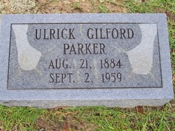
Ulrick Guliford Parker
| Birth | : | 21 Aug 1884 |
| Death | : | 2 Sep 1959 |
| Burial | : | Waitara Cemetery, Waitara, New Plymouth District, New Zealand |
| Coordinate | : | -38.9953000, 174.2537000 |
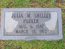
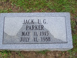
| Description | : | Taken from Horry County Families by Paul Quattlebaum Ulrick Guliford Parker, 75, farmer of Pawley's Swamp section of Horry County, died September 2, 1959. Mr. Parker was born in Pawley's Swamp section, a son of the late Frank and Frances Martin Parker. He was a member of Pawley's Swamp Primitive Baptist Church. Surviving are his widow, Mrs. Julia Shelley Parker; two sons Jack Parker of Georgetown and Spurgeon Parker of Plantersville; three daughters Mrs. H. C. Lundy Jr., of Rt. 1 Galivants Ferrry, Mrs. J. W. Gandy of Florence and Mrs. Tommie Haywood of Kansas City KS; three sisters Miss Hattie Parker... Read More |
frequently asked questions (FAQ):
-
Where is Ulrick Guliford Parker's memorial?
Ulrick Guliford Parker's memorial is located at: Waitara Cemetery, Waitara, New Plymouth District, New Zealand.
-
When did Ulrick Guliford Parker death?
Ulrick Guliford Parker death on 2 Sep 1959 in
-
Where are the coordinates of the Ulrick Guliford Parker's memorial?
Latitude: -38.9953000
Longitude: 174.2537000
Family Members:
Spouse
Children
Flowers:
Nearby Cemetories:
1. Waitara Cemetery
Waitara, New Plymouth District, New Zealand
Coordinate: -38.9953000, 174.2537000
2. Waipapa Māori Cemetery
Motunui, New Plymouth District, New Zealand
Coordinate: -38.9872800, 174.2702100
3. Tikorangi Cemetery
Tikorangi, New Plymouth District, New Zealand
Coordinate: -39.0291440, 174.2967880
4. O'Carroll Family Cemetery
New Plymouth District, New Zealand
Coordinate: -39.0465210, 174.2651080
5. Huirangi Cemetery
Huirangi, New Plymouth District, New Zealand
Coordinate: -39.0500060, 174.2513380
6. Lepperton Cemetery
Lepperton, New Plymouth District, New Zealand
Coordinate: -39.0575500, 174.2086000
7. Taumata Historic Reserve
Bell Block, New Plymouth District, New Zealand
Coordinate: -39.0478297, 174.1720073
8. St Lukes Churchyard
New Plymouth, New Plymouth District, New Zealand
Coordinate: -39.0332876, 174.1539411
9. St Luke's Methodist Church Cemetery
Bell Block, New Plymouth District, New Zealand
Coordinate: -39.0331650, 174.1537750
10. St. Luke's Cemetery Biblical Garden and Labyrinth
Bell Block, New Plymouth District, New Zealand
Coordinate: -39.0348800, 174.1475250
11. Urenui Cemetery
Urenui, New Plymouth District, New Zealand
Coordinate: -38.9988300, 174.3921800
12. Urenui Pa Urupā
Urenui, New Plymouth District, New Zealand
Coordinate: -38.9909130, 174.4058160
13. Henui Primitive Methodist Burial Ground
Fitzroy, New Plymouth District, New Zealand
Coordinate: -39.0502937, 174.0987132
14. Okoki Pa Urupā
Urenui, New Plymouth District, New Zealand
Coordinate: -38.9869340, 174.4261760
15. Te Henui Cemetery
New Plymouth, New Plymouth District, New Zealand
Coordinate: -39.0558000, 174.0910000
16. Awanui Cemetery
New Plymouth, New Plymouth District, New Zealand
Coordinate: -39.0670040, 174.0972140
17. St Mary's Anglican Churchyard
New Plymouth, New Plymouth District, New Zealand
Coordinate: -39.0601390, 174.0734240
18. Marsland Hill
New Plymouth, New Plymouth District, New Zealand
Coordinate: -39.0607490, 174.0733470
19. Inglewood Cemetery
Inglewood, New Plymouth District, New Zealand
Coordinate: -39.1554140, 174.2145930
20. Taranaki Crematorium
New Plymouth, New Plymouth District, New Zealand
Coordinate: -39.1216900, 174.1149500
21. Mangapouri Cemetery
Egmont Village, New Plymouth District, New Zealand
Coordinate: -39.1347278, 174.1282396
22. McClutchie Tomatu Urupā
New Plymouth District, New Zealand
Coordinate: -38.9600680, 174.4741370
23. Tarata Cemetery
Tarata, New Plymouth District, New Zealand
Coordinate: -39.1496000, 174.3658200
24. Port Taranaki
New Plymouth, New Plymouth District, New Zealand
Coordinate: -39.0615099, 174.0420725


