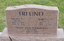
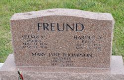
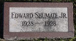
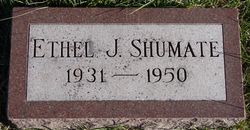
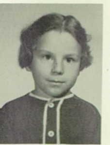
Velma Viola Shumate Freund
| Birth | : | 23 Mar 1919 Dunlap, Harrison County, Iowa, USA |
| Death | : | 31 Mar 1998 Missouri Valley, Harrison County, Iowa, USA |
| Burial | : | Buderim Lawn Crematorium and Memorial Gardens, Buderim, Sunshine Coast Council, Australia |
| Coordinate | : | -26.6800700, 153.0924660 |
| Plot | : | New Section, block 6, row 3 |
| Description | : | VELMA SHUMATE FREUND Velma V. Freund, age 79, of Dunlap, died Tuesday, March 31, 1998, at Alegent Health Community Memorial Hospital in Missouri Valley. Velma was born March 23, 1919 to Edward and Lela (Smith) Shumate at Dunlap. She attended country school near Dunlap. On February 3 1958, she married Harold Freund at St. Patrick's Catholic Church in Dunlap. Velma worked at various restaurants in Dunlap as a cook and at one time managed the Sugar Bowl Cafe which was located on Main Street in Dunlap. In 1986, they moved to Avoca. She entered the nursing home in Avoca in 1992 living there... Read More |
frequently asked questions (FAQ):
-
Where is Velma Viola Shumate Freund's memorial?
Velma Viola Shumate Freund's memorial is located at: Buderim Lawn Crematorium and Memorial Gardens, Buderim, Sunshine Coast Council, Australia.
-
When did Velma Viola Shumate Freund death?
Velma Viola Shumate Freund death on 31 Mar 1998 in Missouri Valley, Harrison County, Iowa, USA
-
Where are the coordinates of the Velma Viola Shumate Freund's memorial?
Latitude: -26.6800700
Longitude: 153.0924660
Family Members:
Parent
Spouse
Siblings
Children
Flowers:
Nearby Cemetories:
1. Buderim Lawn Crematorium and Memorial Gardens
Buderim, Sunshine Coast Council, Australia
Coordinate: -26.6800700, 153.0924660
2. Diddillibah Cemetery
Nambour, Sunshine Coast Council, Australia
Coordinate: -26.6471020, 153.0212960
3. Woombye Cemetery
Woombye, Sunshine Coast Council, Australia
Coordinate: -26.6806580, 152.9732640
4. Mooloolah General Cemetery
Glenview, Sunshine Coast Council, Australia
Coordinate: -26.7750000, 153.0377780
5. Caloundra Cemetery
Caloundra, Sunshine Coast Council, Australia
Coordinate: -26.7940280, 153.1310910
6. Gregson and Weight Caloundra Memorial Gardens
Caloundra, Sunshine Coast Council, Australia
Coordinate: -26.8007321, 153.1174489
7. Nambour General Cemetery
Nambour, Sunshine Coast Council, Australia
Coordinate: -26.6156180, 152.9713150
8. Nambour Garden Lawn Cemetery
Nambour, Sunshine Coast Council, Australia
Coordinate: -26.6116920, 152.9700810
9. Gregson & Weight Chapel & Crematorium
Nambour, Sunshine Coast Council, Australia
Coordinate: -26.6156420, 152.9649380
10. Kulangoor Lawn Cemetery
Kulangoor, Sunshine Coast Council, Australia
Coordinate: -26.5884880, 152.9647280
11. Yandina Cemetery
Yandina, Sunshine Coast Council, Australia
Coordinate: -26.5720000, 152.9570000
12. St Mary's Church
Montville, Sunshine Coast Council, Australia
Coordinate: -26.6879465, 152.8926176
13. Australia Zoo
Beerwah, Sunshine Coast Council, Australia
Coordinate: -26.8361140, 152.9615310
14. Beerwah Cemetery
Beerwah, Sunshine Coast Council, Australia
Coordinate: -26.8521020, 152.9875450
15. Flaxton Cemetery
Flaxton, Sunshine Coast Council, Australia
Coordinate: -26.6617420, 152.8731570
16. Mapleton Cemetery
Mapleton, Sunshine Coast Council, Australia
Coordinate: -26.6241030, 152.8479884
17. Eumundi Cemetery
Eumundi, Sunshine Coast Council, Australia
Coordinate: -26.4913680, 152.9405570
18. Witta Cemetery
Witta, Sunshine Coast Council, Australia
Coordinate: -26.7061560, 152.8270080
19. Peachester Cemetery
Crohamhurst, Sunshine Coast Council, Australia
Coordinate: -26.8199922, 152.8714523
20. Grigor Children
Glass House Mountains, Sunshine Coast Council, Australia
Coordinate: -26.9166600, 152.9228750
21. Tewantin Cemetery
Tewantin, Noosa Shire, Australia
Coordinate: -26.3950054, 153.0254472
22. Beerburrum Cemetery
Beerburrum, Sunshine Coast Council, Australia
Coordinate: -26.9490050, 152.9547500
23. Gheerulla Cemetery
Gheerulla, Sunshine Coast Council, Australia
Coordinate: -26.5538100, 152.7713320
24. Cooroy Cemetery
Cooroy, Noosa Shire, Australia
Coordinate: -26.4095520, 152.9143240

