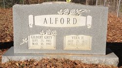
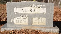
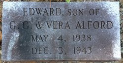
Vera Hope Herring Alford
| Birth | : | 25 Jul 1921 Conway, Horry County, South Carolina, USA |
| Death | : | 4 Oct 2008 Conway, Horry County, South Carolina, USA |
| Burial | : | Church of the Assumption of the Blessed Virgin Cem, Kenel, Corson County, USA |
| Coordinate | : | 45.8521000, -100.4588000 |
| Description | : | Daughter of the late Marion David and Lillie Daniels Herring, she was a charter member of Greenwood Baptist Church where she was very active. Prior to retirement, she was employed by Bashor Woodcraft. She was the widow of Gilbert Grey Alford. She was survived by five sons, Lanier Alford, Tommy Alford, Myron Alford, Joe Alford and Wendell Alford; three daughters, Yvonne Thompson, Sherry Joyner and Gladys Allen; 17 grandchildren; 28 great-grandchildren; two great-great-grandchildren; and an extended family of family and friends. Her funeral was held at Greenwood Baptist Church on October 7, 2008, with The Rev.... Read More |
frequently asked questions (FAQ):
-
Where is Vera Hope Herring Alford's memorial?
Vera Hope Herring Alford's memorial is located at: Church of the Assumption of the Blessed Virgin Cem, Kenel, Corson County, USA.
-
When did Vera Hope Herring Alford death?
Vera Hope Herring Alford death on 4 Oct 2008 in Conway, Horry County, South Carolina, USA
-
Where are the coordinates of the Vera Hope Herring Alford's memorial?
Latitude: 45.8521000
Longitude: -100.4588000
Family Members:
Spouse
Children
Flowers:
Nearby Cemetories:
1. Church of the Assumption of the Blessed Virgin Cem
Kenel, Corson County, USA
Coordinate: 45.8521000, -100.4588000
2. Saint Thomas Cemetery
Corson County, USA
Coordinate: 45.8506012, -100.4036026
3. Saint Lukes Cemetery
Bullhead, Corson County, USA
Coordinate: 45.8053017, -100.4794006
4. LaGrace Cemetery
Campbell County, USA
Coordinate: 45.8800011, -100.3719025
5. Spring Valley Cemetery
Pollock, Campbell County, USA
Coordinate: 45.9308500, -100.2960000
6. Mad Bear Mission Cemetery
Corson County, USA
Coordinate: 45.7355995, -100.3431015
7. Gale Cemetery
Pollock, Campbell County, USA
Coordinate: 45.7971992, -100.2652969
8. Hope Lutheran Cemetery
Corson County, USA
Coordinate: 45.8752382, -100.6667583
9. Dale Cemetery
Emmons County, USA
Coordinate: 45.9874992, -100.3768997
10. Kvernes Cemetery
Pollock, Campbell County, USA
Coordinate: 45.7616997, -100.2544022
11. Saint Bedes Cemetery
Wakpala, Corson County, USA
Coordinate: 45.6581001, -100.5252991
12. Saint Elizabeth Cemetery
Wakpala, Corson County, USA
Coordinate: 45.6423880, -100.5149280
13. Spring Creek Cemetery
Pollock, Campbell County, USA
Coordinate: 45.9131000, -100.1516600
14. McLaughlin City Cemetery
McLaughlin, Corson County, USA
Coordinate: 45.8128390, -100.7996660
15. Redeemer Lutheran Cemetery
McLaughlin, Corson County, USA
Coordinate: 45.8264500, -100.8108200
16. Protestant Cemetery
McLaughlin, Corson County, USA
Coordinate: 45.8255997, -100.8107986
17. Congregational Cemetery
McLaughlin, Corson County, USA
Coordinate: 45.8264600, -100.8112200
18. Westfield Cemetery
Westfield, Emmons County, USA
Coordinate: 46.0279660, -100.2050860
19. Sacred Heart Cemetery
Corson County, USA
Coordinate: 45.6571999, -100.6875000
20. Long Hill Cemetery
Wakpala, Corson County, USA
Coordinate: 45.6575012, -100.6980972
21. Saint Michaels Catholic Cemetery
Herreid, Campbell County, USA
Coordinate: 45.8327514, -100.0909180
22. Reed Cemetery
Fort Yates, Sioux County, USA
Coordinate: 46.0731010, -100.6549988
23. Holy Trinity Krassna Cemetery
Strasburg, Emmons County, USA
Coordinate: 46.0883751, -100.2978897
24. Standing Rock Sioux Tribe Veterans Cemetery
Fort Yates, Sioux County, USA
Coordinate: 45.9580550, -100.8050000


