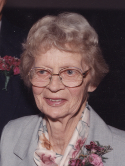
| Birth | : | 3 Nov 1925 Herrick, Gregory County, South Dakota, USA |
| Death | : | 19 Apr 2010 Gregory, Gregory County, South Dakota, USA |
| Burial | : | St. Michael's Roman Catholic Cemetery, Corkery, Ottawa Municipality, Canada |
| Coordinate | : | 45.2828000, -76.1009100 |
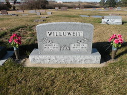
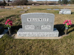
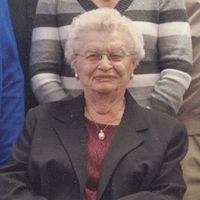
| Description | : | From Kotrba-Smith Funeral Home Web Site: Funeral Services for Vera Papousek, 84 of Gregory, will be held on Friday morning, April 23, at St John Lutheran Church in Gregory beginning at 11:00 AM. Burial will follow at the Bohemian National Cemetery in Grgory. A prayer service will be held on Thursday evening at 7:30 PM at the church. VERA LUREE PAPOUSEK Vera Luree Papousek was born November 3, 1925 near Herrick, SD to Rudolph and Bertha (Ring) Willuweit and went to her eternal home on April 19, 2010 at the Avera Rosebud Country Care Center in Gregory, SD at the age... Read More |
frequently asked questions (FAQ):
-
Where is Vera Luree Willuweit Papousek's memorial?
Vera Luree Willuweit Papousek's memorial is located at: St. Michael's Roman Catholic Cemetery, Corkery, Ottawa Municipality, Canada.
-
When did Vera Luree Willuweit Papousek death?
Vera Luree Willuweit Papousek death on 19 Apr 2010 in Gregory, Gregory County, South Dakota, USA
-
Where are the coordinates of the Vera Luree Willuweit Papousek's memorial?
Latitude: 45.2828000
Longitude: -76.1009100
Family Members:
Parent
Spouse
Siblings
Flowers:
Nearby Cemetories:
1. St. Michael's Roman Catholic Cemetery
Corkery, Ottawa Municipality, Canada
Coordinate: 45.2828000, -76.1009100
2. Saint Mary's Roman Catholic Cemetery Old
Almonte, Lanark County, Canada
Coordinate: 45.2449920, -76.1645940
3. Huntley Presbyterian Cemetery
Carp, Ottawa Municipality, Canada
Coordinate: 45.3201630, -76.0056170
4. Lowry Cemetery
Carp, Ottawa Municipality, Canada
Coordinate: 45.3603830, -76.1161900
5. Saint James Anglican Cemetery
Carp, Ottawa Municipality, Canada
Coordinate: 45.3467500, -76.0362700
6. Christ Church Anglican Cemetery
Carp, Ottawa Municipality, Canada
Coordinate: 45.3144120, -75.9973450
7. Highland Park Cemetery
Carp, Ottawa Municipality, Canada
Coordinate: 45.3201200, -75.9885800
8. Huntley United Cemetery
Huntley, Ottawa Municipality, Canada
Coordinate: 45.2977210, -75.9776920
9. McDonald Cemetery
Almonte, Lanark County, Canada
Coordinate: 45.2564500, -76.2247840
10. Saint Marys Roman Catholic Cemetery
Almonte, Lanark County, Canada
Coordinate: 45.2119800, -76.1931000
11. Wesleyan Methodist Cemetery
Mississippi Mills, Lanark County, Canada
Coordinate: 45.2081040, -76.1889840
12. Saint Pauls Anglican Church Cemetery
Almonte, Lanark County, Canada
Coordinate: 45.2173380, -76.2087260
13. Christie Family Cemetery
Kanata, Ottawa Municipality, Canada
Coordinate: 45.3417090, -75.9833660
14. Saint Paul's Anglican Cemetery
Ottawa Municipality, Canada
Coordinate: 45.3830900, -76.1304940
15. Diamond Cemetery
Kinburn, Ottawa Municipality, Canada
Coordinate: 45.3874600, -76.1367100
16. Auld Kirk Cemetery
Mississippi Mills, Lanark County, Canada
Coordinate: 45.2120400, -76.2187300
17. Kinburn Baptist Cemetery
Kinburn, Ottawa Municipality, Canada
Coordinate: 45.3506420, -76.2308690
18. Baird Family Plot
Carleton Place, Lanark County, Canada
Coordinate: 45.1659683, -76.1214453
19. MacMillan Cemetery
West Carleton, Ottawa Municipality, Canada
Coordinate: 45.3968520, -76.1429700
20. Saint Peter Celestine Roman Catholic Cemetery
Pakenham, Lanark County, Canada
Coordinate: 45.3010030, -76.2835560
21. Saint James Cemetery
Carleton Place, Lanark County, Canada
Coordinate: 45.1571400, -76.1472900
22. Christ Church Anglican Cemetery
Ashton, Ottawa Municipality, Canada
Coordinate: 45.1582110, -76.0307590
23. Saint Isidore Roman Catholic Cemetery
Kanata, Ottawa Municipality, Canada
Coordinate: 45.3683710, -75.9494930
24. Stittsville United Church Cemetery
Stittsville, Ottawa Municipality, Canada
Coordinate: 45.2483230, -75.9122510

