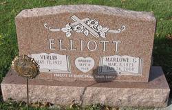
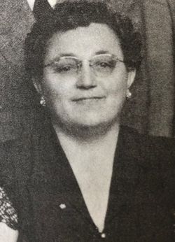
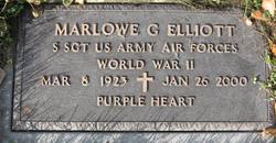
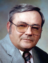
Verlin Heuer Elliott
| Birth | : | 12 May 1927 Leonard, Cass County, North Dakota, USA |
| Death | : | 26 Nov 2012 Portland, Multnomah County, Oregon, USA |
| Burial | : | Timaru Cemetery, Timaru, Timaru District, New Zealand |
| Coordinate | : | -44.4122320, 171.2574270 |
| Description | : | Verlin was born and raised on the family farm in rural Leonard, ND. She went to school in Casselton, ND where she graduated from high school in 1945. She then attended Moorhead College in Moorhead, MN and graduated in 1947. Verlin and Marlowe Elliott were married September 8, 1948 at Bethel Moravian Church, Leonard, ND. After their wedding they moved to Portland, OR, where they lived for 45 years. After retirement they moved back to Leonard, ND, and lived in the house Marlowe grew up in. Before her retirement in 1988 she taught school for a few years in rural... Read More |
frequently asked questions (FAQ):
-
Where is Verlin Heuer Elliott's memorial?
Verlin Heuer Elliott's memorial is located at: Timaru Cemetery, Timaru, Timaru District, New Zealand.
-
When did Verlin Heuer Elliott death?
Verlin Heuer Elliott death on 26 Nov 2012 in Portland, Multnomah County, Oregon, USA
-
Where are the coordinates of the Verlin Heuer Elliott's memorial?
Latitude: -44.4122320
Longitude: 171.2574270
Family Members:
Parent
Spouse
Siblings
Flowers:
Nearby Cemetories:
1. Timaru Cemetery
Timaru, Timaru District, New Zealand
Coordinate: -44.4122320, 171.2574270
2. Salisbury Park Crematorium
Timaru, Timaru District, New Zealand
Coordinate: -44.4292400, 171.2080200
3. Pareora West Cemetery
Pareora West, Timaru District, New Zealand
Coordinate: -44.4383120, 171.1343000
4. Otaio Cemetery
Otaio, Waimate District, New Zealand
Coordinate: -44.5535220, 171.1790260
5. Whareki Cemetery
Temuka, Timaru District, New Zealand
Coordinate: -44.2558600, 171.2734500
6. Temuka Cemetery
Temuka, Timaru District, New Zealand
Coordinate: -44.2499010, 171.3014390
7. St. Mary's Church Cemetery
Esk Valley, Waimate District, New Zealand
Coordinate: -44.5244000, 171.0836000
8. Pleasant Point Cemetery
Pleasant Point, Timaru District, New Zealand
Coordinate: -44.2615490, 171.1237320
9. Burnett Family Cemetery
Cave, Timaru District, New Zealand
Coordinate: -44.3156830, 170.9457270
10. Saint Aidan's Churchyard
Geraldine, Timaru District, New Zealand
Coordinate: -44.1544420, 171.0980340
11. St David’s Anglican Churchyard
Mackenzie District, New Zealand
Coordinate: -44.1706380, 170.9887810
12. Geraldine Cemetery
Geraldine, Timaru District, New Zealand
Coordinate: -44.0982600, 171.2407000
13. Albury Cemetery
Albury, Mackenzie District, New Zealand
Coordinate: -44.2371220, 170.8736570
14. St. Anne's Churchyard
Geraldine, Timaru District, New Zealand
Coordinate: -44.0836111, 171.1994444
15. Waimate Lawn Cemetery
Waimate, Waimate District, New Zealand
Coordinate: -44.7401200, 171.0614100
16. Waimate Old Cemetery
Waimate, Waimate District, New Zealand
Coordinate: -44.7410700, 171.0601300
17. Te Waimatemate Urupā
Waimate, Waimate District, New Zealand
Coordinate: -44.7367311, 171.0277419
18. Woodbury Cemetery
Woodbury, Timaru District, New Zealand
Coordinate: -44.0360900, 171.2127000
19. Fairlie Cemetery
Fairlie, Mackenzie District, New Zealand
Coordinate: -44.1075700, 170.8301500
20. Arundel Cemetery
Arundel, Timaru District, New Zealand
Coordinate: -43.9785690, 171.2838900
21. Longbeach Estate Chapel
Longbeach, Ashburton District, New Zealand
Coordinate: -44.0941090, 171.6884504
22. Hinds Cemetery
Hinds, Ashburton District, New Zealand
Coordinate: -44.0075580, 171.5735400
23. Morven Cemetery
Morven, Waimate District, New Zealand
Coordinate: -44.8658369, 171.0852820
24. Cracroft Cemetery
Ruapuna, Ashburton District, New Zealand
Coordinate: -43.9341900, 171.2989500


