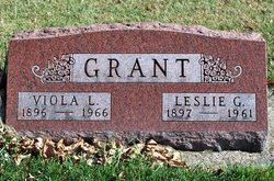
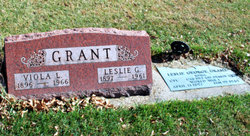
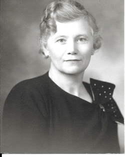
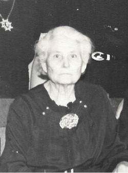
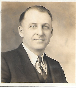
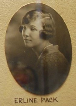
Viola Lucille Pack Grant
| Birth | : | 20 May 1896 Johnson County, Kentucky, USA |
| Death | : | 29 Apr 1966 Jefferson, Greene County, Iowa, USA |
| Burial | : | Paton Cemetery, Paton, Greene County, USA |
| Coordinate | : | 42.1624985, -94.2433014 |
| Inscription | : | Married to Leslie G. |
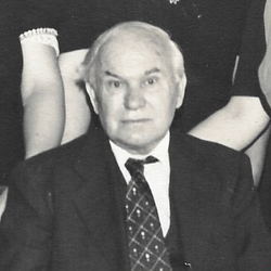
| Description | : | Source: http://freepages.genealogy.rootsweb.ancestry.com/~decourcy/PDF%20files/Charlesa.pdf Viola Lucille Pack was born on 20 May 1896 in White Rock, Johnson Co Ky. She appeared on the census on 26 Apr 1910 in Dawson Township, Greene Co. IA at age 13. She died on 29 Apr 1966 in Paton, Greene Co., IA. She was married to Leslie George GRANT (son of William Simpson GRANT and Margaret WALLACE) on 9 Aug 1918 in Austin, Mower Co., MN. Viola Lucille PACK and Leslie George GRANT had the following children: DONALD LESLIE GRANT. VELVA EULALIE GRANT. DUANE EVERETT GRANT. BEVERLY ANN GRANT. ROBERT WALLACE GRANT. JUDITH ANN GRANT. |
frequently asked questions (FAQ):
-
Where is Viola Lucille Pack Grant's memorial?
Viola Lucille Pack Grant's memorial is located at: Paton Cemetery, Paton, Greene County, USA.
-
When did Viola Lucille Pack Grant death?
Viola Lucille Pack Grant death on 29 Apr 1966 in Jefferson, Greene County, Iowa, USA
-
Where are the coordinates of the Viola Lucille Pack Grant's memorial?
Latitude: 42.1624985
Longitude: -94.2433014
Family Members:
Parent
Spouse
Siblings
Children
Flowers:
Nearby Cemetories:
1. Paton Cemetery
Paton, Greene County, USA
Coordinate: 42.1624985, -94.2433014
2. Dawson Cemetery
Paton, Greene County, USA
Coordinate: 42.1655998, -94.3283005
3. Renner Cemetery
Boone County, USA
Coordinate: 42.1380420, -94.1256570
4. Lost Grove Cemetery
Harcourt, Webster County, USA
Coordinate: 42.2583008, -94.2331009
5. Swedish Lutheran Church Cemetery
Dayton, Webster County, USA
Coordinate: 42.2175000, -94.1065000
6. Lawn Cemetery
Boone County, USA
Coordinate: 42.1771011, -94.0867996
7. Union Cemetery
Boxholm, Boone County, USA
Coordinate: 42.1369019, -94.0852966
8. Grand Ridge Cemetery
Beaver, Boone County, USA
Coordinate: 42.0786018, -94.1157990
9. Gowrie Township Cemetery
Gowrie, Webster County, USA
Coordinate: 42.2813988, -94.3043976
10. Mount Calvary Cemetery
Grand Junction, Greene County, USA
Coordinate: 42.0266000, -94.2325000
11. Beaver Cemetery
Beaver, Boone County, USA
Coordinate: 42.0462000, -94.1446000
12. Junction Township Cemetery
Grand Junction, Greene County, USA
Coordinate: 42.0236015, -94.2593994
13. Maple Grove Cemetery
Boxholm, Boone County, USA
Coordinate: 42.0793690, -94.0859890
14. Maas Cemetery
Boone County, USA
Coordinate: 42.0908012, -94.0618973
15. Pilot Mound Cemetery
Pilot Mound, Boone County, USA
Coordinate: 42.1636200, -94.0282600
16. Christ the King Catholic Cemetery
Dayton, Webster County, USA
Coordinate: 42.2601929, -94.0727539
17. Dayton Cemetery
Dayton, Webster County, USA
Coordinate: 42.2675000, -94.0755000
18. Highland Township Cemetery
Churdan, Greene County, USA
Coordinate: 42.1518310, -94.4699120
19. Saint Joseph Cemetery
Jefferson, Greene County, USA
Coordinate: 42.0289001, -94.3818970
20. Reading Cemetery
Farnhamville, Calhoun County, USA
Coordinate: 42.2593994, -94.4325027
21. Jefferson Cemetery
Jefferson, Greene County, USA
Coordinate: 42.0133018, -94.3591995
22. Runyan Cemetery
Pilot Mound, Boone County, USA
Coordinate: 42.1749992, -94.0015030
23. Our Saviour Cemetery
Callender, Webster County, USA
Coordinate: 42.3396988, -94.3153000
24. Linn Cemetery
Pilot Mound, Boone County, USA
Coordinate: 42.2045330, -93.9970230

