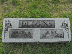
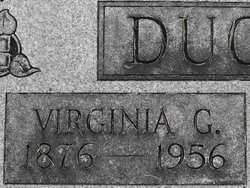
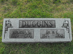
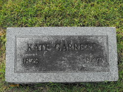
Virginia E. Garrett Duggins
| Birth | : | 19 Jan 1876 Missouri, USA |
| Death | : | 27 Nov 1956 Fulton, Callaway County, Missouri, USA |
| Burial | : | Pleasant Hill Cemetery, Randolph County, USA |
| Coordinate | : | 38.6610400, -80.2581190 |
| Plot | : | Section K Lot 31 |
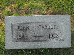
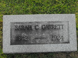
| Description | : | parents given as John Garrett and Sallie Mass |
frequently asked questions (FAQ):
-
Where is Virginia E. Garrett Duggins's memorial?
Virginia E. Garrett Duggins's memorial is located at: Pleasant Hill Cemetery, Randolph County, USA.
-
When did Virginia E. Garrett Duggins death?
Virginia E. Garrett Duggins death on 27 Nov 1956 in Fulton, Callaway County, Missouri, USA
-
Where are the coordinates of the Virginia E. Garrett Duggins's memorial?
Latitude: 38.6610400
Longitude: -80.2581190
Family Members:
Parent
Spouse
Siblings
Flowers:
Nearby Cemetories:
1. Pleasant Hill Cemetery
Randolph County, USA
Coordinate: 38.6610400, -80.2581190
2. Ramsey Cemetery
Pickens, Randolph County, USA
Coordinate: 38.6531420, -80.2459050
3. Robert Bennett Burial Site
Webster County, USA
Coordinate: 38.6599154, -80.2888660
4. George Rashid Burial Site
Pickens, Randolph County, USA
Coordinate: 38.6604220, -80.2169790
5. Sacred Heart Catholic Cemetery
Pickens, Randolph County, USA
Coordinate: 38.6431870, -80.2116660
6. Pickens Cemetery
Pickens, Randolph County, USA
Coordinate: 38.6582985, -80.2007980
7. Goshen Cemetery
Goshen, Upshur County, USA
Coordinate: 38.7098380, -80.3091150
8. Old Cemetery
Webster County, USA
Coordinate: 38.6464005, -80.3371964
9. Helvetia Cemetery
Randolph County, USA
Coordinate: 38.7106018, -80.2050018
10. Sines Cemetery
Goshen, Upshur County, USA
Coordinate: 38.7036900, -80.3221200
11. Fahrner Family Cemetery
Helvetia, Randolph County, USA
Coordinate: 38.6972379, -80.1861842
12. Vance Cemetery
Hacker Valley, Webster County, USA
Coordinate: 38.6469002, -80.3471985
13. Hicks Cemetery
Randolph County, USA
Coordinate: 38.6688995, -80.1592026
14. Canaan Cemetery
Canaan, Upshur County, USA
Coordinate: 38.7413720, -80.2961300
15. Rice Cemetery
Canaan, Upshur County, USA
Coordinate: 38.7378006, -80.3088989
16. M W Cutlip Cemetery
Hacker Valley, Webster County, USA
Coordinate: 38.6767240, -80.3690890
17. Gregory Cemetery
Eden, Upshur County, USA
Coordinate: 38.7299995, -80.3369980
18. Gregory Cemetery
Rock Cave, Upshur County, USA
Coordinate: 38.7299995, -80.3371964
19. Pine Grove Cemetery
Czar, Randolph County, USA
Coordinate: 38.7332993, -80.1789017
20. McIe Cemetery
Hacker Valley, Webster County, USA
Coordinate: 38.6127780, -80.3636110
21. Life Cemetery
Cleveland, Webster County, USA
Coordinate: 38.7118988, -80.3617020
22. Pleasant Dale Cemetery
Selbyville, Upshur County, USA
Coordinate: 38.7578710, -80.2566670
23. Ross Cemetery
Selbyville, Upshur County, USA
Coordinate: 38.7560997, -80.2311020
24. Hacker Valley Cemetery
Hacker Valley, Webster County, USA
Coordinate: 38.6507220, -80.3860970

