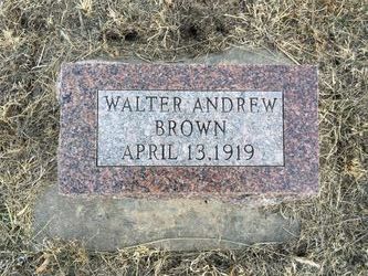
Walter Andrew Brown
| Birth | : | 1917 Woodston, Rooks County, Kansas, USA |
| Death | : | 13 Apr 1919 Woodston, Rooks County, Kansas, USA |
| Burial | : | Survey Cemetery, Woodston, Rooks County, USA |
| Coordinate | : | 39.3722000, -99.1333008 |
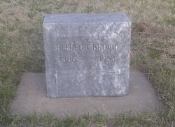
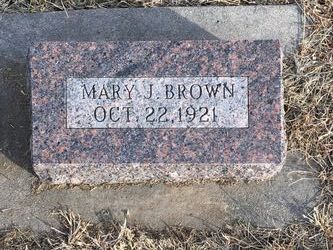
| Description | : | Walter Andrew Brown was born to Alfred Franklin Brown and Mary Alta Brown in 1917. His middle name was after his Grandfather Andrew Brown of Woodston, KS. He was his parents first child. Walter's life was cut short as he died at about two years of age. Walter's only full sibling, a boy, was stillborn, Feb. 18th 1921 and I have been told he was also buried in the Survey cemetery, but there is no marker as all the Brown family markers were not installed until about 1941. |
frequently asked questions (FAQ):
-
Where is Walter Andrew Brown's memorial?
Walter Andrew Brown's memorial is located at: Survey Cemetery, Woodston, Rooks County, USA.
-
When did Walter Andrew Brown death?
Walter Andrew Brown death on 13 Apr 1919 in Woodston, Rooks County, Kansas, USA
-
Where are the coordinates of the Walter Andrew Brown's memorial?
Latitude: 39.3722000
Longitude: -99.1333008
Family Members:
Parent
Flowers:
Nearby Cemetories:
1. Johnson Cemetery
Stockton, Rooks County, USA
Coordinate: 39.3493996, -99.1941986
2. Chalk Mound Cemetery
Laton, Rooks County, USA
Coordinate: 39.3208008, -99.0852966
3. Woodston Cemetery
Woodston, Rooks County, USA
Coordinate: 39.4375000, -99.1268997
4. Pleasant Plain Cemetery
Osborne County, USA
Coordinate: 39.3367004, -99.0372009
5. Aurora Cemetery
Laton, Rooks County, USA
Coordinate: 39.2778015, -99.0847015
6. Twin Mound Cemetery
Rooks County, USA
Coordinate: 39.2855988, -99.2319031
7. Stockton Cemetery
Stockton, Rooks County, USA
Coordinate: 39.4406700, -99.2647400
8. Mount Ayr Cemetery
Alton, Osborne County, USA
Coordinate: 39.3764000, -98.9717026
9. Pleasant Valley Cemetery
Osborne County, USA
Coordinate: 39.4583015, -99.0077972
10. Saint Thomas Cemetery
Stockton, Rooks County, USA
Coordinate: 39.4449997, -99.2771988
11. Shiloh Cemetery
Codell, Rooks County, USA
Coordinate: 39.2350006, -99.1410980
12. Immanuel Lutheran Cemetery
Natoma, Osborne County, USA
Coordinate: 39.2708015, -99.0096970
13. West Hope Cemetery
Rooks County, USA
Coordinate: 39.5024986, -99.2110977
14. Spring Branch Cemetery
Woodston, Rooks County, USA
Coordinate: 39.5099983, -99.0580978
15. Ash Rock Cemetery
Woodston, Rooks County, USA
Coordinate: 39.5248909, -99.0817719
16. Bigge Family Cemetery
Stockton, Rooks County, USA
Coordinate: 39.4584700, -99.3053200
17. Old Stockton Cemetery
Stockton, Rooks County, USA
Coordinate: 39.4597015, -99.3050003
18. Pioneer Cemetery
Alton, Osborne County, USA
Coordinate: 39.4742012, -98.9749985
19. Round Mound Cemetery
Osborne County, USA
Coordinate: 39.2630997, -98.9636002
20. Conger Cemetery
Plainville, Rooks County, USA
Coordinate: 39.1978700, -99.1232100
21. Paradise Center Cemetery
Codell, Rooks County, USA
Coordinate: 39.2050570, -99.2058100
22. Hobart Cemetery
Webster, Rooks County, USA
Coordinate: 39.3847008, -99.3621979
23. Kill Creek Cemetery
Alton, Osborne County, USA
Coordinate: 39.3805528, -98.8967658
24. Natoma Catholic Cemetery
Natoma, Osborne County, USA
Coordinate: 39.2054050, -99.0289480


