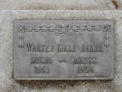
Walter Dale Baker
| Birth | : | 16 Dec 1913 |
| Death | : | 5 May 1954 |
| Burial | : | Plainville Cemetery, Plainville, Rooks County, USA |
| Coordinate | : | 39.2256012, -99.2866974 |
| Plot | : | Orig 180S-2 |
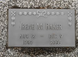
| Description | : | Son of Roy E. & Gladys Lillian Adams Baker. Married to Irene Benson on April 17, 1937. Daughter, Carol Lynette. (Pawnee Library, book of obits in the Pawnee Republican.) |
frequently asked questions (FAQ):
-
Where is Walter Dale Baker's memorial?
Walter Dale Baker's memorial is located at: Plainville Cemetery, Plainville, Rooks County, USA.
-
When did Walter Dale Baker death?
Walter Dale Baker death on 5 May 1954 in
-
Where are the coordinates of the Walter Dale Baker's memorial?
Latitude: 39.2256012
Longitude: -99.2866974
Family Members:
Parent
Spouse
Siblings
Flowers:
Nearby Cemetories:
1. Plainville Cemetery
Plainville, Rooks County, USA
Coordinate: 39.2256012, -99.2866974
2. Sacred Heart Cemetery
Plainville, Rooks County, USA
Coordinate: 39.2270510, -99.2889510
3. Paradise Center Cemetery
Codell, Rooks County, USA
Coordinate: 39.2050570, -99.2058100
4. Twin Mound Cemetery
Rooks County, USA
Coordinate: 39.2855988, -99.2319031
5. Shiloh Cemetery
Codell, Rooks County, USA
Coordinate: 39.2350006, -99.1410980
6. Saint Ann's Catholic Cemetery
Zurich, Rooks County, USA
Coordinate: 39.2310930, -99.4354950
7. Zurich Cemetery
Zurich, Rooks County, USA
Coordinate: 39.2271996, -99.4383011
8. Conger Cemetery
Plainville, Rooks County, USA
Coordinate: 39.1978700, -99.1232100
9. Johnson Cemetery
Stockton, Rooks County, USA
Coordinate: 39.3493996, -99.1941986
10. Norman Cemetery
Ellis County, USA
Coordinate: 39.1044006, -99.1575012
11. Eureka Cemetery
Webster, Rooks County, USA
Coordinate: 39.3139000, -99.4552994
12. Aurora Cemetery
Laton, Rooks County, USA
Coordinate: 39.2778015, -99.0847015
13. Hobart Cemetery
Webster, Rooks County, USA
Coordinate: 39.3847008, -99.3621979
14. Pleasantview Cemetery
Palco, Rooks County, USA
Coordinate: 39.2332993, -99.5124969
15. Green Mound Cemetery
Palco, Rooks County, USA
Coordinate: 39.2788800, -99.5120500
16. Chalk Mound Cemetery
Laton, Rooks County, USA
Coordinate: 39.3208008, -99.0852966
17. Survey Cemetery
Woodston, Rooks County, USA
Coordinate: 39.3722000, -99.1333008
18. Natoma Catholic Cemetery
Natoma, Osborne County, USA
Coordinate: 39.2054050, -99.0289480
19. Saint Severin Cemetery
Ellis County, USA
Coordinate: 39.0236015, -99.2596970
20. Saint Andrew Cemetery
Ellis County, USA
Coordinate: 39.0332985, -99.3882980
21. Natoma Cemetery
Natoma, Osborne County, USA
Coordinate: 39.1907700, -99.0162700
22. Natoma Lutheran Cemetery
Natoma, Osborne County, USA
Coordinate: 39.1907700, -99.0162700
23. Bowlby Ranch Cemetery
Ellis County, USA
Coordinate: 39.1127430, -99.0513540
24. Stockton Cemetery
Stockton, Rooks County, USA
Coordinate: 39.4406700, -99.2647400


